- Cestersover
-
Coordinates: 52°26′06″N 1°15′36″W / 52.435°N 1.260°W
Cestersover
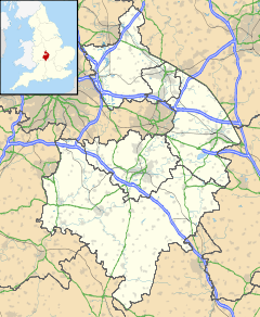
 Cestersover shown within Warwickshire
Parish Pailton District Rugby Shire county Warwickshire Region West Midlands Country England Sovereign state United Kingdom Police Warwickshire Fire Warwickshire Ambulance West Midlands EU Parliament West Midlands List of places: UK • England • Warwickshire Cestersover is a deserted village in Warwickshire, England, now in the civil parish of Pailton.
History
It was a hamlet of Monks Kirby and was site of a watermill, a sizeable village and a chapel. The manor of Cestersover was held by the Waver (or Wara) family from at least the Norman Conquest; and the name of the village derives from Thester Wara (meaning "the Eastern" Wara).
The village was abandoned around 1467 when Henry Waver, who had made his fortune as a London draper (and was appointed a Sheriff of London) was granted permission to rebuild the ancient manor with turrets and crenelations and to enclose 500 acres of land.[1]
Current state
Today, remains of a moat and parts of the old manor are visible.[2]
Coordinates: 52°26′06″N 1°15′36″W / 52.435°N 1.260°W
References
- ^ William Dugdale. "The Antiquities of Warwickshire (1656), p.60". http://www.archive.org/stream/antiquitiesofwar00dugd#page/60/mode/1up. Retrieved 03 January 2011.
- ^ "'The hundred of Knightlow', A History of the County of Warwick: Volume 6: Knightlow hundred (1951)". British History Online. http://www.british-history.ac.uk/report.aspx?compid=57082. Retrieved 03 January 2011.
Categories:- Deserted medieval villages in England
- Former populated places in England
- Warwickshire geography stubs
Wikimedia Foundation. 2010.

