- Český Rudolec
-
Český Rudolec — Municipality — 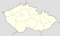
 Český Rudolec
Coordinates: 49°3′56″N 15°19′12″E / 49.06556°N 15.32°ECoordinates: 49°3′56″N 15°19′12″E / 49.06556°N 15.32°E Country  Czech Republic
Region South Bohemian District Jindřichův Hradec Area – Total 49.22 km2 (19 sq mi) Elevation 511 m (1,677 ft) Population (2007) – Total 967 – Density 19.6/km2 (50.9/sq mi) Postal code 378 53 to 380 01 Website http://www.ceskyrudolec.cz Český Rudolec is a village and municipality (obec) in Jindřichův Hradec District in the South Bohemian Region of the Czech Republic.
The municipality covers an area of 49.22 square kilometres (19.00 sq mi), and has a population of 967 (as at 31 December 2007).
Český Rudolec lies approximately 26 kilometres (16 mi) east of Jindřichův Hradec, 63 km (39 mi) east of České Budějovice, and 131 km (81 mi) south-east of Prague.
References
Towns, market towns and villages of Jindřichův Hradec District Báňovice · Bednárec · Bednáreček · Blažejov · Bořetín · Březina · Budeč · Budíškovice · Cep · Cizkrajov · Červený Hrádek · České Velenice · Český Rudolec · Číměř · Člunek · Dačice · Dešná · Deštná · Dívčí Kopy · Dobrohošť · Dolní Pěna · Dolní Žďár · Domanín · Doňov · Drunče · Dunajovice · Dvory nad Lužnicí · Frahelž · Hadravova Rosička · Halámky · Hamr · Hatín · Heřmaneč · Horní Meziříčko · Horní Němčice · Horní Pěna · Horní Radouň · Horní Skrýchov · Horní Slatina · Hospříz · Hrachoviště · Hříšice · Chlum u Třeboně · Jarošov nad Nežárkou · Jilem · Jindřichův Hradec · Kačlehy · Kamenný Malíkov · Kardašova Řečice · Klec · Kostelní Radouň · Kostelní Vydří · Kunžak · Lásenice · Lodhéřov · Lomnice nad Lužnicí · Lužnice · Majdalena · Nová Bystřice · Nová Olešná · Nová Včelnice · Nová Ves nad Lužnicí · Novosedly nad Nežárkou · Okrouhlá Radouň · Peč · Písečné · Pístina · Plavsko · Pleše · Pluhův Žďár · Polště · Ponědraž · Ponědrážka · Popelín · Příbraz · Rapšach · Ratiboř · Rodvínov · Roseč · Rosička · Slavonice · Smržov · Staňkov · Staré Hobzí · Staré Město pod Landštejnem · Stráž nad Nežárkou · Strmilov · Stříbřec · Střížovice · Studená · Suchdol nad Lužnicí · Světce · Třebětice · Třeboň · Újezdec · Velký Ratmírov · Vícemil · Višňová · Vlčetínec · Volfířov · Vydří · Záblatí · Záhoří · Zahrádky · Žďár · Županovice

This South Bohemian Region location article is a stub. You can help Wikipedia by expanding it.
