- Col di Lana
-
Col di Lana 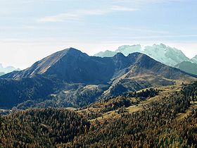
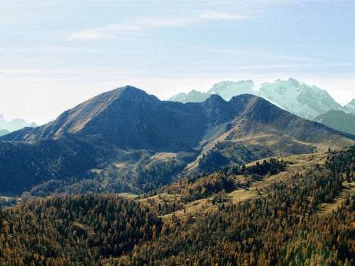
Col di Lana (left) and the neighbouring Monte Sief (right)Elevation 2,462 m (8,077 ft) Location Province of Belluno, Italy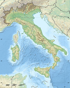
 Col di Lana
Range Dolomites, Fanes group Coordinates 46°29′24″N 11°58′12″E / 46.49°N 11.97°ECoordinates: 46°29′24″N 11°58′12″E / 46.49°N 11.97°E Climbing Easiest route Over the Valparola Pass, over saddle of Monte Sief, then over the Dente del Sief (German: Knotz) to the summit The Col di Lana is a mountain of the Fanes Group in the Italian Dolomites, situated in Livinallongo del Col di Lana (German: Buchenstein), a municipality of the Province of Belluno, in the Italian region of Veneto.
During World War I the mountain, alongside the neighbouring Monte Sief, was the scene of heavy fighting between Austria and Italy. It is now a memorial to the War in the Dolomites.
During the years of 1915/16, Italian troops from the 12th Infantry and the 14th Alpine Companies repeatedly attempted to storm the peak, defended first by the German Alpenkorps and later by Austrian regiments. These attempts resulted in heavy losses; 278 Italians died due to avalanches alone. However this is not the only reason that the Italians dubbed it "Col di Sangue", "Blood Mountain". Like all sides in the First World War, the Italian Army sought to conquer the summit with relatively large forces, paying a high price in casualties.
Lieutenant Caetani of the Italian engineers developed a plan for mining the peak, which was executed silently using hand-operating drilling machines and chisels. At the start of 1916, the Austrians learned through an artillery observer on Pordoi Pass that the summit had been mined. The Austrians began a counter mine, and exploded this on 5 April 1916. The counter mine was, however, too far away from the Italian explosive tunnel. This was laid with five tonnes of blasting gelatin. On the night of 16/17 April 1916, the 5th Company of the 2nd Tyrolean Kaiserjäger regiment was relieved by the 6th Company, under Oberleutnant Anton von Tschurtschenthaler. The struggle reached its zenith on the night of 17/18 April 1916, when at around 23:30 the summit was blasted. The Austrians under Tschurtschenthaler then had to surrender the mountain; however they were able to maintain a position on Monte Sief, which is linked to Col di Lana by a ridge, thereby obstructing the Italian breakthrough in the area.
In 1932, the architect Kuno Krissler (from South Tyrol) planned a memorial that would have restored the contour of the summit, but it was never constructed. Today a chapel stands on the summit as a memorial to the soldiers that fell in battle. The remains of a barracks and decaying gun and communications trenches have been left behind from the war. There is also a small war museum on the mountain.
The route is from Pieve di Livinallongo (1,465 m) via the Rifugio Pian della Lasta (1,835 m); there is a road as far as the hut.
References
- Anton (Toni) von Tschurtschenthaler: Col di Lana 1916, Schlern-Schriften Vol. 179, 1957
- Generalmajor Viktor Schemfil: Col di Lana - Geschichte der Kämpfe um den Dolomitengipfel 1915-1917; Schriftreihe zur Zeitgeschichte Tirols Vol. 3, Buchdienst Südtirol E. Kienesberger Nürnberg 1983, ISBN 0002284219
- Alberto Giacobbi: Il fronte delle Dolomiti (1915/17), Verlag Ghedina, 2005
- Walther Schaumann: Schauplätze Des Gebirgskrieges 1915-17. Vol. 1/2: Westliche Dolomiten. ISBN 9788876910203
- Heinz von Liechem: Gebirgskrieg 1915-1918 Band 2, Verlagsanstalt Athesia 1997, ISBN 88-7014-236-1
- Gunther Langes: Die Front in Fels und Eis, Verlagsanstalt Arthesia 1997, ISBN 88-7014-118-7
Categories:- Mountains of the Veneto
- Mountains of Italy
- Mountains of the Alps
- Geography of the Veneto
- Province of Belluno

Wikimedia Foundation. 2010.