- Craignaw
-
Craignaw 
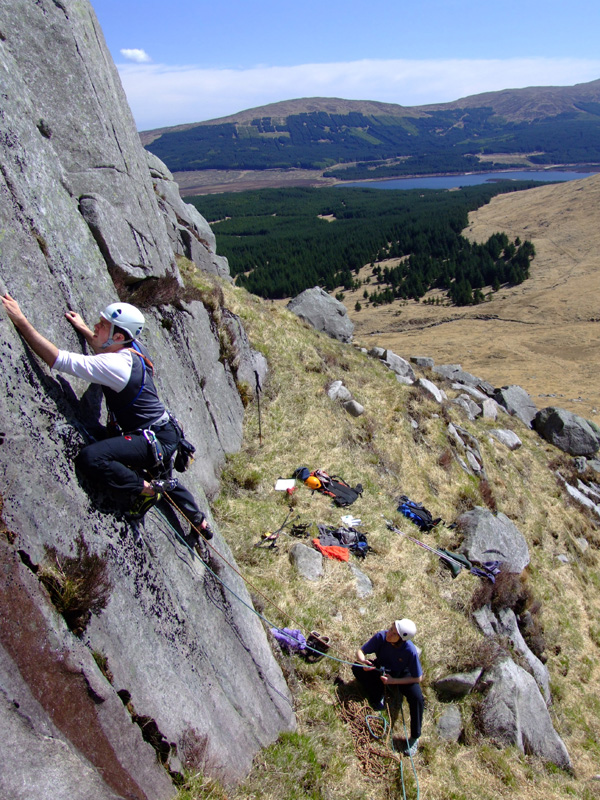
Climbing at Snibe Hill on CraignawElevation 645 m (2,116 ft) Prominence 151 m (495 ft) Listing Marilyn, Donald, Graham Location Location Dumfries and Galloway,  Scotland
Range Galloway Hills Topo map OS Landranger 77 OS grid NX459833 Craignaw is a small but very rocky hill in centre of the Galloway Hills of southern Scotland. Unlike many hills in the Southern Uplands, Craignaw has a complex and rocky summit area, with a long line of crags and rough ground on the east side. The hill is largely composed of granite[1]. Near the north end of the hill is an interesting area of terrain known as the "De'ils Bowlin' Green" where various rounded granite boulders are scatterd at random over an area of nearly horizontal granite slabs. These are believed to be glacial erratics or result from a similar glacier process. On the west side of the hill, near grid reference NX458831, a few hundred meters from the summit is an F-111E Aardvark crash site. The site is marked by a small memorial to the two US Airforce pilots who were killed in the accident (Captains Spaulding and Hetzner)[2]. Although the crash happened on December 19, 1979 there are still small amounts of aircraft debris in the area.
Walking
Craignaw is quite a remote hill and climbing it is a long and rough walk from the road-ends at either Craigencallie or Bruces Stane.
Climbing
There is some good but short rock climbing on Craignaw at Snibe Hill, Memorial Crag and Scotland Slab. However in winter after a good freeze the broken ground on the east side of the hill has some of the best ice climbs in Southern Scotland with routes of up to 150 m in length.[3] The most famous of these is the frozen waterfall of the Dow Spout.
References
- ^ Geological Map of Scotland
- ^ http://www.f-111.net/t_no_E.htm%7CF-111 site - see USAF tail number 68-0003
- ^ John Biggar. "Craignaw Ice". http://www.johnbiggar.com/craignaw-ice-climbing.asp. Retrieved 2007-06-14.
Coordinates: 55°07′12″N 4°25′05″W / 55.12005°N 4.41793°W
Categories:- Marilyns of Scotland
- Donalds
- Mountains and hills of the Southern Uplands
- Dumfries and Galloway
- Climbing areas of Scotland
- Grahams
- Dumfries and Galloway geography stubs
- Scottish sports venue stubs
Wikimedia Foundation. 2010.