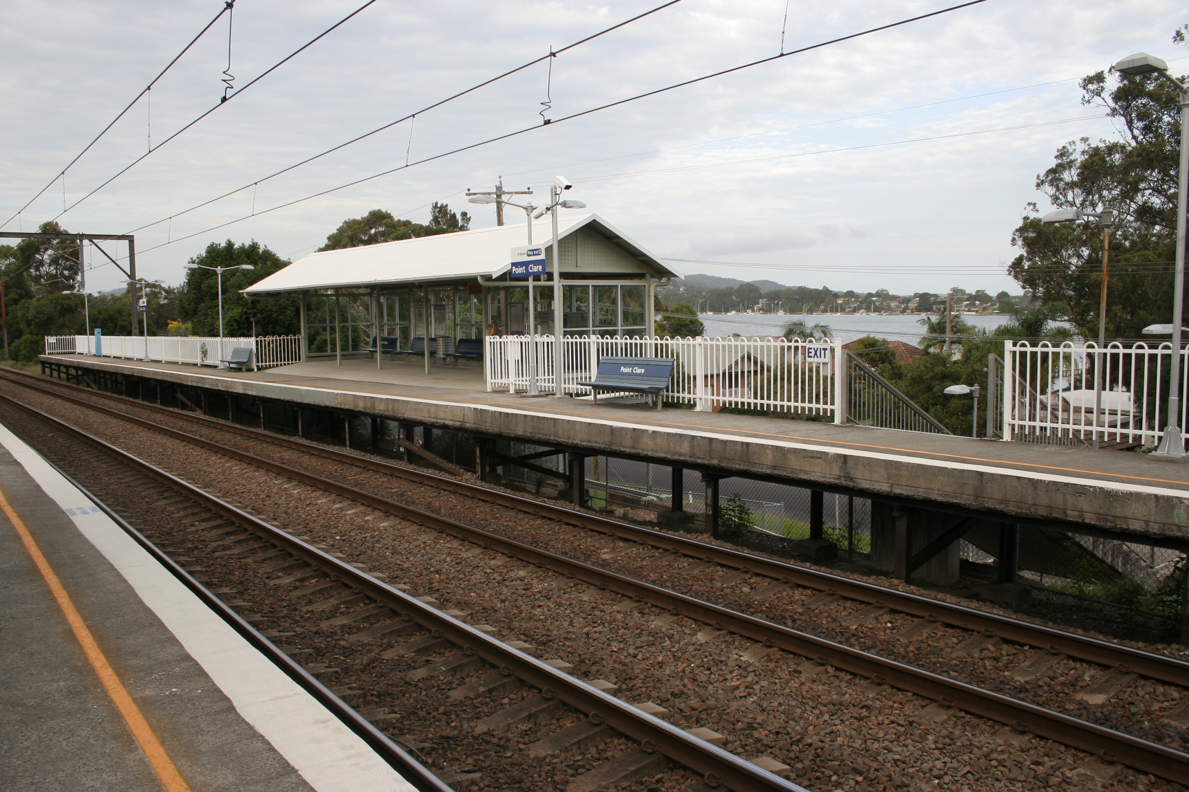
Point Clare railway station, New South Wales
- Point Clare railway station, New South Wales
Cityrail Station alt|station_name=Point Clare|
servicearea=Newcastle & Central Coast Line|servicearea_color=#Newcastle line colour|servicearea_textcolor=white
code=PCL|suburb=Point Clare|street=Pacific Hwy|distance=78.05|altitude=?|traintype=Intercity|platforms=2|tracks=2|platform_arr=2 Side|stationtype=Ground|gates=No|connect=Bus|disabled=No
facilities= [http://www.cityrail.info/facilities/facilities.jsp?n=223&giveOutput=true&facility= Link]
Point Clare railway station is located in Point Clare on the Central Coast of New South Wales, Australia. The station is a side station with two short platforms which are four carriages long. The station is served hourly by intercity trains during the off peak. Two trains per hour serve Point Clare during peak periods. A tunnel runs beneath the platforms for easy access to either as well as a way to safely cross the tracks.
Platforms/Service
Platform 1:
*Newcastle and Central Coast line colour>Newcastle & Central Coast Line - intercity services to Central (via Strathfield).
Platform 2:
*Newcastle and Central Coast line colour>Newcastle & Central Coast Line - intercity services to Gosford, Wyong and Newcastle.
Transport Links
Busways runs five routes via Potnt Clare railway station:
*Route 50 - Between Woy Woy and Mt Ettalong.
*Route 51 - Between Woy Woy and Ettalong.
*Route 52 - Between Woy Woy and Umina.
*Route 53 - Between Woy Woy and Umina.
ee also
Wikimedia Foundation.
2010.
Look at other dictionaries:
Main North railway line, New South Wales — For other railways called Main North Line, see Main North Line. For other railways called Great Northern, see Great Northern Railway. [v · d · … Wikipedia
Point Clare, New South Wales — Infobox Australian Place | type = suburb name = Point Clare city = Central Coast state = nsw caption = lga = City of Gosford postcode = 2250 pop = 2,975 (2006 census) area = 2.9 est = parish = Patonga stategov = Gosford fedgov = Robertson dist1 … Wikipedia
Parramatta, New South Wales — ] dist1 = 23 dir1 = west location1 = Sydney CBD lga = City of Parramattacite web|url=http://www.dlg.nsw.gov.au/dlg/dlghome/dlg Regions.asp?regiontype=2 slacode=6250 region=SO|title=Suburb Search Local Council Boundaries Sydney Outer (SO)… … Wikipedia
Maitland, New South Wales — Maitland New South Wales Maitland Town Hall, High Street … Wikipedia
Narara, New South Wales — Narara redirects here. For the ship, see Narara (ship). Narara Central Coast, New South Wales Looking down Deane Street, Na … Wikipedia
Niagara Park, New South Wales — Niagara Park Central Coast, New South Wales Population: 2,289 (2006 census) Postcode: 2250 Area: 2.4 km² (0 … Wikipedia
Tascott, New South Wales — Infobox Australian Place | type = suburb name = Tascott city = Central Coast state = nsw caption = lga = City of Gosford postcode = 2250 pop = 1,696 (2006 census) area = 2.2 est = parish = Patonga stategov = Gosford fedgov = Robertson dist1 = 7… … Wikipedia
Milsons Point railway station — Milsons Point … Wikipedia
Chatswood railway station — Chatswood … Wikipedia
South Australia — South Australian. a state in S Australia. 1,285,033; 380,070 sq. mi. (984,380 sq. km). Cap.: Adelaide. * * * State (pop., 2001: 1,514,854), south central Australia. It covers an area of 379,720 sq mi (983,470 sq km), and its capital is Adelaide.… … Universalium