- Natagaima
-
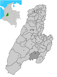 Location of the municipality and town of Natagaima in Tolima Department.
Natagaima — Municipality and town — Country  Colombia
Department Tolima Department Time zone Colombia Standard Time (UTC-5) Natagaima is a town and municipality in the Tolima department of Colombia, on the shore of the Magdalena River, at 326 meters over the sea level. The population of the municipality was 21,324 as of the 1993 census, and its average temperature is 26 degrees celsius. Natagaima was founded in 1606 by Spanish conqueror Juan de Borja y Armendia.
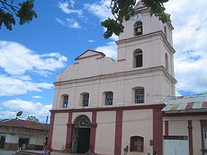 Iglesia de Natagaima
Contents
Etymology
Some believe the name of Natagaima comes from the words Nataga ("Cacique", Tribal Chief) and Ima (land), while others state that the name was created because there was an Indian named Nataga, who was the chief of this region, and married Queen Ima, ruler of the Tribal Chiefs of the center of Tolima.
Limits
North: Coyaima and Prado, East: Dolores and Alpujarra, West: Ataco and Coyaima, South: Aipe(Huila). Distance from Ibagué(capital of Tolima): 118 km.
Population and economic activities
Approximately 26,600 inhabitants reside in the 862 sq. kilometers of Natagaima. Its economy consists mainly in agriculture, an activity induced by its hot weather. The main agricultural products are rice, cotton, corn and sorghum. Besides agriculture, breeding of livestock occupies an important place in the economy of Natagaima, specially that of the Zebu species.
Other economical activities include craftsmanship and saddlery.
History
The people of Natagaima were submitted by Spanish Conqueror Juan the Borja, who gathered the survivors of this incursion and proceeded with the foundation of the town. It is said that Natagaima lies in a place different from his original location, and was moved there by orders of the priest Ignacio Navarro in 1801. From 1863 to 1866 it was the capital of the Sovereign State of Tolima. Through a law emitted on February 21, 1963, it became a Municipality, starting its role on January 1, 1964.
Its territory was initially inhabited by the Pijao Indians, that were mainly composed by the Natagaima and Coyaima communities, tough warriors who posed fierce resistance to the Spanish invasion, forcing the Spaniards to establish an extermination policy. Other local tribes were the Dujos and Babadujos, who continuously fought against the Natagaimas and Coyaimas, and, motivated by the overwhelming quantity of received attacks, ultimately decided to support the Spaniards.
Typical foods
Tamale (Tolimense), almojábana, yucca bread with oats, Lechona, bizcochuelo, Mistela, Chanfaina, Corn Chicha, Masato, Poporoi are the most important dishes of the zone.
Typical songs
Among many others, La caña(Cantalicio Rojas), El contrabandista and El pasamanos, are famous songs that are danced during the festivities.
Sites of interest
Pacandé Mountain, The Painima Bath Zone, The Patá(la Palmita) Bath Zone, The Anchique River, The Hipogeo Indian Cemetery (vereda Palma Alta), and the Magdalena River crossing.
Health
San Antonio Hospital (a "first level" hospital).
Education
Primary
1st of May Urban Mixed School Maria Auxiliadora Urban Mixed School Gabriel Rebeis Pizarro Urban Mixed School Gustavo Perdomo Ávila Urban Mixed School
Secondary
Francisco José de Caldas School Alfonzo Reyes Echandia School Luis Carlos Galan Sarmiento School
Rural schools
Rural and Agricultural Development School Anchique Policarpa Salavarrieta Basic Education Institute La Palmita Rural Mixed School New Town Adult Centre Mariano Ospina Perez Institute
People born in Natagaima
Rafael Godoy, Cantalicio Rojas, IndiaMery Yara, Teófilo Forero
Municipalities in Tolima Department Alpujarra • Alvarado • Ambalema • Anzoategui • Armero • Ataco • Cajamarca • Carmen Apicala • Casabianca • Chaparral • Coello • Coyaima • Cunday • Dolores • Espinal • Falan • Flandes • Fresno • Guamo • Herveo • Honda • Ibagué • Icononzo • Lérida • Libano • Mariquita • Melgar • Murillo • Natagaima • Ortega • Palocabildo • Piedras • Planadas • Prado • Purificacion • Rioblanco • Roncesvalles • Rovira • Saldaña • San Antonio • San Luis • Santa Isabel • Suárez • Valle de San Juan • Venadillo • Villahermosa • Villarrica Categories:
- Populated places in the Tolima Department
- Municipalities of Tolima


Wikimedia Foundation. 2010.