- Greater Reykjavík Area
Infobox settlement
official_name = Höfuðborgarsvæðið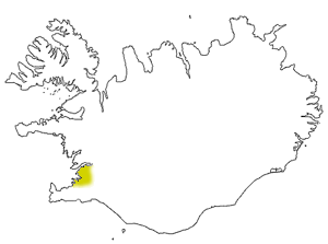
map_caption = The Höfuðborgarsvæði area
subdivision_type = Country
subdivision_name =Iceland
seat =Reykjavík
area_total_km2 = 1042
population_as_of = 2007
population_total = 202000
population_density_km2 = 187.4The Greater Reykjavík area (Icelandic: "Höfuðborgarsvæðið, meaning "the capital district")" is the
metropolitan area of the Icelandic capitalReykjavík , with a population of 202,000 inhabitants, about 64% of Iceland's population. Reykjavík and its neighbouring municipalities are:By population
*Reykjavík : 120.165
*Kópavogur : 29,886
*Hafnarfjörður : 25,726
*Garðabær : 10,331
*Mosfellsbær : 8,625
*Seltjarnarnes : 4,437
*Álftanes : 2,487
*Kjósarhreppur : 190
* Total: 201,847"(Population in October 2008)"
By location
* West of Reykjavík: Seltjarnarnes
* North-east of Reykjavík: Mosfellsbær and Kjósarhreppur
* South of Reykjavík: Kópavogur, Garðabær, Hafnarfjörður and ÁlftanesGeography
Reykjavík itself is located on an 8 km long and 5 km wide peninsula,
Seltjarnarnes . The peninsula juts out from the south-eastern coast ofFaxaflói Bay. Its landscape has many small hills and one main valley,Laugardalur . On the north coast of Seltjarnarnes there is a small bay called Reykjavík and on its shore is located the historical centre and oldest part of Reykjavík.Following development over the decades, the geographical centre of the metropolitan area is now at
Kópavogur , the largest town in the area apart from Reykjavík. Five of the six suburbs have developed in the last 50-70 years: the exception isHafnarfjörður , an old fishing town.The bulk of the population of this area lives either on the Seltjarnarnes peninsula or in the three suburbs of Reykjavík. Each of the suburbs was planned individually, and between them are big, almost unused spaces. The suburbs are:
*
Breiðholt , the southernmost and biggest suburb
*Árbær in the middle, the smallest suburb but includes the most populated street in Iceland, Hraunbær, with 2403 inhabitants
*Grafarvogur , the latest suburb.Grafarholt is also a residential district, but as it is small, it is generally considered to be part of Grafarvogur.All of these suburbs are south and east of Reykjavík. The landscape of this area is characterized by small peninsulas, bays and many small islands. Seltjarnarnes lies from south to west, but a bay divides it from the mainland lying north to south, straight through the peninsula. It only merges with the mainland in the south.
The city centers of
Hafnarfjörður and Reykjavík make an attracting line and the urban area is in between these attractions. Reykjavík has most of the jobs of this area and is also mostly dense, exceptGrafarvogur . The town of Seltjarnarnes, at the end of the peninsula, is a dense residential district and includes almost no jobs.Mosfellsbær has not yet developed so that it connects to Reykjavík and is an individual town.Kópavogur consists mainly of residential and commercial areas.Garðabær , south of Kópavogur, is mostly a residential district with very wide-spread houses.Hafnarfjörður has got many jobs as well as residents.Reykjavík influences an area beyond the Greater Reykjavík described above. Most of Iceland's population lives within a 50 km radius of Reykjavík. More and more Icelanders are starting to talk about the whole of
south-west Iceland as the Greater Reykjavík area.
Wikimedia Foundation. 2010.