- Bong County
Infobox Liberia County
Fullname = Bong County
Name = Bong
FlagSize =
SealSize =
Motto =
MapSize = 250px
Languages =
Demonym =
Capital =Gbarnga
LargestCity =
Coordinates = coord|7|00|N|9|40|W|region:LR_type:adm1st|display=inline,title
Districts = 12
Area = convert|8772|km2|mi2
AreaRank = 6th
Latitude = 7° N
Longitude = 9° 40′ W
PopRank = 3rd
2008Pop = 328,919
2008Density =
HighestPoint =
HighestElev =
LowestPoint =
LowestElev =
Created = 1964
Superintendent = Ranney Jackson
TimeZone = GMT
TZ1Where =
TimeZone2 =
TZ2Where =
ISOCode = BG
Website =
Footnotes =
ImageSize =
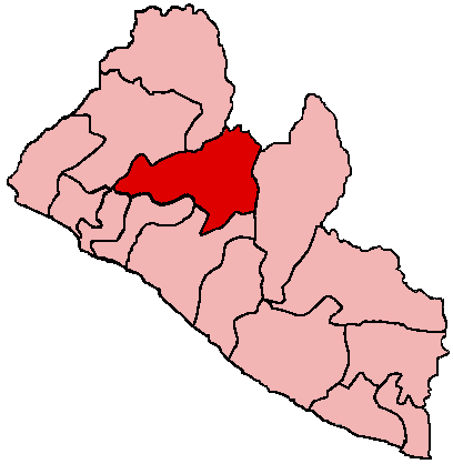
Caption =Bong is a county in the north-central portion of the West African nation of
Liberia . One of 15 counties that comprise the first-level of administrative division in the nation, it has twelve districts.Gbarnga serves as the capital with the area of the county measuring convert|8772|km2|mi2. As of the 2008 Census, it had a population of 328,919, making it the third most populous county in Liberia.cite web|url=http://www.geohive.com/cntry/liberia.aspx|title=Liberia|date=2008|publisher=GeoHive|accessdate=2008-10-08]Named after
Mount Bong in the southern portion of the county, it is bordered by Lofa and Gbarpolu counties to the north, Margibi and Montserrado counties to the west,Grand Bassa County to the south, andNimba County to the east. The northeast part of Bong borders the nation ofGuinea . Created in 1964, the County Superintendent is Ranney Jackson. [cite news|url=http://allafrica.com/stories/200809081383.html|title=Liberia: Abuses, Wastes of Resources in Bong County|last=Dalieh|first=Jerome|date=September 8, 2008|work=The NEWS|publisher=allAfrica.com|accessdate=2008-10-10] Bong County’s flag is purple, signifying the dawn, and orange, signifying the County’s newness. The two geological instruments in the white field portion of the flag symbolize Bong County’smining industry.History
Bong County was created in 1964 (along with Nimba, Lofa and Grand Gedeh when the administrative sub-divisions of Liberia were increased to a total of thirteen. The capital is
Gbarnga , named after an old farm in the location. [ [http://www.unitedbong.org/html/facts.html Facts about Bong] ]Gbarnga was used by
Charles Taylor as the base for his rebellion against the Presidency ofSamuel Doe in the early 1990s. Having failed to capture Monrovia, in early 1991, he established an unofficial provisional government (the (National Patriotic Reconstruction Assembly Government , or NPRAG) onceECOMOG had arrived as a peacekeeping force based in the Liberian capital. [ [http://www.c-r.org/our-work/accord/liberia/profiles.php Conciliation Resources analysis of the Liberian war (1990-1996)] ] . NPRAG continued to operate out of Gbarnga until 1994.Bong County is represented in the Liberian senate by
Jewel Taylor , the controversial ex-wife of the former President Charles Taylor, andFranklin Siakor , a widely respected independent candidate with a strong background in community development. [ [http://www.kas-benin.de/liberia/Profiles_2005_52nd_Legislature-Liberia.pdf A Profile of Members of the 52nd Legislature of Liberia] ]Geography
Bong County is situated in the central part of Liberia, on the main paved road that runs from
Monrovia toSanniquellie inNimba County .Districts
Bong County has twelve districts (2008 population):
*Boinsen District (8,352)
*Fuamah District (27,784)
*Jorquelleh District (78,803)
*Kokoyah District (3,707)
*Kpaai District (25,127)
*Panta District (16,326)
*Salala District (41,982)
*Sanayea District (30,932)
*Suakoko District (28,277)
*Tukpahblee (11,767)
*Yeallequellah (36,919)
*Zota District (18,943)Demographics
The population of Bong from the 1984 Census was 255,813 for the convert|8772|km2|mi2 county. In July 2005, the population was estimated to be around 804 000. [ [http://www.humanitarianinfo.org/Liberia/infocentre/Countyprofile/doc/Bong%20County%20Profile%20Edited%2029%20July%202005.doc "Bong County: A profile" by UNMIL Civil Affairs Section] ] In 2008, the Census placed the figure at 328,919, ranking it third in Liberia after Montserrado and Nimba. The main ethnic groups include the
Kpelle ,Mandingo and Mano. [ [http://www.kas-benin.de/liberia/Profiles_2005_52nd_Legislature-Liberia.pdf A Profile of Members of the 52nd Legislature of Liberia] ]Education
*
Cuttington University References
External links
* [http://www.CuttingtonChronicle.com "Cuttington Chronicle"] - Student Newspaper
* [http://www.unitedbong.org/OurMission.asp US-based United Bong County Association website]
** [http://www.unitedbong.org/html/facts.html United Bong County Association - Bong County factsheet]
* [http://www.humanitarianinfo.org/Liberia/infocentre/Countyprofile/doc/Bong%20County%20Profile%20Edited%2029%20July%202005.doc July 2005 Profile of Bong County] -UNMIL
* [http://www.fallingrain.com/world/LI/1/ Internet directory of place names in Bong County]
* [http://www.bong-town.com The Bong Town community on the web]
Wikimedia Foundation. 2010.