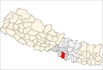
Nijgadh

Nijgadh
Nijgadh
—  Village Development Committee  —
Nijgadh is located in Nepal
Nijgadh
Location in Nepal
Coordinates: 27°12′N 85°08′E / 27.20°N 85.14°E / 27.20; 85.14Coordinates: 27°12′N 85°08′E / 27.20°N 85.14°E / 27.20; 85.14
Country  Nepal
Zone Narayani Zone
District Bara District
Population (1991)
 - Total 13,561
Time zone Nepal Time (UTC+5:45)

Nijgadh is a town and Village Development Committee in Bara District in the Narayani Zone of south-eastern Nepal. At the time of the 1991 Nepal census it had a population of 13,561 persons living in 2500 individual households.[1]


The town has been targeted as a site for an international airport that can handle 15 million passengers and even accommodate the super-jumbo Airbus A380 after the first phase of construction. As of April 2011, a feasibility study of the report was completed. The report stated that the airport would cover 3,000 hectares of land- 2,000 hectares for airport and remaining for airport city.[2]


References

  1. ^ "Nepal Census 2001". Nepal's Village Development Committees. Digital Himalaya. http://www.digitalhimalaya.com/collections/nepalcensus/form.php?selection=1. Retrieved 21 September 2008. 
  2. ^ http://www.ekantipur.com/2011/04/11/editors-pick/second-international-airport-to-be-on-the-runway-by-2015/332320.html

External links


Wikimedia Foundation. 2010.

Игры ⚽ Нужен реферат?

Look at other dictionaries:

  • Ram Bahadur Bomjon — (born c. April 9, 1990, sometimes Bomjan or Banjan ), also known as Palden Dorje (his official Buddhist name), is from Ratanapuri village, Bara district, Nepal and drew thousands of visitors and media attention for spending months in meditation.… …   Wikipedia

  • Spice Nepal — Private Ltd. (SNPL) stands as a privately owned GSM mobile operator in Nepal and is the first company to operate private GSM services in telecommunications sector of Nepal with the brand name “MERO MOBILE”. It broke the monopoly held by the state …   Wikipedia

  • Bara District — Infobox Nepal district district = Bara District area = population = pop year = density = caption = region = established = languages = website = Bara District, a part of Narayani Zone, is one of the seventy five districts of Nepal, a landlocked… …   Wikipedia

  • April 2006 — NOTOC April 2006 : ← January February March April May June July August September October November December →{| class= infobox width= 250 style= font size: 133%; background color: #DDDDDD; padding top: 5px; padding bottom: 5px !Trials | *Chile:… …   Wikipedia

  • Postal codes of Nepal — POSTAL CODES OF NEPALThis is taken from : www.rishiram.org.np/postalcode.htmlDistrict Post Office Postal/Pin Code Post Office TypeAchham Achham 10700 D.P.O. Achham Chaurpati 10701 A.P.O. Achham Srikot 10702 A.P.O. Achham Thanti 10703 A.P.O.… …   Wikipedia

  • Chhata Pipra —   Village Development Committee   Country  Nepal Zone Narayani Zone …   Wikipedia

  • Chhatawa —   Village Development Committee   …   Wikipedia

  • Dahiyar —   Village Development Committee   …   Wikipedia

  • Dewapur —   Village Development Committee   …   Wikipedia

  • Dharma Nagar —   Village Development Committee   Country  Nepal Zone Narayani Zone …   Wikipedia

Share the article and excerpts

Direct link
Do a right-click on the link above
and select “Copy Link”