- Whitburn, West Lothian
-
Coordinates: 55°51′44″N 3°41′14″W / 55.86210°N 3.68719°W
Whitburn 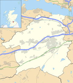
 Whitburn
Whitburn shown within West LothianPopulation 10,391 (2001 Census) OS grid reference NS945645 Council area West Lothian Lieutenancy area West Lothian Country Scotland Sovereign state United Kingdom Post town BATHGATE Postcode district EH47 Dialling code 01501 Police Lothian and Borders Fire Lothian and Borders Ambulance Scottish EU Parliament Scotland UK Parliament Linlithgow and East Falkirk Scottish Parliament Linlithgow List of places: UK • Scotland • Whitburn (Scottish Gaelic: Am Fionn Allt) is a small town in West Lothian, Scotland located halfway between Scotlands's two largest cities being about 23 miles (37 km) east of Glasgow and 23 miles (37 km) west of Edinburgh. The nearest major towns are Bathgate, 4 miles (6.4 km) and Livingston, 8 miles (13 km)
The town was once dominated by Polkemmet Colliery – a large coal mine – but this was closed as a result of damage by underground flooding during the 1984-85 miners' strike and never re-opened. The colliery buildings have gone and the coal bings that once were so prominent have now been removed. Work to dismantle Bing No 3, the infamous burning bing, started in August 2006 and was completed by February 2008.[1] The last major outbreak of burning occurred in 1998.
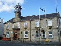 Whitburn Council Offices
The town's population was boosted by the 1960s Glasgow overflow. The town's Murraysgate and surrounding areas northwest of the cross were established to deal with the overflow.
Contents
Schools
The local secondary school is Whitburn Academy. It is a co-educational comprehensive school serving pupils aged 11 to 18. Its catchment area is the town of Whitburn and the surrounding villages of Fauldhouse, Longridge, East Whitburn, Stoneyburn, and Greenrigg. There are approximately 1,000 pupils at the school.
The town's primary schools include Whitdale, Polkemmet, Croftmalloch, St Joseph's and Burnhouse.
Sport and recreation
Whitburn has a King George's Field in memorial to King George V which was opened in 1955 by Queen Elizabeth II.
Whitburn recently had two major fires less than three weeks apart, destroying the Whitburn Miners Welfare and Whitburn Swimming Pool (owned by West Lothian Leisure). More information on both fires is not yet available.
Whitburn is home to Whitburn Junior F.C. who play at Central Park and are in the SJFA East Region Super League. In 2000 they won the OVD Scottish Juniors Cup.
Whitburn Martial Arts Centre opened in 2009, though ran as West Lothian Taekwon-Do since 2004. They ran free Taekwon-Do keep fit classes at Polkemmet, Croftmalloch, St. Joseph's and St John the Baptist's Primary Schools in Whitburn from 2004 to 2008. The Centre funds many students to compete at National Championships and has many Scottish and British Champions.[citation needed]
The town holds its annual gala day on the fourth Saturday in June, and sees a parade take part through the town, followed by games and races at King George V Park. The gala day is part of a week of activities known as the "Civic Week", the Civic week also attracts a fairground and fireworks display which is based just on the edge of King George V Park.
Polkemmet Country Park is located to the west of the town, and incorporates woodland, a golf course, cafe, and play area. The park is also locally famous for the Polkemmet Horn which can be seen from the M8 motorway which runs to the north of the country park. There is also a disused steam locomotive from Polkemmet Colliery on display.
Industry
The town was once the site of Levi Strauss & Co., the clothing manufacturer. The plant opened in 1969 with a large work force, employing over 500 local people. At its height, the plant was producing 4 million pairs of jeans in a year. The plant shut its doors in December 1999.
The town has been given the go-ahead for a 500 million pound project called "Heartlands". This has included the removal of 1.4 million tonnes of shallow coal reserves by opencast methods and the regeneration of 600 hectares of derelict ground, to the south-west and west of the town. It will also include land at Cowhill, next to the M8 motorway, where a new junction and business park is planned. A roundabout and spur road have been built at the west of the town to allow access for the construction of the new junction and business park. This new roundabout replaces a dangerous pair of sliproads on the B7066. The project will provide 4000 new jobs, 2000 new homes (with the land available for more), 2 championship golf courses, a 5 star, 150 bedroom, luxury golf lodge and hotel and a 350 car park and ride facility.[2]
There are many main street stores like The Co-operative Food, previously Somerfield, John Livingstone and Sons butchers and A & C Fisher's bakery.
Whitburn Bands
Whitburn Band is a brass band formed in 1870. The band has been successful on the contest stage and competes at the British Open, National Final and European Championships, and has been Scottish Champion on 15 occasions. The band maintains strong links with the local community of Whitburn by offering concerts throughout the year and participation in civic activities. Whitburn Band retained its Scottish Open Championship title in November 2007 as well as again being crowned Scottish Band of the Year. The band is now the 2008 Scottish Champion and is ranked 7th in the World of Brass / British Bandsman /4barsrest World Rankings.[3]
Whitburn Flute Band were formed in 1962 and are based in Whitburn. The band has previously won the Best Overseas Band award in Belfast two years running in 2002 and 2003.
The Young Conquerors Flute Band is also based in Whitburn. They reformed in 2008.
Notable people
References
- ^ "Environment: Bing 3 (the burning bing)". Heartlands. Ecosse Regeneration Limited. http://www.polkemmetOCCS.co.uk. Retrieved 9 March 2011.
- ^ http://www.polkemmetoccs.co.uk
- ^ http://www.4barsrest.com/news/detail.asp?id=9613
- ^ "X-Factor Leon has singing in his genes". Edinburgh: The Scotsman. 2007-10-15. http://news.scotsman.com/ViewArticle.aspx?articleid=3470674. Retrieved 2007-12-15.
External links
Categories:- Towns in West Lothian


Wikimedia Foundation. 2010.