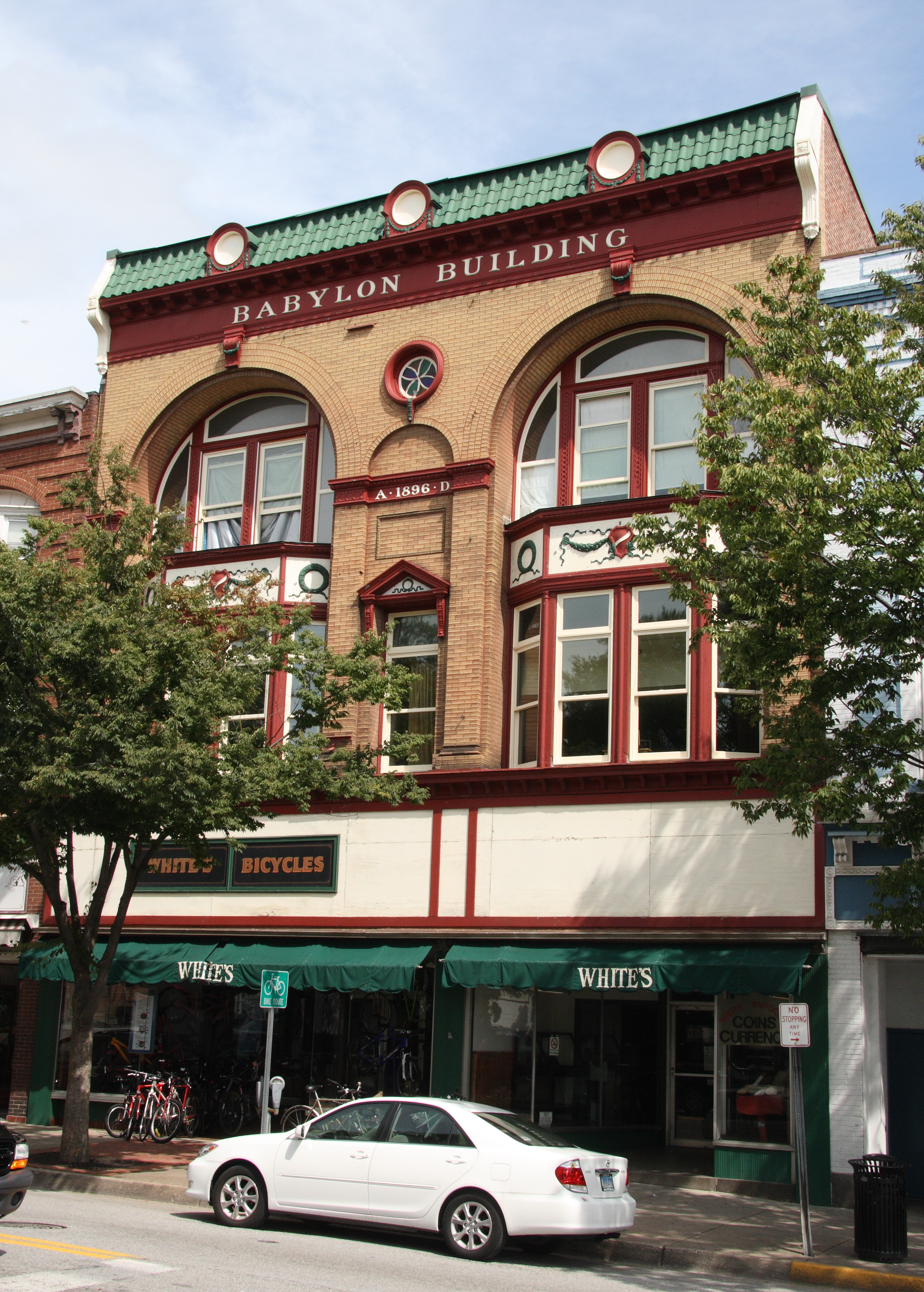
Westminster Historic District
- Westminster Historic District
Infobox_nrhp | name =Westminster Historic District
nrhp_type = hd

caption =
location= Westminster, Maryland
lat_degrees = 39
lat_minutes = 34
lat_seconds = 30
lat_direction = N
long_degrees = 76
long_minutes = 59
long_seconds = 43
long_direction = W
locmapin = Maryland
area =
architect= Winchester,William
architecture= Greek Revival, Georgian, Gothic Revival
added = August 06, 1980[cite web|url=http://www.nr.nps.gov/|title=National Register Information System|date=2008-04-15|work=National Register of Historic Places|publisher=National Park Service] ]
governing_body = Local
refnum=80001804
The Westminster Historic District comprises the historic center of Westminster, Maryland. The district includes about 1400 structures, with a high proportion of contributing structures. The town exhibits a variety of building styles, with an emphasis on early 19th-century residential vernacular architecture and mid-19th century commercial architecture. [cite web|url=http://www.marylandhistoricaltrust.net/nr/NRDetail.aspx?HDID=1041&COUNTY=Carroll&FROM=NRCountyList.aspx?COUNTY=Carroll|title=Maryland Historical Trust|date=2008-09-17|work= National Register of Historic Places: Properties in Carroll County|publisher=Maryland Historical Trust]
References
External links
* [http://www.marylandhistoricaltrust.net/nr/NRDetail.aspx?HDID=482&COUNTY=Carroll&FROM=NRCountyList.aspx?COUNTY=Carroll Terra Rubra, Carroll County] , including photo in 2006, at Maryland Historical Trust
Wikimedia Foundation.
2010.
Look at other dictionaries:
Westminster Village-Academy Hill Historic District — Infobox nrhp | name =Westminster Village Academy Hill Historic District nrhp type = hd caption = location= Westminster, Massachusetts lat degrees = 42 lat minutes = 32 lat seconds = 37 lat direction = N long degrees = 71 long minutes = 54 long… … Wikipedia
Westminster Street Historic District — Infobox nrhp | name =Westminster Street Historic District nrhp type = hd caption = location= Providence, Rhode Island lat degrees = 41 lat minutes = 49 lat seconds = 4 lat direction = N long degrees = 71 long minutes = 25 long seconds = 18 long… … Wikipedia
Customhouse Historic District — U.S. National Register of Historic Places U.S. Historic district … Wikipedia
Cripple Creek Historic District — U.S. National Register of Historic Places U.S. National Historic Landmark District … Wikipedia
Frederick Douglass Square Historic District — Douglass, Frederick, Square Historic District U.S. National Register of Historic Places U.S. Historic district … Wikipedia
Downtown Providence Historic District — U.S. National Register of Historic Places U.S. Historic district … Wikipedia
Westminster, Massachusetts — Infobox Settlement official name = Westminster, Massachusetts nickname = motto = imagesize = 250px image caption = Westminster Historic District image mapsize = 250px map caption = Location in Worcester County in Massachusetts mapsize1 = map… … Wikipedia
National Register of Historic Places listings in Carroll County, Maryland — Location of Carroll County in Maryland This is a list of the National Register of Historic Places listings in Carroll County, Maryland. This is intended to be a complete list of the properties and districts on the National Register of Historic… … Wikipedia
Indiana Register of Historic Sites and Structures — The Indiana Register of Historic Sites and Structures was created in 1981 by the Indiana General Assembly. The Survey and Registration Section of the Indiana Division of Historic Preservation and Archaeology oversees this state register. All… … Wikipedia
Westminster, Colorado — Infobox Settlement official name = City of Westminster, Colorado other name = native name = nickname = settlement type = City motto = imagesize = image caption = flag size = image seal size = image shield = shield size = image blank emblem =… … Wikipedia

