- Nallu
-
Nallu — Village development committee — Location in Nepal
 Nallu
NalluCoordinates: 27°33′N 85°20′E / 27.55°N 85.34°ECoordinates: 27°33′N 85°20′E / 27.55°N 85.34°E Country  Nepal
NepalZone Bagmati Zone District Lalitpur District Population (1991) – Total 1,849 Time zone Nepal Time (UTC+5:45) Nallu is a village development committee in Lalitpur District in the Bagmati Zone of central Nepal. At the time of the 1991 Nepal census it had a population of 1849 living in 320 individual households.[1]
References
- ^ "Nepal Census 2001". Nepal's Village Development Committees. Digital Himalaya. http://www.digitalhimalaya.com/collections/nepalcensus/form.php?selection=1. Retrieved 2008-09-15.
Most of the people here are from Tamang Cast.According to the report taken 96.7% people are Tamang.
External links
Ashrang · Badikhel · Bhardev · Bhattedanda · Bisankhunarayan · Bukhel · Bungamati · Chandanpur · Chapagaun · Chaughare · Chhampi · Dalchoki · Devichour · Dhapakhel · Dhusel · Dukuchhap · Durlung · Gimdi · Godamchaur · Godawari · Gotikhel · Harisiddhi · Ikudol · Imadol · Jharuwarasi · Kaleswor · Khokana · Lamatar · Lele · Lubhu · Malta · Manikhel · Nallu · Pyutar · Sainbu · Sankhu · Siddhipur · Sunakothi · Thaiba · Thecho · Thuladurlung · Tikathali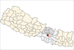 Categories:
- Populated places in Lalitpur District
- Bagmati Zone geography stubs


Wikimedia Foundation. 2010.