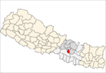
Chandanpur

Chandanpur
Chandanpur
—  Village development committee  —
Chandanpur is located in Nepal
Chandanpur
Location in Nepal
Coordinates: 27°28′N 85°25′E / 27.47°N 85.42°E / 27.47; 85.42Coordinates: 27°28′N 85°25′E / 27.47°N 85.42°E / 27.47; 85.42
Country  Nepal
Zone Bagmati Zone
District Lalitpur District
Population (1991)
 - Total 1,003
Time zone Nepal Time (UTC+5:45)

Chandanpur is a village development committee in Lalitpur District in the Bagmati Zone of central Nepal. At the time of the 1991 Nepal census it had a population of 1003 in 160 individual households.[1]

References

  1. ^ "Nepal Census 2001". Nepal's Village Development Committees. Digital Himalaya. http://www.digitalhimalaya.com/collections/nepalcensus/form.php?selection=1. Retrieved 2008-09-03. 

External links


Wikimedia Foundation. 2010.

Игры ⚽ Нужно сделать НИР?

Look at other dictionaries:

  • Khairi Chandanpur — Infobox Settlement official name = Khairi Chandanpur other name = native name = nickname = settlement type = motto = imagesize = image caption = flag size = image seal size = image shield = shield size = image blank emblem = blank emblem type =… …   Wikipedia

  • Mela (2000 film) — Mela Directed by Dharmesh Darshan Produced by Ashok Kadam Umed Jain Screenplay by Neeraj Vora Sanjeev Duggal Robin Bhatt Story by …   Wikipedia

  • Manpur Tapara —   Village development committee   Country  Nepal Zone …   Wikipedia

  • Village development committee — Nepal This article is part of the series: Politics and government of Nepal Government …   Wikipedia

  • Bardiya District — Infobox Nepal district district = Bardiya District area = population = pop year = density = caption = region = established = languages = website = Bardiya District, one of the seventy five districts of Nepal, is part of Bheri Zone and is… …   Wikipedia

  • Lalitpur District, Nepal — Infobox Nepal district district = Lalitpur District area = 385 population = 337,785 pop year = 2001 density = caption = region = established = languages = website = Lalitpur District, a part of Bagmati Zone, is one of the seventy five districts… …   Wikipedia

  • Kolkata Suburban Railway — Infobox Public transit name = Kolkata Suburban Railway imagesize = 300px locale = Kolkata, India transit type = Rapid transit began operation = 1854 lines = Circular, Eastern and South Eastern stations = Howrah Sealdah and Kolkata track gauge =… …   Wikipedia

  • List of Jain temples — Holy sites= Jain Temples in India There are many Jain tirtha (pilgrimage sites) throughout India. * Hastinapur, holy destination comprising of a collection of temples and pilgrimage locations * Shikharji, also known as Parshvanathji or Sammet… …   Wikipedia

  • Shri Mahaveerji temple — This idol was excavated over 200 years ago from the same spot, after which the temple was constructed. Thousands of worshipers flock from across India to catch a glimpse of this famous statue.] Shri Mahavirji temple is in karauli district in… …   Wikipedia

  • Dukuchhap —   Village development committee   …   Wikipedia

Share the article and excerpts

Direct link
Do a right-click on the link above
and select “Copy Link”