- Cimetta
-
Cimetta 
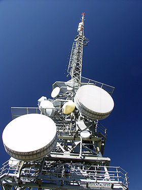
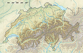
Radio relay tower on the topElevation 1,671 m (5,482 ft) Prominence 61 m (200 ft) [1] Location Switzerland Range Lepontine Alps Coordinates 46°12′03″N 8°47′27.8″E / 46.20083°N 8.791056°ECoordinates: 46°12′03″N 8°47′27.8″E / 46.20083°N 8.791056°E Climbing Easiest route Aerial tramway Cimetta is a mountain in the Lepontine Alps, it is located above Locarno and Lake Maggiore. It can be accessed by cable car from Orselina to Cardada and with a chair lift to the summit.
Weather
Climate data for Cimetta Month Jan Feb Mar Apr May Jun Jul Aug Sep Oct Nov Dec Year Average high °C (°F) 0.5
(32.9)0.3
(32.5)1.6
(34.9)4.9
(40.8)9.1
(48.4)13
(55)15.5
(59.9)14.9
(58.8)12.4
(54.3)8.7
(47.7)3.8
(38.8)1.9
(35.4)7.2 Daily mean °C (°F) −1.8
(28.8)−2.6
(27.3)−0.6
(30.9)1.6
(34.9)5.6
(42.1)9.6
(49.3)12.1
(53.8)11.8
(53.2)9.6
(49.3)6
(43)1
(34)−0.9
(30.4)4.3 Average low °C (°F) −4.3
(24.3)−4.6
(23.7)−2.6
(27.3)−0.3
(31.5)3.6
(38.5)7.3
(45.1)9.8
(49.6)9.6
(49.3)7.5
(45.5)3.9
(39.0)−0.9
(30.4)−3.4
(25.9)2.1 Precipitation mm (inches) 53
(2.09)62
(2.44)84
(3.31)137
(5.39)180
(7.09)171
(6.73)168
(6.61)189
(7.44)175
(6.89)168
(6.61)112
(4.41)49
(1.93)1,547
(60.91)Avg. precipitation days 6.6 7.1 8.3 10.5 13.3 11.2 10.2 11 8.3 8.5 8.3 5.5 108.8 Source: MeteoSchweiz [2] External links
References
- ^ Swisstopo maps
- ^ "Average Values-Table, 1961-1990" (in German, French, Italian). Federal Office of Meteorology and Climatology MeteoSwiss. http://www.meteoswiss.admin.ch/web/de/klima/klima_schweiz/tabellen.html. Retrieved 8 May 2009.
Categories:- Mountains of the Alps
- Mountains of Ticino
- Cable cars in Switzerland
- Ticino geography stubs
Wikimedia Foundation. 2010.

