- Malumela
-
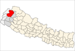
Malumela — Village development committee — Location in Nepal
 Malumela
Coordinates: 29°29′N 81°05′E / 29.49°N 81.09°ECoordinates: 29°29′N 81°05′E / 29.49°N 81.09°E Country  Nepal
NepalZone Seti Zone District Bajhang District Population (1991) - Total 1,855 - Religions Hindu Time zone Nepal Time (UTC+5:45) Malumela is a village in Bajhang District in the Seti Zone of north-western Nepal. At the time of the 1991 Nepal census it had a population of 1,855 and had 319 houses in the village.[1]
References
- ^ "Nepal Census 2001". Nepal's Village Development Committees. Digital Himalaya. http://www.digitalhimalaya.com/collections/nepalcensus/form.php?selection=1. Retrieved 2008-08-27.
Banjh · Bhairab Nath · Bhamchaur · Bhatekhola · Byasi · Chaudhari · Dahabagar · Dangaji · Dantola · Daulichaur · Deulekh · Deulikot · Dhamena · Gadaraya · Hemantabada · Kadal · Kailash · Kalukheti · Kanda · Kaphalaseri · Khiratadi · Koiralakot · Kot Bhairab · Kotdewal · Lamatola · Lekhgaun · Luyanta · Majhigaun · Malumela · Mashdev · Matela · Maulali · Melbisauni · Parakatne · Patadewal · Pauwagadhi · Pipalkot · Rayal · Ridhapata · Rilu · Sainpasela · Subeda · Sunikot · Sunkuda · Surma · Syandi
 Categories:
- Populated places in Bajhang District
- Seti Zone geography stubs


Wikimedia Foundation. 2010.