- Marpak
-
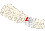
Marpak — Village development committee — Location in Nepal Coordinates: 28°01′N 84°58′E / 28.02°N 84.96°ECoordinates: 28°01′N 84°58′E / 28.02°N 84.96°E Country  Nepal
NepalZone Bagmati Zone District Dhading District Population (1991) - Total 3,987 - Religions Hindu Time zone Nepal Time (UTC+5:45) Marpak is a village development committee in Dhading District in the Bagmati Zone of central Nepal. At the time of the 1991 Nepal census it had a population of 3987 and had 718 houses in it.[1]
References
- ^ "Nepal Census 2001". Nepal's Village Development Committees. Digital Himalaya. http://www.digitalhimalaya.com/collections/nepalcensus/form.php?selection=1. Retrieved 2008-08-24.
Agnichok · Baireni · Baseri · Benighat · Bhumesthan · Budhathum · Chainpur · Chhatre Dyaurali · Darkha · Dhola · Dhussa · Dhuwakot · Gajuri · Gaunkharka · Gerkhu · Ghussa · Goganpani · Gumdi · Jeewanpur · Jharlang · Jogimara · Jyamaruk · Kalleri · Katunge · Kebalpur · Khalte · Khari · Kiranchok · Kumpur · Lapa · Mahadevsthan · Maidi · Marpak · Mulpani · Murali Bhanjyang · Nalang · Naubise · Nilkantha
· Phulkharka · Pida · Ree Gaun · Salang · Salyankot · Salyantar · Sangkosh · Satyadevi · Semjong · Sirtung · Sunaula Bazar · Tasarpu · Thakre · Tipling · Tripureswor Categories:
- Populated places in Dhading District
- Bagmati Zone geography stubs
Wikimedia Foundation. 2010.

