- Choukati
-
Choukati — Village development committee — Location in Nepal
 Choukati
Coordinates: 27°46′N 85°58′E / 27.76°N 85.97°ECoordinates: 27°46′N 85°58′E / 27.76°N 85.97°E Country  Nepal
NepalZone Bagmati Zone District Sindhupalchok District Population (1991) – Total 2,346 – Religions Hindu Time zone Nepal Time (UTC+5:45) Choukati is a village in Sindhupalchok District in the Bagmati Zone of central Nepal. At the time of the 1991 Nepal census it had a population of 2346 and had 539 houses in the village.[1]
References
- ^ "Nepal Census 2001". Nepal's Village Development Committees. Digital Himalaya. http://www.digitalhimalaya.com/collections/nepalcensus/form.php?selection=1. Retrieved 2008-08-24.
Atarpur · Badegau · Bansbari · Banskharka · Baramchi · Barhabise · Baruwa · Batase · Bhimtar · Bhote Namlang · Bhotechaur · Bhotsiba · Choukati · Dhumthang · Dubarchour · Fatakshila · Fulping Katti · Fulpingdandagau · Fulpingkot · Gati · Ghorthali · Ghuskun · Gloche · Gumba · Gunsakot · Hagam · Haibung · Helumbu · Ichok · Ikhu Bhanjyang · Jalbire · Jethal · Jyamire · Kalika · Karkhali · Katambas · Kiwool · Kubhinde · Kunchok · Langarche · Lisankhu · Listikot · Mahankal · Maneswor · Mankha · Marming · Melamchi · Motang · Nawalpur · Pagretar · Palchok · Pangtang · Petaku · Pipaldanda · Piskar · Ramche · Sangachok · Sanusiruwari · Selang · Sikharpur · Sindhukot
· Sipa Pokhare · Sipal Kavre · Sunkhani · Syaule Bazar · Talamarang · Tatopani · Tauthali · Tekanpur · Thakani · Thampal Chhap · Thanpalkot · Thokarpa · Thulo Dhading · Thulo Pakhar · Thulo Sirubari · Thumpakhar · Timpool Ghyangul · Yamanadanda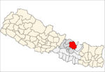 Categories:
- Populated places in Sindhulpalchok District
- Bagmati Zone geography stubs


Wikimedia Foundation. 2010.