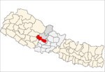
- Chhisti
-
Chhisti — Village development committee — Location in Nepal Coordinates: 28°07′N 83°35′E / 28.11°N 83.58°ECoordinates: 28°07′N 83°35′E / 28.11°N 83.58°E Country  Nepal
NepalZone Dhawalagiri Zone District Baglung District Population (1991) - Total 5,236 - Religions Hindu Time zone Nepal Time (UTC+5:45) Chhisti is a village development committee in Baglung District in the Dhawalagiri Zone of central Nepal. At the time of the 1991 Nepal census it had a population of 5,236 and had 1024 houses in the town.[1]
References
- ^ "Nepal Census 2001". Nepal's Village Development Committees. Digital Himalaya. http://www.digitalhimalaya.com/collections/nepalcensus/form.php?selection=1. Retrieved 2008-08-23.

Adhikarichaur · Amalachaur · Amarbhumi · Argal · Arjewa · Baglung · Baskot · Batakachaur · Bhakunde · Bhimgithe · Bhimpokhara · Bihunkot · Binamare · Boharagaun · Bowang · Bungadovan · Burtiwang · Chhisti · Daga Tumdada · Damek · Darling · Devisthan · Dhamja · Dhullu Gaidi · Dhullubaskot · Dudhilamati · Ghorepani · Gwalichaur · Harichaur · Hatiya · Heele · Hudgisheer · Jaidi · Jaljala · Jharkot · Kandebas · Khukhani · Khunga · Kusmishera · Lekhani · Malika · Malma · Mulpani · Narayansthan · Narethanti · Nisi · Paiyunpata · Palakot · Pandavkhani · Praiyunpata · Rajkut · Ranasinkiteni · Rangkhani · Rayadanda · Resh · Righa · Salyan · Sarkuwa · Singana · Sisakhani · Sukhaura · Sunkhari · Taman · Tangram · Tara · Tityang
 Categories:
- Populated places in Baglung District
- Dhawalagiri Zone geography stubs
Wikimedia Foundation. 2010.

