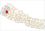
- Dhudharukot
-
Dhudharukot — Village development committee — Location in Nepal Coordinates: 29°17′N 81°14′E / 29.28°N 81.23°ECoordinates: 29°17′N 81°14′E / 29.28°N 81.23°E Country  Nepal
NepalZone Seti Zone District Achham District Population (1991) – Total 2,778 – Religions Hindu Time zone Nepal Time (UTC+5:45) Dhudharukot is a village in Achham District in the Seti Zone of western Nepal. At the time of the 1991 Nepal census it had a population of 2,778 and had 601 houses in the village.[1]
References
- ^ "Nepal Census 2001". Nepal's Village Development Committees. Digital Himalaya. http://www.digitalhimalaya.com/collections/nepalcensus/form.php?selection=1. Retrieved 2008-08-22.
Babala · Bannatoli · Baradadivi · Basti · Batulasen · Baujinath · Bayala · Bhagyaswor · Bhairavsthan · Bhatakatiya · Bhuli · Binayak · Bindhyawasini · Birpath · Budhakot · Chalsa · Chandika · Chapamandau · Chhatara · Darna · Devisthan · Dhakari · Dhaku · Dhamali · Dharaki · Dhodasain · Dhudharukot · Dhungachalna · Dumi · Gajara · Hatikot · Hichma · Jalapadevi · Janalibandali · Janalikot · Jupu · Kalagaun · Kalekanda · Kalika · Kalikasthan · Khaptad · Khodasadevi · Kuika · Kuntibandali · Kushkot · Layati · Lungra · Malatikot · Marku · Mashtanamdali · Mastamandau · Nada · Nandegata · Nawathana · Oligau · Patalkot · Payal · Pulletala · Rahaph · Ramarosan · Raniban · Ridikot · Risidaha · Sakot · Santada · Sera · Siddheswor · Siudi · Sutar · Tadigaira · Thanti · Timilsain · Toli · Tosi · Tumarkhad · Walant · Warla
 Categories:
- Populated places in Achham District
- Seti Zone geography stubs
Wikimedia Foundation. 2010.

