- Kakamas
Infobox Settlement
official_name = Kakamas
settlement_type =
motto =
imagesize =
image_caption =
flag_size =
image_
seal_size =
image_shield =
shield_size =
city_logo =
citylogo_size =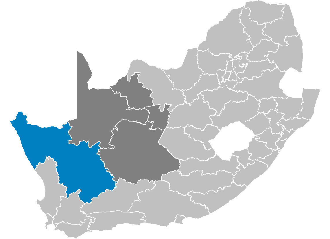
mapsize =
map_caption =
mapsize1 =
map_caption1 = Map of South Africa showing Kakamas's location
image_dot_
dot_mapsize =
dot_map_caption =bvbvbvbvvbvbv
dot_x = |dot_y =
pushpin_
pushpin_label_position =
pushpin_map_caption =
pushpin_mapsize =
subdivision_type = Country
subdivision_name = South Africa
subdivision_type1 = Province
subdivision_name1 =Northern Cape
subdivision_type2 =
subdivision_name2 =
subdivision_type3 =
subdivision_name3 =
subdivision_type4 =
subdivision_name4 =
government_footnotes =
government_type =
leader_title =
leader_name =
leader_title1 =
leader_name1 =
leader_title2 =
leader_name2 =
leader_title3 =
leader_name3 =
leader_title4 =
leader_name4 =
established_title = Established
established_date = 1898
established_title2 =
established_date2 =
established_title3 =
established_date3 =
area_magnitude =
unit_pref =
area_footnotes =
area_total_km2 =
area_land_km2 =
area_water_km2 =
area_total_sq_mi =
area_land_sq_mi =
area_water_sq_mi =
area_water_percent =
area_urban_km2 =
area_urban_sq_mi =
area_metro_km2 =
area_metro_sq_mi =
population_as_of = 2007
population_footnotes =
population_note =
population_total = 8.000
population_density_km2 =
population_density_sq_mi =
population_metro =
population_density_metro_km2 =
population_density_metro_sq_mi =
population_urban =
population_density_urban_km2 =
population_density_urban_sq_mi =
population_blank1_title =
population_blank1 =
population_density_blank1_km2 =
population_density_blank1_sq_mi =
timezone = SAST
utc_offset = +2
timezone_DST =
utc_offset_DST =
latd=28 |latm=48 |lats= |latNS=S
longd=20 |longm=39 |longs= |longEW=E
elevation_footnotes =
elevation_m =
postal_code_type =
postal_code =
area_code =
blank_name =
blank_info =
blank1_name =
blank1_info =
website =
footnotes =Kakamas [ [http://www.greenkalahari.co.za/kaka_background.htm Green Kalahari - Kakamas, name origins] ] is a
town founded in1898 and located in theNorthern Cape province ofSouth Africa , on the banks of theOrange River .Originated as at a place where the
Gariep River could be realtively easily crossed. The spot was first known asBassonsdrif . In1898 a proper settlement was established and under the auspices of theDutch Reformed Church the area was developed as an agricultural spot. It became a municipality in 1954 [ [http://www.routes.co.za/nc/kakamas/ Kakamas - municipality] ] .History
The small town of Kakamas was built on the sheer hard work and determination of a couple of impoverished stock farmers at the end of the
19th century .In
1897 , theDutch Reformed Church started a “colony ” on the farms Soetap and Kakamas on the banks of theOrange River for white people who had lost everything as a result of the drought.Ignoring the criticism of qualified engineers about their building methods, the farmers continued to construct the water canals by hand that are still used to supply the town and surrounding area with water for irrigation. For their efforts they were each awarded the right to one of the irrigation plots. The men worked extremely hard even taking the yoke themselves, rather than wasting precious time in launching a time consuming search for
oxe n anddonkey s grazing somewhere in theVeld .The exceptional dry piling of the stone along rocky slopes can still be seen today. By dry piling instead of excavating through rock, the farmers were able to cut the overall costs of the canals considerably.
The ingenuity of the workers under the leadership of Japie Lutz is aptly demonstrated in the workmanship at the water tunnels in the northern canal. Mr
Piet Burger perfected thewater wheel that was widely used in Kakamas. This pumping device almost led to a court case about patent rights, when ablacksmith who used to live in Kakamas registered the patent in 1922. The Commission that ran the “colony” planned ahead and in 1912 building operations on ahydro-electric power station and turbine in the northern canal were started. Ultimately thepower station , built to look like an Egyptian temple, generated so much electricity that the Kakamas town management liased withUpington about the possibility of Kakamas supplying this neighbouring town with electricity too!Thanks to irrigation from the
Orange River farmers from the Kakamas area are now prime exporters of tablegrapes toEurope andEngland . The region also exportsPeaches ,dried fruit ,raisins , oranges and dates.Name origins
The name Kakamas was originally given to a drift that was known as Takemas or T’Kakamas since 1779. The name means “place of the raging cow” – probably referring to an incident when a raging cow stormed the
Korana while they were herding their cattle through the drift.To some the town's name originates from the
Khoi word, "gagamas" (brown), referring to the red clay of the area with which women daub their faces. To most, though, Kakamas is aKorana word meaning "poor pasture".Today, the name reflects poorly on a fertile valley in the Lower
Orange River , graced withvineyard s,cotton and lucern fields.The drought of 1895-97 was followed by an outbreak of
rinderpest , leaving many farmers destitute.Important facts
*Situated 80km from
Upington
*Annual rain fall about 100mm
*Very hot summers and moderate winters without frost
*Population: 8000References
Notes
External links
* [http://www.greenkalahari.co.za Green Kalahari]
* [http://www.kakamas.co.za Kakamas site]
* [http://www.routes.co.za/nc/kakamas Routes]
Wikimedia Foundation. 2010.