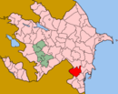
| v · Cəlilabad
|
|
Abazallı, Abdullu, Abışabad, Adnalı, Ağbulaq, Ağdaş, Ağusəm, Alaşar, Albalan, Allahverənli, Allar, Andreyevka, Asadabad, Assuly, Astanlı, Astrakhanovka, Axtaxana, Babalı, Babaxanlı, Badamağac, Badamağac, Baladzha Bozayran, Bashsyz, Bəcirəvan, Bədirli, Bëyuk Bozayran, Boyxanlı, Buravar, Cəfərli, Cəfərli, Cəfərxanlı, Cəlayir, Cəngan, Chay-Karali, Çinar, Çünəxanlı, Çünzəli, Darılıq, Dələli, Dostallı, Dövlətalıbəyli, Dzherimbel, Edişə, Əliabad, Əliqasımlı, Əsədli, Eshakchi, Ətcələr, Fərəcullalı, Fərzili, Fətullaqışlaq, Gasanabad, Germili, Göytəpə, Gülməmmədli, Günzəli, Hacıcavadlı, Hacıismayıllı, Hacıməmmədli, Hamarqışlaq, Hasıllı, Həsənli, Həziabad, İcarə, İncilli, İnili, Karayarka, Kazakhbarasi, Kazımabad, Khasayevka, Köarz, Komanlı, Korlar, Kövüzbulaq, Kövüzbulaq, Kürd, Kürdlər, Lallar, Ləkin, Ləzran, Maşlıq, Medeni Ingilab, Mədətli, Məlikqasımlı, Məmmədcanlı, Məmmədrzalı, Məşədi Hüseynli, Məşədilər, Məşədivəlli, Mikayıllı, Mirtəhməzli, Mirzəli, Mollalı, Moranlı, Muğan, Musalı, Naftuluq, Narimanovka, Novaya Teklya, Novoqolovka, Novruzallı, Ocaqlı, Oğrubulaq, Parnaim, Pərdili, Pokrovka, Porsova, Privolnoye, Qamışlıgöl, Qaraağac, Qarakazımlı, Qarazəncir, Qarğılı, Qasımbəyli, Qayalı, Rəcəbli, Şabanlı, Sabirabad, Sadatlı, Sarxanlı, Şatırlı, Ser-Abad, Sərhədabad, Seyidbazar, Şiləvəngə, Şıxlar, Soltankənd, Şorbaçı, Şötüklü, Söyüdlü, Şükürlü, Suluçeşmə, Svetlaya Zarya, Tahirli, Tatlar, Taza-Abad, Təklə, Təzəkənd, Təzəkənd, Tomarkhanly, Tyulkyulyu, Üçtəpə, Uzuntəpə, Vənlik, Xanəgah, Xanılı, Xəlilabad, Xəlilli, Yarly, Yusifli, Zaryar, Zəhmətabad, Zərbəli, Zopun, Zubanly
|
 |
|
 Cəfərxanlı
 Azerbaijan
