- Nemətabad
-
For the villages in Agdash Rayon, see Nemətabad, Agdash.
Nemətabad — Municipality — 
 Nemətabad
Coordinates: 40°36′25″N 47°02′04″E / 40.60694°N 47.03444°ECoordinates: 40°36′25″N 47°02′04″E / 40.60694°N 47.03444°E Country  Azerbaijan
Rayon Yevlakh Population[citation needed] – Total 2,062 Time zone AZT (UTC+4) – Summer (DST) AZT (UTC+5) Nemətabad (also, Ne’mətabad, Nametabad, and Neymetabad) is a village and municipality in the Yevlakh Rayon of Azerbaijan. It has a population of 2,062. The municipality consists of the villages of Nemətabad and Düzdaq.[1]
References
Ağqıraq, Alatly, Aran, Aşağı Bucaq, Aşağı Qarxun, Aşağı Salamabad, Balçılı, Bayramly, Bəydili, Boşçalı, Bünyadabad, Cəfərli, Cırdaxan, Danalar, Dəlləklər, Düzdaq, Dzhinly, Əcəmi, Ərəbbəsra, Ərəş, Əxşam, Gülövşə, Hacımahmudlu, Hacıselli, Havarlı, Hürüuşağı, İsmayılabad, İyirmi Səkkiz Aprel, Kebikeru, Kəhrəmanlı, Kelanly, Kodzharly, Kolanı, Kövər, Köyük, Malbinəsi, Marzığı, Meyvəli, Nemətabad, Nəmirli, Nərimanabad, Nurulular, Odzhek, Pederly, Qaramanlı, Qaraməmmədli, Qaraoğlan, Qoyunbinəsi, Quşçu, Rüstəmlı, Sadafli, Salahlı, Səmədabad, Şilyan, Tanrıqulular, Valilar, Varvara, Xaldan, Xanabad, Yaldili, Yenicə, Yuxarı Bucaq, Yuxarı Qarxun, Yuxarı Salamabad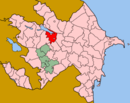 Categories:
- Populated places in Yevlakh Rayon
- Yevlakh Rayon geography stubs


Wikimedia Foundation. 2010.