Aşağı Küngüt

Aşağı Küngüt
Aşağı Küngüt
—  Municipality  —
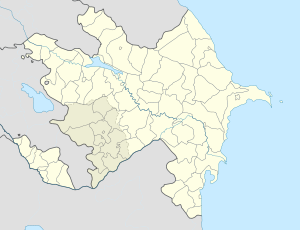
Aşağı Küngüt is located in Azerbaijan
Aşağı Küngüt
Coordinates: 41°03′51″N 47°15′02″E / 41.06417°N 47.25056°E / 41.06417; 47.25056Coordinates: 41°03′51″N 47°15′02″E / 41.06417°N 47.25056°E / 41.06417; 47.25056
Country  Azerbaijan
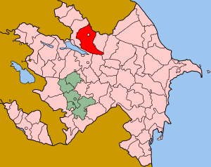
Rayon Shaki
Population[citation needed]
 – Total 1,298
Time zone AZT (UTC+4)
 – Summer (DST) AZT (UTC+5)

Aşağı Küngüt (also, Ashaga-Kyungyut and Ashagy-Kyungyut) is a village and municipality in the Shaki district of Azerbaijan. It has a population of 1,298.

The etymology of the name Küngüt in the name of the village comes from the name of the country Kang (Kangar), with a Sogdian plural suffix -t, expressed in the ancient Chinese annals as Guniue.[1]

References

  1. ^ Yu. Zuev, "Early Türks: Essays on history and ideology", p. 148, with reference to M.Kashgari "Divan-i Lughat-it-Turk", Vol. 1, p. 159; Vol. 3, p. 149, Tashkent, 1964


Wikimedia Foundation. 2010.

Игры ⚽ Поможем написать реферат

Look at other dictionaries:

  • Aşağı Layısqı —   Municipality   …   Wikipedia

  • Aşağı Göynük —   Municipality   …   Wikipedia

  • Aşağı Daşağıl —   Municipality   …   Wikipedia

  • Aşağı Şabalıd —   Municipality   …   Wikipedia

  • Aşağı Kəldək — Coordinates: 41°02′13″N 47°16′50″E / 41.03694°N 47.28056°E / 41.03694; 47.28056 …   Wikipedia

  • Aşağı Zəyzid — Coordinates: 41°05′35″N 47°12′35″E / 41.09306°N 47.20972°E / 41.09306; 47.20972 …   Wikipedia

  • Orta Zəyzid — For the other town of the same name, see Aşağı Zəyzid. Orta Zəyzid   Municipality   …   Wikipedia

  • Çolaxlı — Coordinates: 41°02′N 47°12′E / 41.033°N 47.2°E / 41.033; 47.2 …   Wikipedia

  • Daşyüz — Coordinates: 41°14′N 46°56′E / 41.233°N 46.933°E / 41.233; 46.933 …   Wikipedia

  • Çayqaraqoyunlu —   Municipality   …   Wikipedia

Share the article and excerpts

Direct link
Do a right-click on the link above
and select “Copy Link”