- Aşağı Ləgər, Qusar
-
Aşağı Ləgər — Municipality — 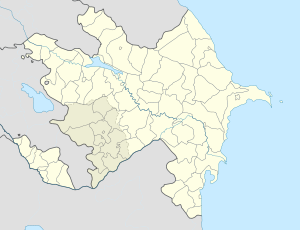
 Aşağı Ləgər
Coordinates: 41°29′51″N 48°27′14″E / 41.4975°N 48.45389°ECoordinates: 41°29′51″N 48°27′14″E / 41.4975°N 48.45389°E Country  Azerbaijan
Rayon Qusar Population[citation needed] – Total 1,725 Time zone AZT (UTC+4) – Summer (DST) AZT (UTC+5) Aşağı Ləgər (also, Ashaga-Leger, Ashagy-Leger, Ashagy-Lyagyar, and Ash-Leger) is a village and municipality in the Qusar Rayon of Azerbaijan. It has a population of 1,725.
References
Arçan, Aşağı İmamqulukənd, Aşağı Ləgər, Aşağı Qələnxur, Atlıxan, Avaran, Avaranqışlaq, Bala Qusar, Bədirqala, Bədişqala, Böyük Muruq, Caqar, Caqarqışlaq, Çətgün, Cibir, Çiləgir, Çubuqlu, Düztahir, Dzhibir-Kazmalary, Əcəxur, Əcəxuroba, Əlix, Əniq, Əniqoba, Əniqqışlaq, Əvəcük, Gədəzeyxur, Gican, Gilah, Gilahoba, Girik, Gündüzqala, Haçatala, Hərzəoba, Həsənqala, Həzrə, Hil, Hiloba, İmamqulukənd, Kazioba, Kələntəroba, Knarçay, Köhnə Xudat Qazmalar, Köhnə Xudat, Kufoba, Kuzun, Kuzunqışlaq, Kyraglydzhek, Laza, Ləcət, Ləgərqışlaq, Ləngi, Minaxür, Mucuq, Mucuqoba, Mudzhukh-Kazma, Nəcəfkənd, Piral, Qalacıq, Qaratoba, Qayakənd, Qullar, Quturğan, Quxur, Quxuroba, Salahoba, Samur, Şirvanovka, Sudur, Suduroba, Suvacal, Torpaqkörpü, Ukur, Urva, Urvaoba, Üzdənoba, Xuluq, Xuluqoba, Xuray, Xurəl, Yasab, Yasaboba, Yeni Həyat, Yerği Kek, Yuxarı Ləgər, Yuxarı Qələnxur, Yuxarı Tahircal, Yuxarı Zeyxur, Zindanmuruq, Zindanmuruqqışlaq, Zuxul, Zuxuloba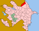 Categories:
- Populated places in Qusar Rayon
- Qusar Rayon geography stubs


Wikimedia Foundation. 2010.