Washington Street Shoe District
- Washington Street Shoe District
Infobox_nrhp | name =Washington Street Shoe District
nrhp_type = hd
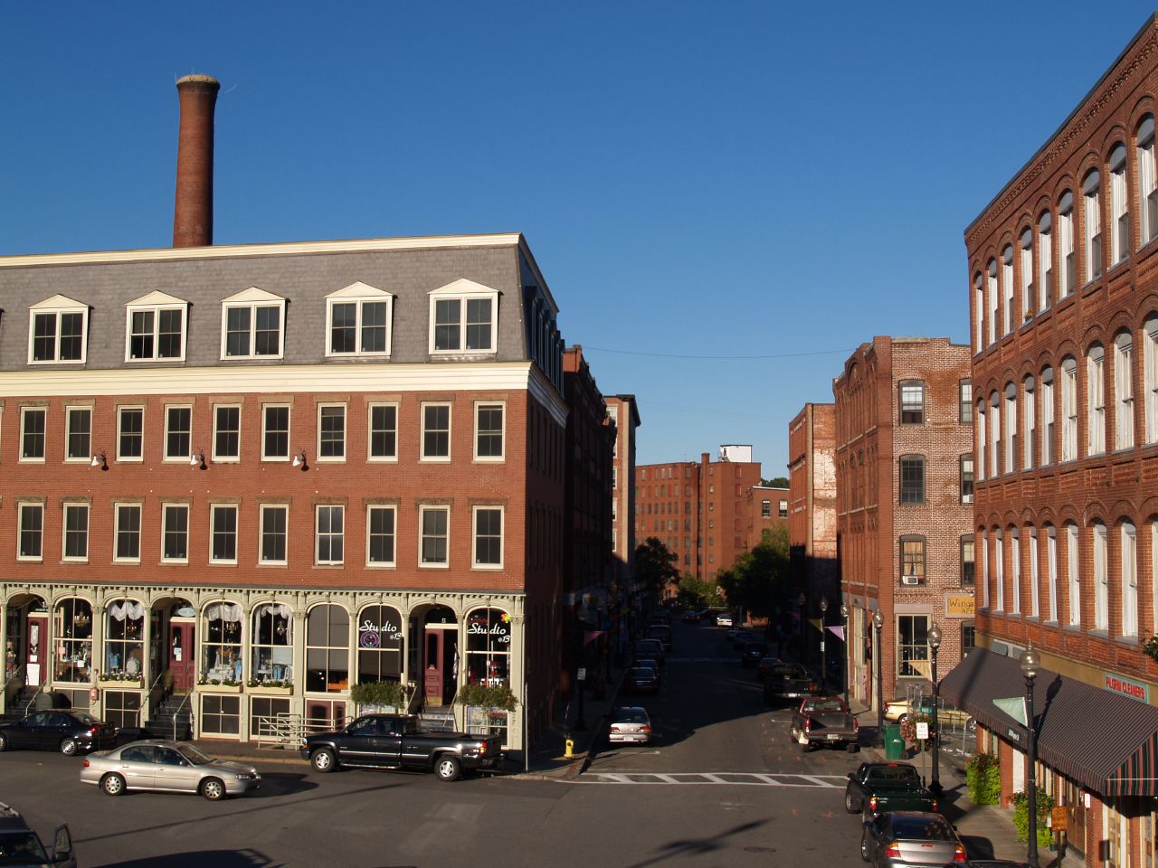
caption = Wingate Street
location= Haverhill, Massachusetts
lat_degrees = 42
lat_minutes = 46
lat_seconds = 25
lat_direction = N
long_degrees = 71
long_minutes = 5
long_seconds = 5
long_direction = W
locmapin = Massachusetts
area =
built =1856
architect= Littlefield,Josiah M.; Multiple
architecture= Italianate, Queen Anne, Romanesque
added = October 14, 1976
governing_body = U.S. POSTAL SERVICE
refnum=76000257[cite web|url=http://www.nr.nps.gov/|title=National Register Information System|date=2008-04-15|work=National Register of Historic Places|publisher=National Park Service] ]
Washington Street Shoe District is a historic district on Washington, Wingate, Emerson Sts. Railroad and Washington Squares in Haverhill, Massachusetts.
References
Wikimedia Foundation.
2010.
Look at other dictionaries:
Georgetown, Washington, D.C. — Infobox nrhp2 name = Georgetown Historic District nhld=yes caption = location = Roughly bounded by Whitehaven St., Rock Creek Park, Potomac River, and Georgetown University campus nearest city = lat degrees = 38 lat minutes = 54 lat seconds = 34… … Wikipedia
Detroit Financial District — U.S. National Register of Historic Places … Wikipedia
Cheney, Washington — City Location of Cheney, Washington … Wikipedia
National Register of Historic Places listings in Washington County, Texas — List of Registered Historic Places in Washington County, Texas Map of all coordinates from Google Map of all coordinates from Bing … Wikipedia
Liste der Einträge im National Register of Historic Places im Washington County (Texas) — Die Liste der Registered Historic Places im Washington County führt alle Bauwerke und historischen Stätten im texanischen Washington County auf, die in das National Register of Historic Places aufgenommen wurden. Aktuelle Einträge Lfd. Nr. Name… … Deutsch Wikipedia
National Register of Historic Places listings in Essex County, Massachusetts — Location of Essex County in Massachusetts This is a list of the National Register of Historic Places listings in Essex County, Massachusetts. This is intended to be a complete list of the properties and districts on the National Register of… … Wikipedia
Streetcars in Washington, D.C. — This article refers to the streetcars that existed in Washington prior to 1962. For information on the proposed new streetcar lines, see DC Streetcar. Washington Streetcars 15th Street NW in the early 20th century Info … Wikipedia
Bloomingdale, Washington, D.C. — The neighborhood of Bloomingdale is in the heart of Washington, D.C. less than two miles (3 km) north of the U.S. Capitol. Specifically, Bloomingdale lies south of Channing Street NW, east of 2nd Street NW (north of Rhode Island Avenue), east of… … Wikipedia
Essex National Heritage Area — Salem Witch Museum Die fast 500 Quadratmeilen (1.300 Quadratkilometer) große Essex National Heritage Area ist ein 1996 vom US Kongress ausgewiesenes Schutzgebiet im Osten des Bundesstaates Massachusetts nördlich von Boston. Inhaltsverzeichnis … Deutsch Wikipedia
Lynden, Washington — Infobox Settlement official name = Lynden, Washington Nooksack: Sqwehálich settlement type = City nickname = Gem City [ [http://theusgenweb.org/wa/whatcom/townhistories/lynden2.htm The Gem City of Twenty Years Ago] ] [… … Wikipedia