- Route 10 bridge, Northfield, Massachusetts
Infobox Bridge
bridge_name=Route 10 Bridge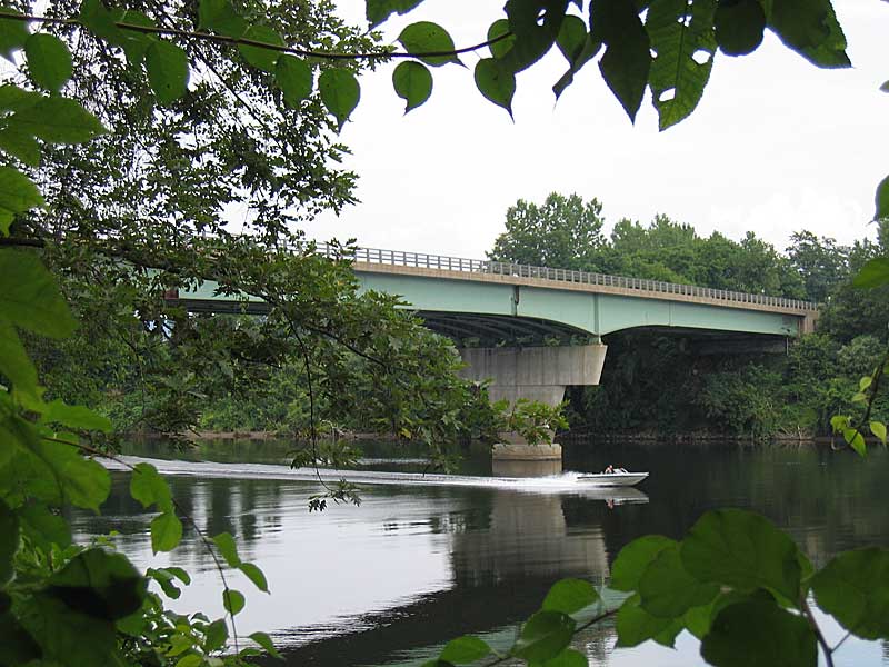
caption=
official_name=
carries=
crosses=Connecticut River
locale=Northfield, Franklin County,Massachusetts
maint=MassHighway
id=N2200412EMHDNBI
designer=
design=Steel Stringer/Multi-beam or Girder
material=Steel (and concrete)
spans=3
pierswater=
mainspan=
length=Convert|215.5|m|ft|1
width=Convert|13.4|m|ft|1
height=
load=57.5 Metric Tons
clearance=
below=
traffic=4267 (2002)
begin=
complete=
open=1969
closed=
toll=
map_cue=
map_
map_text=
map_width=
coordinates= coord|42|41|00|N|72|28|18|W|region:US_type:landmark|display=inline,title|name=Bennett's Meadow Bridge
lat=
long= The Route 10 bridge, also known as Bennett's Meadow Bridge is a convert|215.5|m steel stringer bridge crossing theConnecticut River in the town ofNorthfield, Massachusetts . The bridge carries state highway Route 10 and was built in 1969.History
The town of Northfield first authorized a bridge at or near the site of the current bridge in 1810. The bridge was built by a private corporation with the town holding stock. The new bridge was destroyed in a flood after only a few years. A horse boat ferry, known as Bennett's Meadow Ferry, replaced the river crossing. [J.H. Temple,G. Sheldon, and M.T. Stratton, [http://books.google.com/books?id=yjdcfw-5Q2cC&pg=PA355 A History of the Town of Northfield] , (J. Munsell, 1875)] In 1897, the state legislature authorized Franklin County to construct a second bridge at or near the site of the ferry at a cost not to exceed $35,000. The new bridge was designed by
Edward Shaw of Boston and was opened to traffic in 1899. [ [http://books.google.com/books?id=el8yAAAAIAAJ&pg=RA1-PA495 Massachusetts General Court, Acts of 1897, Chapter 497] ] The bridge was one of the first bridges erected by a then novel method without the use offalse work s that has since become standard procedure. ["A Novel Method of Bridge Erection; Connecticut River Bridge, Northfield, Mass.", "Engineering News", Sept. 7, 1899.] The 1899 bridge was later demolished and a third bridge (the current bridge) was constructed just south of the former bridge, resulting also in the slight relocation of the highway.ee also
List of crossings of the Connecticut River References
* [http://nationalbridges.com/nbi_record.php?StateCode=25&struct=N2200412EMHDNBI Bridge Inventory Record] on NationalBridges.com.
*cite book | last = Massachusetts Historical Commission, Massachusetts Secretary of the Commonwealth| authorlink = Massachusetts Secretary of the Commonwealth | year = 1982 | title = MHC Reconnaissance Survey Town Report, Northfield| publisher = Commonwealth of Massachusetts | location = Boston|url=http://www.sec.state.ma.us/MHC/mhcpdf/Town%20reports/CT-Valley/nfl.pdfFootnotes
Crossings navbox
structure = Crossings
place =Connecticut River
bridge = Route 10 Bridge
bridge signs =
upstream = Rail bridge
upstream signs =
downstream =French King Bridge
downstream signs =
Wikimedia Foundation. 2010.