- Meije
-
For the town in the Netherlands, see Meije (Netherlands).
Meije 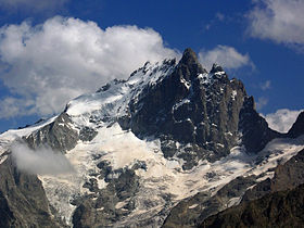
La MeijeElevation 3,984 m (13,071 ft) Prominence 821 m (2,694 ft) Location Isère - Hautes-Alpes,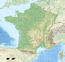
 Meije
Meije France
Range Dauphiné Alps Coordinates 45°00′17″N 6°18′31″E / 45.00472°N 6.30861°ECoordinates: 45°00′17″N 6°18′31″E / 45.00472°N 6.30861°E Climbing First ascent 1877 by E.B. de Castelneu and P. Gaspard and son Easiest route mixed climbing La Meije is a mountain in the Massif des Écrins range, located at the border of the Hautes-Alpes and Isère départements. It overlooks the nearby village of La Grave, a mountaineering centre and ski resort, well-known for its off-piste and extreme skiing possibilities.
La Meije is composed of three principal summits. The highest point is the Grand Pic de la Meije at 3,984 metres. The Grand Pic is notorious in that there is no "easy" path to the top. For this reason, La Meije was the last major peak in the Alps to be summited. The first ascent was made on August 16, 1877 by Pierre Gaspard and his son and their client Emmanuel Boileau de Castelnau. In 1891, J. H. Gibson, U. Almer and F. Boss made the first traverse of the ridge, from west to east.
The Doigt de Dieu (English: Finger of God), a large snow-clad tower at the east end of the ridge, overhanging the south slopes, is an attraction for mountaineers of various levels of ability.
For mountaineering, La Meije can be approached from two mountain refuges:
- The refuge du Promontoire at 3,082 metres, is situated at the bottom of the steep south buttress of the peak, and allows access to routes on the south face of the mountain.
- The refuge de l'Aigle at 3,450 metres, is situated at the top of the Tabuchet glacier, and allows access to the north face.
References
- Some of the content of this article comes from the equivalent French-language Wikipedia article.
Categories:- Mountains of Isère
- Mountains of Hautes-Alpes
- Mountains of the Alps
- Alpine Three-thousanders
- Provence-Alpes-Côte d'Azur geography stubs
- Rhône-Alpes geography stubs


Wikimedia Foundation. 2010.