Maine State Route 228

Maine State Route 228

State Route 228 marker

State Route 228
Route information
Maintained by MaineDOT
Length: 16.93 mi[1] (27.25 km)
Existed: 1939 – present
Major junctions
South end: MA Route 164.svg SR 164 in Washburn
North end: MA Route 161.svg SR 161 in Caribou
Location
Counties: Aroostook
Highway system

State Routes in Maine

SR 227 SR 229

State Route 228 is part of Maine's system of numbered state highways. It runs 16.93 miles (27.25 km) from Washburn to Caribou. It begins at an intersection with State Route 164 in downtown Washburn, and ends at an intersection of State Route 161 in Caribou. The road is also known as Hines Street (in Washburn), Perham Street (in Wade and Perham), Woodland Center Road (in Woodland), and Sweden Street (in Caribou).

228 runs through the communities of Wade, Perham, and Woodland.

SR 228 Truck


State Route 228 Truck
Location: Washburn
Length: 0.6 mi[2] (1.0 km)
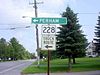
228 Truck Route signage

State Route 228T is part of Maine's system of numbered state highways. It is a 0.6-mile (0.97 km) long truck route that bypasses downtown Washburn. It begins at an intersection with Maine State Route 164 on the West side of downtown Washburn, and ends at an intersection with Maine State Route 228 just North of downtown. The road is also known as Canaan Avenue and Victoria Street. State Route 228T is notable for being the only truck route ever in the Maine State Highway System.

References


Wikimedia Foundation. 2010.

Игры ⚽ Поможем написать курсовую

Look at other dictionaries:

  • Maine State Route 228T — Infobox road highway name = State Route 228T marker alternate name = length mi = 0.6 length round = 2 length ref = [ [http://www.floodgap.com/roadgap/me/r?228T Maine State Route Log via floodgap.com] ] direction a = North direction b = South… …   Wikipedia

  • Maine State Route 164 — State Route 164 Route information Maintained by MaineDOT Length: 23.26 mi[ …   Wikipedia

  • Maine State Route 229 — State Route 229 Route information Maintained by MaineDOT Length: 1.96 mi[1 …   Wikipedia

  • List of Maine State Routes — Standard markers of State Routes in Maine. Highway names Interstates: Interstate x (abbreviated I X) …   Wikipedia

  • Maine — This article is about the U.S. state of Maine. For other uses, see Maine (disambiguation). State of Maine …   Wikipedia

  • Route 173 (Québec) — Route 173 Route du Président Kennedy Informations Gérée par le …   Wikipédia en Français

  • Route 161 (Québec) — Route 161 Informations Gérée par le MTQ Longueur : 173 kilomètres& …   Wikipédia en Français

  • List of highways numbered 228 — The following highways are numbered 228: United States Arkansas Highway 228 California State Route 228 (former) Florida State Road 228 …   Wikipedia

  • Liste der State-, U.S.- und Interstate-Highways in Florida — Die Liste gibt eine Übersicht der State , U.S. und Interstate Highways in Florida. Inhaltsverzeichnis 1 State Routes 2 Interstate Highways 3 United State Routes …   Deutsch Wikipedia

  • Liste der State-, U.S.- und Interstate-Highways in Georgia — Dies ist eine Aufstellung von State Routes, U.S. Highways und Interstates im US Bundesstaat Georgia, nach Nummern. Inhaltsverzeichnis 1 State Routes 1.1 Gegenwärtige Strecken 1.2 Außer Dienst gestellte Strecken …   Deutsch Wikipedia

Share the article and excerpts

Direct link
Do a right-click on the link above
and select “Copy Link”