- Chacao Channel bridge
-
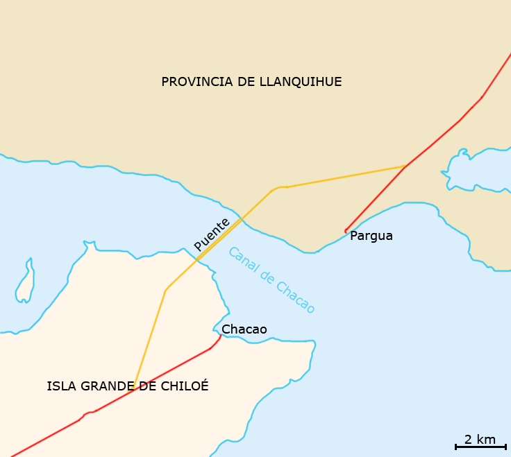
 Chacao Channel bridge map
The Chacao Channel bridge, officially decreed Chiloé Bicentennial Bridge, was a planned suspension bridge that was to link the island of Chiloé with mainland Chile crossing the Chacao Channel. It was one of the several projects that were planned to commemorate the Chile's bicentennial in 2010. If completed, it would have been the largest suspension bridge in South America.
Construction of the bridge was scheduled to start in the second half of 2007 and completion was due in late 2012 at an approximate cost of US$410 million. However, on July 31, 2006, the consortium in charge of the project revealed that the total cost of constructing the bridge was US$930 million, which was above the limit of US$607 million imposed by the Chilean state. Because of this, the ministry of Public Works decided not to continue with the project, resulting in outrage by some people of Chiloé, who saw this as a broken promise by the previous government of the same coalition. The mayors of Chiloé's communes, most of them part of the ruling left-wing coalition, criticized the ministry of Public Works for cancelling the project. To compensate the people of Chiloé for not building the bridge, president Michelle Bachelet promised a variety of improvements of the island's infrastructure.
In June 2009, the government announced it was reviving the project. The bridge would be redesigned (it would no longer be a suspension bridge) and its total cost would be less than in the original design, due to the falling price of steel worldwide. The toll would be also cheaper than a ferry ticket.[1]
Contents
Dimensions and features
The bridge's length would total 2,635 m, and would consist of three concrete towers (two 179.6 m high towers and one 160.77 m high south tower), two mainspans of 1,055 m and 1,100 m, and a suspended sidespan of 380 m, providing a minimum vertical clearance for navigation of 59 m. It would link Highway Ruta 5 Sur near Pargua with Chiloé near Chacao via two one-way lanes on each side. The bridge, which is designed for a lifespan of 100 years, would be resistant to winds over 240 km/h, magnitude 10 earthquakes (Richter scale) and strong sea currents.
Design and construction
Design, financing, construction, operation and maintenance was awarded for 30 years to the Chiloé Bicentennial Bridge Consortium, consisting of French company VINCI Construction Grand Projets, German company Hochtief, American Bridge Company and Chilean companies Besalco and Tecsa. Hochtief is overall leader, French company VINCI is technical lead, and American Bridge is contributing cable spinning and deck erection technology.
Advantages
Currently, the only way to reach Chiloé from the mainland is by ferry, which takes about 25-45 minutes. With the bridge, the time would be reduced to less than three minutes travelling at a speed of 100 km/h (63 mph).
Criticism
Supporters expected that the bridge would boost tourism and increase investment and business opportunities on the island. However, some inhabitants of Chiloé didn't agree and they claimed that the bridge was harmful and even dangerous. This was due to claims that it would increase resource collection such as logging and increase pollution.
References
- American Bridge Co.
- La Nación, December 23, 2004 (in Spanish) (Ed. note: The bridge depicted in this article is incorrect.)
- El Mercurio, July 15, 2005 (in Spanish)
- El Mercurio, January 14, 2006 (in Spanish)
Categories:- Proposed bridges
- Transport in Los Lagos Region
- Buildings and structures in Los Lagos Region
Wikimedia Foundation. 2010.