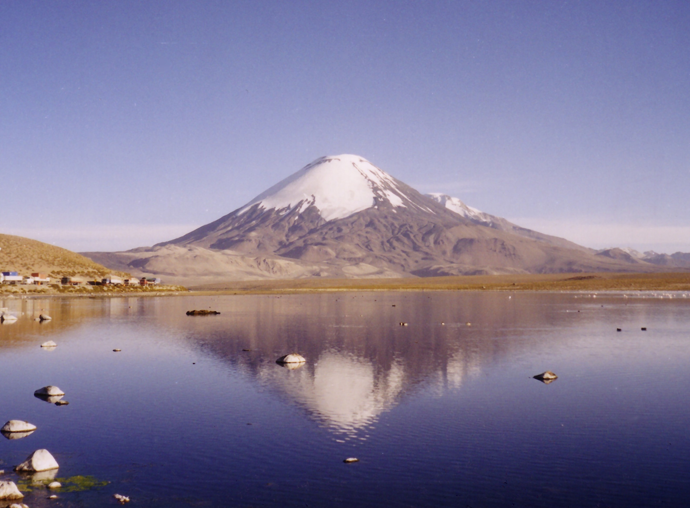
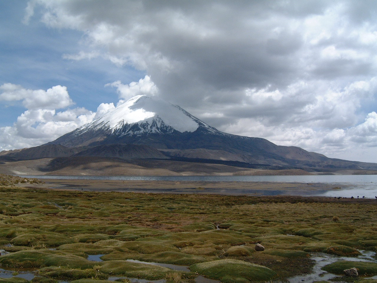
Chungará Lake

Chungará Lake
Lake Chungará
Lake and Parinacota Volcano
Location Arica and Parinacota Region, Chile
Coordinates 18°15′S 69°09′W / 18.25°S 69.15°W / -18.25; -69.15Coordinates: 18°15′S 69°09′W / 18.25°S 69.15°W / -18.25; -69.15
Primary inflows Chungará, Sopocalane
Basin countries Chile
Surface area 21.5 km²
Max. depth 33 m
Surface elevation 4517 m
"Chungara" redirects here. For the journal see Chungara (journal).

Chungará is a lake situated in the extreme north of Chile, in the Altiplano of Arica and Parinacota Region. It is the 29th highest lake in the world (and the 10th highest in South America)[1]. It is near the volcanos Parinacota (20,827 feet or 6,348 metres) and Pomerape (20,413 feet or 6,222 metres)[2]. It was formed 8000 years ago, when a major collapse of the edifice of Parinacota produced an avalanche of 6km³ of debris which blocked drainage pattern, thus creating the lake.

The situation of this lake is not very stable due to environmental issues nowadays, especially concerning potable water supply to dense population. See the state on August 9, 2008, by this link: http://outdoors.webshots.com/album/570624077WBPqhi?vhost=outdoors


Wikimedia Foundation. 2010.

Игры ⚽ Нужен реферат?

Look at other dictionaries:

  • Cotacotani Lake — Cotacotani (left), Pomerape and Parinacota (right). Location Arica Parinacota Region Coordinates …   Wikipedia

  • Lago Chungará — País  Chile Región …   Wikipedia Español

  • Lago Chungará — Vulkan Parinacota und Lago Chungará Geographische Lage Chile (Región de Arica y Parinacota, Provincia de Arica) Zuflüsse …   Deutsch Wikipedia

  • List of Chile-related topics — This is a list of topics related to Chile. Those interested in the subject can monitor changes to the pages by clicking on Related changes in the sidebar.Chile* ChileArchaeological sites of Chile* Easter Island * Monte VerdeEaster Island* Aku Aku …   Wikipedia

  • Laguna de Cotacotani — Infobox lake lake name = Cotacotani Lake image lake = Volcan Parinacota + CotaCotani lakes.jpg caption lake = Cotacotani (left), Pomerape and Parinacota (right). image bathymetry = caption bathymetry = location = Arica Parinacota Region coords =… …   Wikipedia

  • Parinacota Volcano — Infobox Mountain Name = Parinacota Photo = Parinacota.jpg Caption = Parinacota and Chungará Lake Elevation = 6,348 metres (20,827 feet) Location = Bolivia Chile Range = Andes Prominence = Coordinates = coord|18|10|0|S|69|9|0|W|type:mountain… …   Wikipedia

  • Nevados de Payachata — FLTR: the Pomerape and Parinacota volcanoes …   Wikipedia

  • List of lakes in Chile — This is a list of lakes in Chile. There are lakes are of varying types and origins but the majority of the lakes (specially in the south) are glacial in origin. A lakes location is identified by the natural region. The watershed or catchment area …   Wikipedia

  • Chungar — may refer to: Chungar Lake or Chungará Lake, a lake in the Lauca National Park, Chile Chungar (camp) (11° 7 S, 76° 32 W), the camp of a mining company in Peru which was destroyed by a landslide into Lake Yanahuni Eslām Chūngar, a town in Northern …   Wikipedia

  • Chile — For other uses, see Chile (disambiguation). Republic of Chile República de Chile (Spanish) …   Wikipedia

Share the article and excerpts

Direct link
Do a right-click on the link above
and select “Copy Link”