City Road Basin

City Road Basin
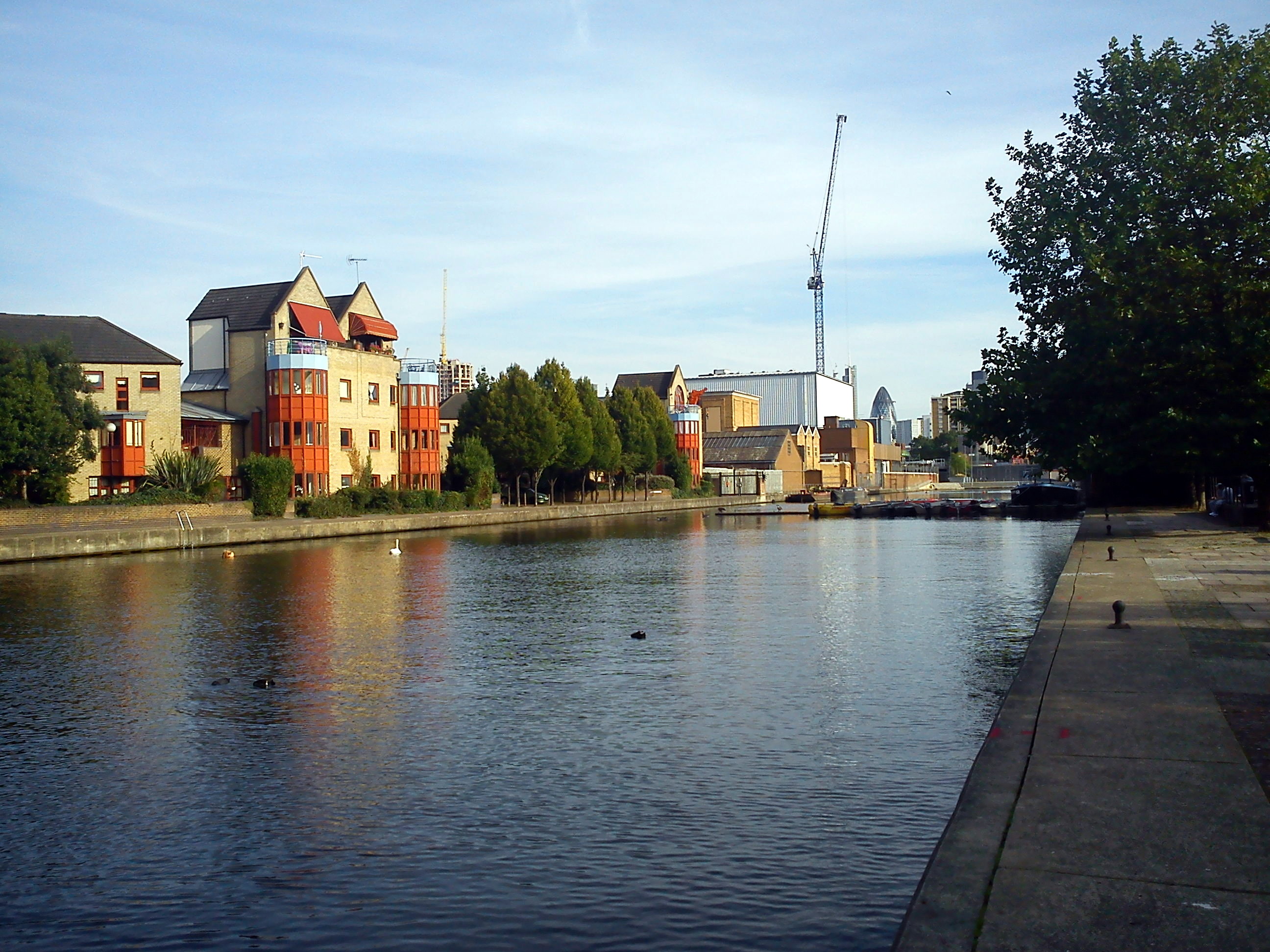
City Road Basin from Graham Road Park
[v · Legend
Urban straight track
To Paddington
Station on transverse track
Unknown BSicon "tSTRq" + Urban straight track
Kings Cross Station
Unknown BSicon "uAKRZq" Unknown BSicon "uAKRZu"
A5200 York Way
Unknown BSicon "uDOCKl" Waterway T-junction to right
Battlebridge Basin
Unknown BSicon "uAKRZq" Unknown BSicon "uAKRZu"
A5203 Caledonian Road
Enter urban tunnel
Unknown BSicon "uFEATURE" Urban tunnel straight track
Pentonville
Urban tunnel straight track
Islington Tunnel (960 yd)
Unknown BSicon "uAKRZq"
Urban tunnel straight track + Unknown BSicon "uAKRZq"
A1 Upper Islington Street
Exit urban tunnel
Waterway under track or footbridge
Danbury Road bridge
Unknown BSicon "uFGATEu"
City Road Lock
Unknown BSicon "uDOCKl" Waterway T-junction to right
City Road Basin
Waterway under track or footbridge
Wharf Road bridge
Unknown BSicon "uDOCKl" Waterway T-junction to right
Wenlock Basin
Waterway under track or footbridge
Packington Square footbridge
Unknown BSicon "uFGATEu"
Sturts Road Lock
Unknown BSicon "uAKRZq" Unknown BSicon "uAKRZu"
A1200 New North Road Bridge
Urban straight track
To Limehouse

Coordinates: 51°31′52″N 0°05′50″W / 51.531140°N 0.097321°W / 51.531140; -0.097321 The City Road Basin is a canal basin and part of the Regent's Canal in London, owned by British Waterways. There are currently several large-scale residential developments in progress.

This section of the canal was built after the Camden Town to Paddington arm, in 1820. This basin, the nearest to the City of London soon eclipsed the Paddington Basin in the amount of goods carried, principally for coal and building materials. Goods that were being shipped locally, in contrast to the canal's original purpose of transshipping imports to the Midlands. The opening of the London and Birmingham Railway in 1838 actually increased the tonnage of coal carried by the canal. However, by 1929, with the Midlands trade lost to the railways, and more deliveries made by road, the canal – and this basin, fell into a long decline.[1]

See also

Moore Bridge.jpg UK Waterways portal

References

External links


Wikimedia Foundation. 2010.

Игры ⚽ Нужно сделать НИР?

Look at other dictionaries:

  • City Road (disambiguation) — City Road is a street in Islington. City Road may also refer to: City Road, Sydney, New South Wales, Australia City Road Baptist Church, a Baptist church on Upper York Street City Road Basin, part of the Regent s Canal in London City Road… …   Wikipedia

  • City Road Lock — No. 5 City Road Lock, 2008 Waterway Regent s Canal County …   Wikipedia

  • Wenlock Basin — The Wenlock Basin is part of the Regent s Canal in the London Borough of Hackney, just east of City Road Basin, on the other side of Wharf Road. It was constructed in 1826 and is close to the entrance of the Islington Tunnel, where a tug service… …   Wikipedia

  • City of Shoalhaven — New South Wales Location in NSW Population: 95,000(2009) …   Wikipedia

  • City Mill River — City Mill Lock The Waterworks River. To the left is the lock leading to City Mill River Waterway Bow Back Rivers River Lee …   Wikipedia

  • City of Halifax — Halifax Jipugtug Chebucto Halafacs (Gaelic)   Metropolitan area   …   Wikipedia

  • Basin, Montana — Infobox Settlement official name = Basin settlement type = CDP nickname = motto = imagesize = 250px image caption = Basin Street image image mapsize = 250px map caption = Location of Basin, Montana mapsize1 = 250px map caption1 = subdivision type …   Wikipedia

  • City of Sails — Auckland Spitzname: City of Sails Lage …   Deutsch Wikipedia

  • City of sails — Auckland Spitzname: City of Sails Lage …   Deutsch Wikipedia

  • City Creek (California) — For the tributary of the Jordan River in Utah, see City Creek (Utah). Coordinates: 34°09′55″N 117°21′43″W / 34.16528°N 117 …   Wikipedia

Share the article and excerpts

Direct link
Do a right-click on the link above
and select “Copy Link”