East Riverside, New Orleans

East Riverside, New Orleans

Geobox Neighborhood
name = East Riverside
native_name =
other_name =
other_name1 =
category = New Orleans Neighborhood
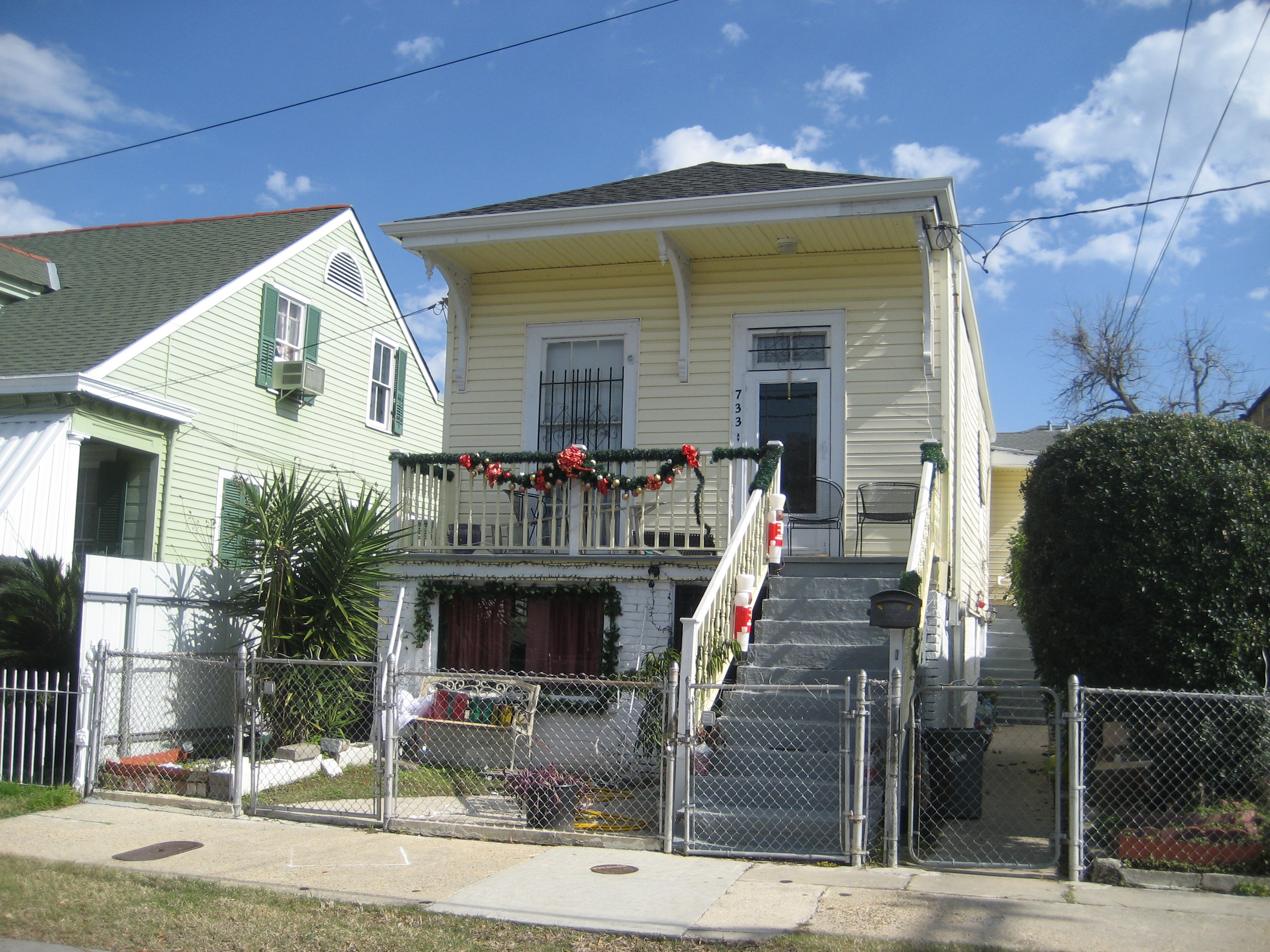


image_caption = "Raised shotgun" style house, 19th century residential architecture in the neighborhood


flag_size =
symbol =
symbol_size =
etymology_type =
etymology =
nickname =
motto =
country = United States
state = Louisiana
region_type = City
region = New Orleans
district_type = Planning District
district = District 2, Central City/Garden District
area_imperial = 0.25
area_land_imperial = 0.25
area_water_imperial = 0.00
area_water_percentage = auto
area_percentage_round = 2
area_round = 1
location =
lat_d = 29
lat_m = 55
lat_s = 10
lat_NS = N
long_d = 90
long_m = 05
long_s = 40
long_EW = W
elevation_imperial = 7
elevation_round = 1
population_as_of = 2000
population = 3220
population_density_imperial = auto
established_type =
established =
mayor =
timezone = CST
utc_offset = -6
timezone_DST = CDT
utc_offset_DST = -5
postal_code =
postal_code_type = ZIP Codes
area_code = 504
area_code_type =
code2_type =
code2 =
free_type =
free =
free1_type =
free1 =


map_size =
map_caption =
map_locator =
map_locator_x =
map_locator_y =
website =

East Riverside is a neighborhood of the city of New Orleans. A subdistrict of the Central City/Garden District Area, its boundaries as defined by the City Planning Commission are: Magazine Street to the north, Toledano Street to the east, Tchoupitoulas Street to the south and Napoleon Avenue to the west.

Geography

East Riverside is located at coor dms|29|55|10|N|90|05|40|W|city GR|1 and has an elevation of convert|7|ft|1GR|3. According to the United States Census Bureau, the district has a total area of convert|0.25|mi2|1. convert|0.25|mi2|1 of which is land and convert|0.00|mi2|1 (0.0%) of which is water.

Adjacent Neighborhoods

* Touro (north)
* Irish Channel (east & south)
* West Riverside (west)

Boundaries

The City Planning Commission defines the boundaries of East Riverside as these streets: Magazine Street, Toledano Street, Tchoupitoulas Street and Napoleon Avenue. [cite web|url=http://gnocdc.org/orleans/2/69/index.html|title=East Riverside Neighborhood|author=Greater New Orleans Community Data Center|accessdate=2008-06-21]

Demographics

As of the censusGR|2 of 2000, there were 3,220 people, 1,386 households, and 709 families residing in the neighborhood. The population density was 12,880 /mi² (5,367 /km²).

ee also

* New Orleans neighborhoods

References


Wikimedia Foundation. 2010.

Игры ⚽ Поможем написать курсовую

Look at other dictionaries:

  • West Riverside, New Orleans — Geobox Neighborhood name = West Riverside native name = other name = other name1 = category = New Orleans Neighborhood image caption = Neighborhood restaurant flag size = symbol = symbol size = etymology type = etymology = nickname = motto =… …   Wikipedia

  • New Orleans metropolitan area — New Orleans Metairie Kenner Common name: New Orleans Metropolitan Area Largest city New Orleans Other cities …   Wikipedia

  • New Orleans Jazz National Historical Park — U.S. National Register of Historic Places …   Wikipedia

  • New Orleans neighborhoods — In 1980 the New Orleans City Planning Commission divided the city into 13 planning districts and 72 distinct neighborhoods.While most of these assigned boundaries match with traditional local designations, some others differ from common… …   Wikipedia

  • New Orleans Women's Open — The New Orleans Women s Open was a golf tournament on the LPGA Tour from 1952 to 1954.[1] It was played in New Orleans, Louisiana at City Park Course in 1952 and 1953 and at the Colonial Country Club. Winners 1954 Marlene Bauer 1953 Patty Berg… …   Wikipedia

  • Audubon, New Orleans — Geobox Neighborhood name = Audubon native name = other name = University District other name1 = category = New Orleans Neighborhood image caption = Christian Roselius House in the Greenville Section flag size = symbol = symbol size = etymology… …   Wikipedia

  • Neighborhoods in New Orleans — In 1980 the New Orleans City Planning Commission divided the city into 13 planning districts and 72 distinct neighborhoods. While most of these assigned boundaries match with traditional local designations, some others differ from common… …   Wikipedia

  • Irish Channel, New Orleans — Geobox Neighborhood name = Irish Channel native name = other name = other name1 = category = New Orleans Neighborhood image size = image caption = flag size = symbol = symbol size = etymology type = etymology = nickname = motto = country = United …   Wikipedia

  • Audubon Park, New Orleans — Audubon Park entrance on the St. Charles Avenue side, directly across from Gibson Hall Audubon Park (historically French: Plantation de Boré[1]) is a city park located in the Uptown neighborhood of New Orleans …   Wikipedia

  • List of tallest buildings in New Orleans — Skyline of the Central Business District of New Orleans The city of New Orleans, Louisiana, United States, is the site of 106 completed high rises,[1] 36 of which stand taller than 250 feet (76  …   Wikipedia

Share the article and excerpts

Direct link
Do a right-click on the link above
and select “Copy Link”