Touro, New Orleans

Touro, New Orleans

Geobox Neighborhood
name = Touro
native_name =
other_name =
other_name1 =
category = New Orleans Neighborhood
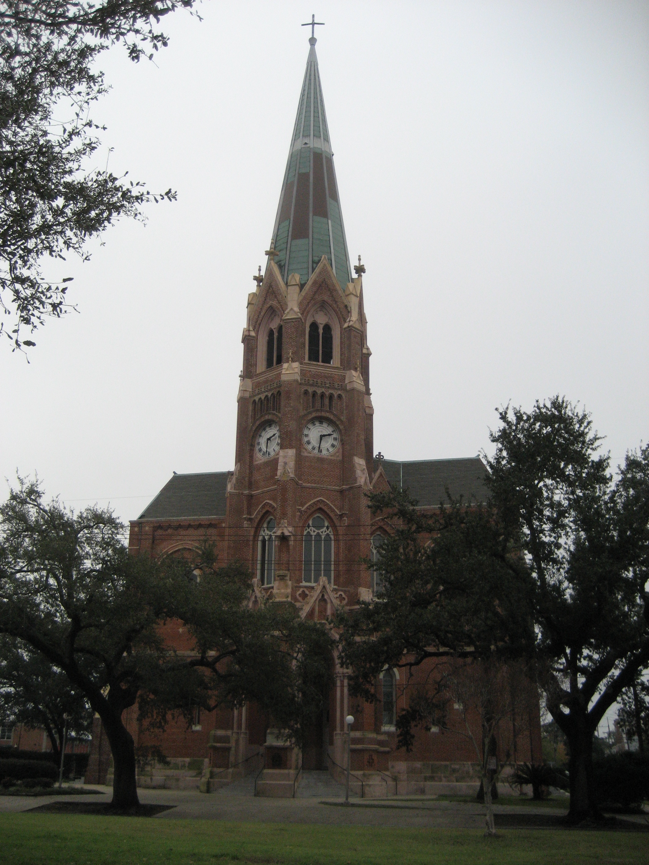


image_caption = St. Stephen's Church on Napoleon Avenue


flag_size =
symbol =
symbol_size =
etymology_type =
etymology =
nickname =
motto =
country = United States
state = Louisiana
region_type = City
region = New Orleans
district_type = Planning District
district = District 2, Central City/Garden District
area_imperial = 0.30
area_land_imperial = 0.30
area_water_imperial = 0.00
area_water_percentage = auto
area_percentage_round = 2
area_round = 1
location =
lat_d = 29
lat_m = 55
lat_s = 27
lat_NS = N
long_d = 90
long_m = 05
long_s = 46
long_EW = W
elevation_imperial = 3
elevation_round = 1
population_as_of = 2000
population = 3242
population_density_imperial = auto
established_type =
established =
mayor =
timezone = CST
utc_offset = -6
timezone_DST = CDT
utc_offset_DST = -5
postal_code =
postal_code_type = ZIP Codes
area_code = 504
area_code_type =
code2_type =
code2 =
free_type =
free =
free1_type =
free1 =


map_size =
map_caption =
map_locator =
map_locator_x =
map_locator_y =
website =

Touro is a neighborhood of the city of New Orleans. A subdistrict of the Central City/Garden District Area, its boundaries as defined by the City Planning Commission are: St. Charles Avenue to the north, Toledano Street to the east, Magazine Street to the south and Napoleon Avenue to the west.

Geography

Touro is located at coor dms|29|55|27|N|90|05|46|W|city GR|1 and has an elevation of convert|3|ft|1GR|3. According to the United States Census Bureau, the district has a total area of convert|0.30|mi2|1. convert|0.30|mi2|1 of which is land and convert|0.00|mi2|1 (0.0%) of which is water.

Adjacent Neighborhoods

* Milan (north)
* Garden District (east)
* East Riverside (south)
* Uptown (west)

Boundaries

The City Planning Commission defines the boundaries of Touro as these streets: St. Charles Avenue, Toledano Street, Magazine Street and Napoleon Avenue. [cite web|url=http://gnocdc.org/orleans/2/67/index.html|title=Touro Neighborhood|author=Greater New Orleans Community Data Center|accessdate=2008-06-21]

Demographics

As of the censusGR|2 of 2000, there were 3,242 people, 1,672 households, and 482 families residing in the neighborhood. The population density was 10,807 /mi² (4,053 /km²).

ee also

* New Orleans neighborhoods

References


Wikimedia Foundation. 2010.

Игры ⚽ Поможем сделать НИР

Look at other dictionaries:

  • NEW ORLEANS — NEW ORLEANS, U.S. port and commercial center near the mouth of the Misxsissippi River in the State of louisiana . Before Hurricane Katrina struck the city on August 29, 2005, had an estimated population of approximately 1,200,000, of which about… …   Encyclopedia of Judaism

  • Touro Synagogue (New Orleans) — Touro Synagogue is the name of a Reform synagogue in New Orleans, Louisiana, named after Judah Touro, Isaac Touro s son.The New Orleans Touro Synagogue is one of the Oldest synagogues in the United States. The current synagogue was founded in… …   Wikipedia

  • New Orleans — The Big Easy and NOLA redirect here. For other uses, see The Big Easy (disambiguation) and NOLA (disambiguation). This article is about the city. For other uses, see New Orleans (disambiguation). City of New Orleans Ville de La Nou …   Wikipedia

  • New Orleans neighborhoods — In 1980 the New Orleans City Planning Commission divided the city into 13 planning districts and 72 distinct neighborhoods.While most of these assigned boundaries match with traditional local designations, some others differ from common… …   Wikipedia

  • Milan, New Orleans — Coordinates: 29°55′59″N 90°05′50″W / 29.93306°N 90.09722°W / 29.93306; 90.09722 …   Wikipedia

  • Uptown, New Orleans — Geobox Neighborhood name = Uptown native name = other name = other name1 = category = New Orleans Neighborhood image size = image caption = flag size = symbol = symbol size = etymology type = etymology = nickname = motto = country = United States …   Wikipedia

  • List of songs about New Orleans — The is a list of songs set in or referring to the city of New Orleans, Louisiana.9* 912 Greens by Ramblin Jack ElliotA* Acadia to Louisiana by Bruce Daigrepont * [Ain t] No City Like New Orleans by Earl King * After the Mardi Gras performed by… …   Wikipedia

  • Congregation Beth Israel (New Orleans, Louisiana) — For other synagogues named Beth Israel , see Beth Israel. Beth Israel Beth Israel building on Canal Boulevard in 2010, gutted and vacant. Lines from long standing floodwaters are still visible. Basic information Location …   Wikipedia

  • Neighborhoods in New Orleans — In 1980 the New Orleans City Planning Commission divided the city into 13 planning districts and 72 distinct neighborhoods. While most of these assigned boundaries match with traditional local designations, some others differ from common… …   Wikipedia

  • Garden District, New Orleans — Geobox Neighborhood name = Garden District native name = other name = other name1 = category = New Orleans Neighborhood image caption = New Orleans Streetcar on St. Charles Avenue in the Garden District with Mardi Gras beads on a tree in the… …   Wikipedia

Share the article and excerpts

Direct link
Do a right-click on the link above
and select “Copy Link”