- Wheatland, New Mexico
Infobox Settlement
official_name = Wheatland, New Mexico
settlement_type = Unincorporated comumunity
nickname =
motto =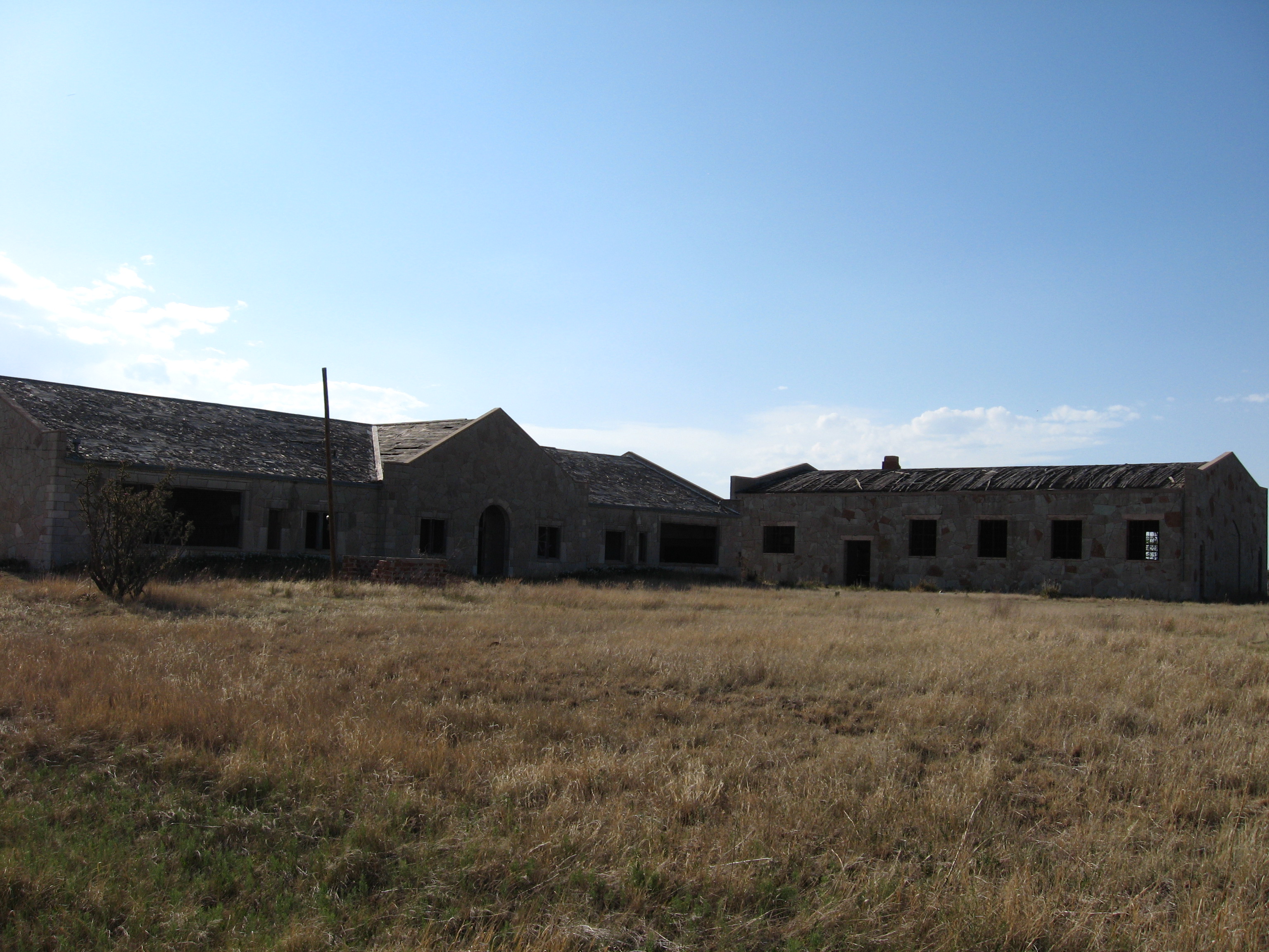
imagesize = 250px
image_caption = Wheatland School (abandoned)
image_
mapsize =
map_caption =
mapsize1 =
map_caption1 =subdivision_type = Country
subdivision_name =United States
subdivision_type1 = State
subdivision_name1 =New Mexico
subdivision_type2 = County
subdivision_name2 = Quay
government_footnotes =
government_type =
leader_title =
leader_name =
leader_title1 =
leader_name1 =
established_title =
established_date =unit_pref = Imperial
area_footnotes =area_magnitude =
area_total_km2 =
area_land_km2 =
area_water_km2 =
area_total_sq_mi =
area_land_sq_mi =
area_water_sq_mi =population_as_of =
population_footnotes =
population_total =
population_density_km2 =
population_density_sq_mi =timezone = MST
utc_offset = -7
timezone_DST = MDT
utc_offset_DST = -6
elevation_footnotes =
elevation_m =
elevation_ft =
latd = |latm = |lats = |latNS =
longd = |longm = |longs = |longEW =postal_code_type =
postal_code =
area_code = 575
blank_name =
blank_info =
blank1_name =
blank1_info =
website =
footnotes =Wheatland is an unincorporated community in Quay County,
New Mexico ,United States . It is located approximated 15 miles south of San Jon onNew Mexico State Highway 469 .History
Wheatland traces its beginnings to the building of its first school. Several one-room schools existed in the area, including North Bend School, Blair School, and Adobe School. In 1920, these were consolidated to form Wheatland School, which was housed in a frame
stucco building constructed for the purpose.cite book|last=Moncus (Editor)|first=Mary Lynn|coauthors=Marian Farmer Knapp (Editor)|title=Quay County|publisher=Quay County Book Committee|date=1985|pages=102-103]The original Wheatland School burned in April 1938. It was replaced by a new school building and gymnasium built by the WPA. The new buildings, reinforced with steel and plastered inside, used multicolored rock from a nearby
quarry . A duplex teacherage was also built at the same time. Completed in 1939, the buildings were only used as a school until the early 1950s, after which they were used as a community center for a time before being abandoned.References
External links
*commons-inline|Wheatland, New Mexico
Wikimedia Foundation. 2010.