- Hubbardston, Michigan
Infobox Settlement
official_name = Hubbardston, Michigan
settlement_type = Village
nickname =
motto =
imagesize =
image_caption =
image_
imagesize =
image_caption =
image_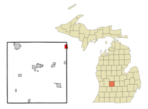
mapsize = 250px
map_caption = Location of Hubbardston, Michigan
mapsize1 =
map_caption1 =subdivision_type = Country
subdivision_name =United States
subdivision_type1 = State
subdivision_name1 =Michigan
subdivision_type2 = Counties
subdivision_name2 = Ionia, Clintongovernment_footnotes =
government_type =
leader_title =
leader_name =
leader_title1 =
leader_name1 =
established_title =
established_date =area_footnotes =
area_magnitude =
area_total_km2 = 4.2
area_land_km2 = 4.1
area_water_km2 = 0.1
area_total_sq_mi = 1.6
area_land_sq_mi = 1.6
area_water_sq_mi = 0.1population_as_of = 2000
population_footnotes =
population_total = 394
population_density_km2 = 96.6
population_density_sq_mi = 250.2timezone = Eastern (EST)
utc_offset = -5
timezone_DST = EDT
utc_offset_DST = -4
elevation_footnotes =
elevation_m = 208
elevation_ft = 682
latd = 43 |latm = 5 |lats = 36 |latNS = N
longd = 84 |longm = 50 |longs = 25 |longEW = Wpostal_code_type =
ZIP code
postal_code = 48845
area_code = 989
blank_name = FIPS code
blank_info = 26-39660GR|2
blank1_name = GNIS feature ID
blank1_info = 0628745GR|3
website =
footnotes =Hubbardston is a village located in the
U.S. state ofMichigan . The village is on the boundary between Ionia County and Clinton County, and is partially in both. The village is mostly within North Plains Township in Ionia County and partially within Lebanon Township in Clinton County. The population was 394 at the 2000 census.Geography
According to the
United States Census Bureau , the village has a total area of 1.6square mile s (4.2km² ), of which, 1.6 square miles (4.1 km²) of it is land and 0.1 square miles (0.1 km²) of it (3.07%) is water.Demographics
As of the
census GR|2 of 2000, there were 394 people, 130 households, and 99 families residing in the village. Thepopulation density was 250.2 per square mile (96.9/km²). There were 139 housing units at an average density of 88.3/sq mi (34.2/km²). The racial makeup of the village was 98.22% White, 1.02% Native American, and 0.76% from two or more races. Hispanic or Latino of any race were 0.76% of the population.There were 130 households out of which 36.9% had children under the age of 18 living with them, 58.5% were married couples living together, 10.8% had a female householder with no husband present, and 23.8% were non-families. 13.8% of all households were made up of individuals and 4.6% had someone living alone who was 65 years of age or older. The average household size was 2.84 and the average family size was 3.15.
In the village the population was spread out with 26.6% under the age of 18, 7.4% from 18 to 24, 28.4% from 25 to 44, 24.6% from 45 to 64, and 12.9% who were 65 years of age or older. The median age was 36 years. For every 100 females there were 96.0 males. For every 100 females age 18 and over, there were 97.9 males.
The median income for a household in the village was $36,458, and the median income for a family was $38,750. Males had a median income of $34,688 versus $21,500 for females. The
per capita income for the village was $12,690. About 8.8% of families and 11.5% of the population were below thepoverty line , including 13.2% of those under age 18 and 5.8% of those age 65 or over.References
External links
* [http://www.hubbardston.org/ Hubbardston community website]
Wikimedia Foundation. 2010.