- Chüebodenhorn
-
Chüebodenhorn 
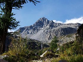
The south side of ChüebodenhornElevation 3,070 m (10,072 ft) Prominence 316 m (1,037 ft) [1] Parent peak Pizzo Rotondo Location  Switzerland
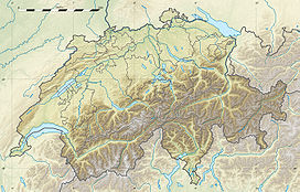
Range Lepontine Alps Coordinates 46°30′29.2″N 8°27′11.1″E / 46.508111°N 8.453083°ECoordinates: 46°30′29.2″N 8°27′11.1″E / 46.508111°N 8.453083°E The Chüebodenhorn is a 3,070 metres high mountain in the Lepontine Alps, located on the border between the cantons of Valais and Ticino. It is situated south of Passo di Rotondo (2,754 metres), where a glacier named Ghiacciaio del Pizzo Rotondo lies at the foot of its north face. The south side (Ticino) overlooks the valley of Bedretto.
References
External links
Categories:- Mountains of the Alps
- Alpine Three-thousanders
- Mountains of Switzerland
- Switzerland stubs
Wikimedia Foundation. 2010.

