- Orkhon Valley
-
This article is about the cultural landscape. For other uses, see Orkhon.
Orkhon Valley Cultural Landscape * UNESCO World Heritage Site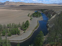
Country Mongolia Type Cultural Criteria ii, iii, iv Reference 1081 Region ** Asia-Pacific Inscription history Inscription 2004 (28th Session) * Name as inscribed on World Heritage List
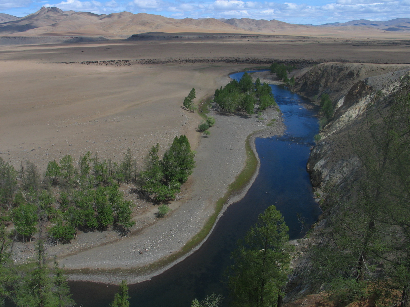
** Region as classified by UNESCOOrkhon Valley Cultural Landscape (Mongolian: Орхоны хөндийн соёлын дурсгал) sprawls along the banks of the Orkhon River in Central Mongolia, some 360 km west from the capital Ulaanbaatar. It was inscribed by UNESCO in the World Heritage List as representing evolution of nomadic pastoral traditions spanning more than two millennia. (See List of World Heritage Sites in Mongolia)
Importance
For many centuries, the Orkhon Valley was viewed as the seat of the imperial power of the steppes. The first evidence comes from a stone stele with runic inscriptions, which was erected in the valley by Bilge Khan, an 8th century ruler of the Göktürk Empire. Some 25 miles to the north of the stele, in the shadow of the sacred forest-mountain Ötüken, was his Ördü, or nomadic capital. During the Qidan domination of the valley, the stele was reinscribed in three languages, so as to record the deeds of a Qidan potentate.
Mountains were considered sacred in Tengriism as an axis mundi, but Ötüken was especially sacred because the ancestor spirits of the khagans and beys resided here. Moreover, a force called qut was believed to emanate from this mountain, granting the khagan the divine right to rule the Turkic tribes.[1] Whoever controlled this valley was considered heavenly appointed leader of the Turks and could rally the tribes. Thus control of the Orkhon Valley was of the utmost strategic importance for every Turkic state. Historically every Turkic capital (Ördü) was located here for this exact reason. There were many houses by the bank but they are all gone now.
Sites
The main monuments of the Orkhon Valley are as follows:
- Early 8th-century Turkic memorials to Bilge Khan and Kul Tigin with their Orkhon inscriptions are admittedly the most impressive monuments from the nomadic Göktürk Empire. They were excavated and deciphered by Russian archaeologists in 1889-93.
- Ruins of Khar Balgas, an 8th-century capital of the Uyghur Empire, which cover 50 square km and contain evidence of the palace, shops, temples, monasteries, etc.
- Ruins of Genghis Khan's capital Karakorum which could have included the famed Xanadu palace.
- Erdene Zuu monastery is the first Buddhist monastery established in Mongolia. It was partly destroyed by Communist authorities in 1937-40.
- Tuvkhun Hermitage is another spectacular monastery, overlooking a hill at 2,600 m. above sea-level. Likewise, it was almost totally destroyed by the Communists.
- Remains of the 13th and 14th century Mongol palace at Doit Hill, thought to be Ögedei Khan's residence.
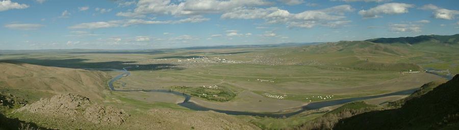 Panorama of the Orkhon
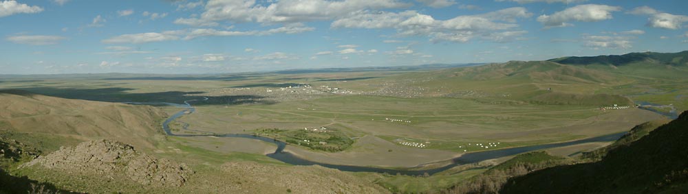
References
- ^ Franke, Herbert. The Cambridge History of China. Cambridge University Press, 1994. ISBN 0521214475. Page 347.
World Heritage Sites in Mongolia Orkhon Valley Cultural Landscape · Uvs Lake Basin (with Russia)

Göktürks Turkic Khaganate Bumin Qaghan · Issik Qaghan · Muqan Qaghan · Taspar Qaghan · Ashina Anluo · Ishbara Qaghan · Bagha Qaghan · Tulan Qaghan · (Empress Ashina) · (Apa Qaghan)Western Turkic Khaganate (Istämi) · Tardush · Niri Qaghan · Heshana Khan · Tong Yabghu Qaghan · Ishbara Qaghan · Yukuk Shad · Bagha Shad) · (Böri Shad)Eastern Turkic Khaganate Yami Qaghan · Shibi Qaghan · Chulo Qaghan · Illig Qaghan · Qilibi Qaghan · Chebi Qaghan · Ashina Nishufu · Ashina Funian · (Ashina Jiesheshuai)Second Eastern Turkic Khaganate Ilterish Qaghan · Qapaghan Qaghan · Inel Qaghan · Bilge Qaghan · Yiran Qaghan · Tengri Qaghan · Kutlug Yabghu Qaghan · Irterish Qaghan · Ozmish Qaghan · (Kul Tigin) · (Tonyukuk)Göktürk culture Ashina clan · Tengriism · Asena · Ötüken · Suyab · Khagan · Kurultai · Yabgu · Ishad · Elteber · Old Turkic language · Old Turkic script · Orkhon inscriptions · Orkhon ValleyGöktürk wars and treaties Göktürk civil war · Perso-Turkic Wars (First, Second, Third) · Taizong's Eastern Tujue campaign · Xueyantuo · Taizong's Western Tujue campaign · Ili River TreatyCoordinates: 47°33′24″N 102°49′53″E / 47.55667°N 102.83139°E
Categories:- World Heritage Sites in Mongolia
- Valleys of Mongolia
- Göktürks
Wikimedia Foundation. 2010.