- Mērsrags
-
The rural municipality of Mērsrags (Markgrafen) is located on the west coast of the Gulf of Riga (Latvia), beside Lake Engure and surrounded by extensive woodlands. It’s situated in northwest Latvia in wooded lowland close the sea. It is in the district of Talsi, which includes the townships of Kulciems, Lauciena, Vandzene and Roja. To the south is the district of Tukums, where the townships of Engure and Zentene are situated. The total area of the municipality is 109 km2 (10896,2 ha). 63.7% of this area is woodland and Lake Engure covers 20.4%. The coastline is about 12 km. long. Talsi, the main city of the area is 42 km. from the town centre, and there are 95 km. to the capital, Riga.
Population: 1986 inhabitants (2008.06). Population density: 18.6 inhabitants/km2. Principle nationality: Latvians.
Many types of landscape can be seen; seaside, lake reservation, everglades, lagoons, the bed of the dried-up Litorīnas lake (Litorīnas ezers), the sand dune forest, and rural and urban landscapes.
History
The earliest information about Mērsrags is from the 15th. century, when it was a small fishing hamlet beside the Gulf of Riga. There are many stories and myths about Mērsrags. Pirates, who lured ships ashore and plundered them, used to live here. During the ducal period, there was a large production of soap.
In 1842 a canal was dug from the north end of Lake Engure to the sea and in 1843 Mērsrags began to develop. In 1880 a lighthouse had been completed and the first ship was launched from the dockyard. Altogether 22 sailing ships were built in Mērsrags. Between 1860 and 1915 66 sailing ships were built in Upesgrīva village.
Until 1918 Mērsrags village and Upesgrīva village belonged to the parish of the Engure manor but in 1918 Mērsrags became a separate parish. Likewise in 1926 Upesgrīva became a separate parish.
In 1926 a narrow-gauge railway came to Mērsrags and in 1927 the port was built to satisfy the needs of fishing boats and shipping.
In the 60’s (20.th century) the development of the fish farm collective resulted in a great increase in the production of fish and canned products. The first block of flats and a distant steam heating plant were built. A new fish processing plant was constructed as well as a net repair shop and an engineering workshop. The village roads were repaired and asphalted.
Sights worth to see in Mērsrags
Mērsrags canal (dug in 1842-1843), it is about 4 km. long and connects Lake Engure to the sea. Mersrags port north mole (constructed in 1927, reconstructed in 2007).
Museum - The Peoples House (Saieta Names - latv.). The building is from 1872 and contains an exhibition about life and conditions in Mērsrags and its surroundings at the beginning of the 20th. century. There are many relics, tools and items from the houses of the period.
Mērsrags lighthouse, built in 1874, survived the 1st. & 2nd. World Wars.
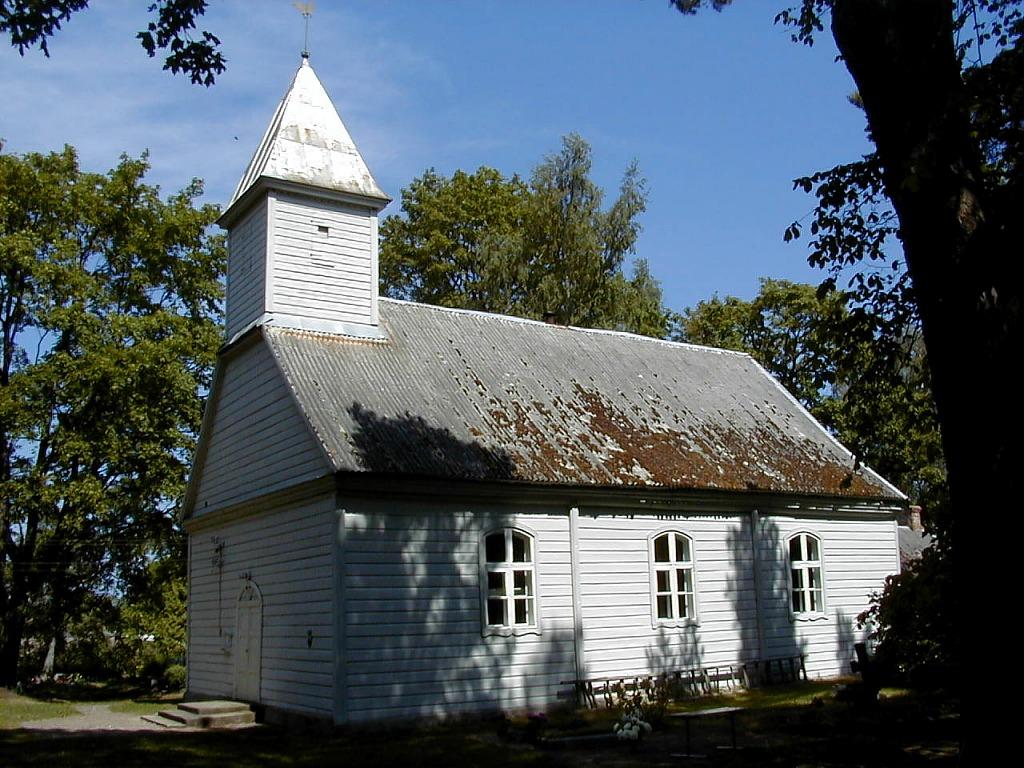
Mērsrags Lutheran Church, built in 1809, is one of the oldest wooden churches in the country. The church contains several preserved cultural monuments. Located in the old churchyard.
 Wooden Lutheran church in Mērsrags
Lake Engure National Park. Founded in 1957 as a bird reservation it became a national park in 1998.
Picturesque meadow. About 51 ha with big meadows and a wide variety of biotopes. Mērsrags foreland (18 ha.) The site of the Devil stone.
Svētmeitas akmens (Holydaughter stone), there are some legends about this stone, sea pirates and hidden treasure.
Port of Mērsrags
The port of Mērsrags is located on one of the Gulf of Riga’s most picturesque stretches of coast. It's the one from the biggest of Latvia’s small ports. Most of Mērsrags industry is concentrated near the port. Mērsrags traditional industries are fishery, fish canning, and forestry. New sectors are appearing that are related to commerce and service. The port is very important as an export terminal.
Categories:- Towns and villages in Latvia
- Port cities and towns of the Baltic Sea
Wikimedia Foundation. 2010.