- Mayoyao, Ifugao
-
Mayoyao — Municipality — Map of Ifugao showing the location of Mayoyao.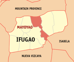 Location in the Philippines
 Mayoyao
Coordinates: 16°58′N 121°13′E / 16.967°N 121.217°ECoordinates: 16°58′N 121°13′E / 16.967°N 121.217°E Country  Philippines
Region Cordillera Administrative Region (CAR) Province Ifugao District Lone District Founded Barangays 27 Government - Mayor Romeo D. Chulana Area - Total 238.05 km2 (91.9 sq mi) Population (2007) - Total 16,722 - Density 70.2/km2 (181.9/sq mi) Time zone PST (UTC+8) ZIP code 3602 Income class 4th class Population Census of Mayoyao Census Pop. Rate 1995 14,733 — 2000 14,191 -0.80% 2007 16,722 2.29% Mayoyao is a 4th class municipality in the province of Ifugao, Philippines. According to the latest census, it has a population of 16,722 people in 2,917 households.
Contents
Barangays
Mayoyao is politically subdivided into 27 barangays.
- Aduyongan
- Alimit
- Ayangan
- Balangbang
- Banao
- Banhal
- Bongan
- Buninan
- Chaya
- Chumang
- Guinihon
- Inwaloy
- Langayan
- Liwo
- Maga
- Magulon
- Mapawoy
- Mayoyao Proper
- Mongol
- Nalbu
- Nattum
- Palaad
- Poblacion
- Talboc
- Tulaed
- Bato-Alatbang
- Epeng
History
Battle of Mayoyao Ridge
Battle of Mayoyao Ridge Part of World War II Date July 26, 1945, to August 9, 1945 Location Mayoyao, Mt. Province (now Ifugao) Result Filipino and American victory Belligerents  Philippine Commonwealth
* Philippine Commonwealth Army
* Philippine Constabulary
 United States
* United States Army Air Forces Empire of Japan
* Imperial Japanese Army
Commanders and leaders Donald Blackburn Tomoyuki YamashitaStrength 68,000 Filipino troops
200 American bomber pilots85,000 Japanese troops Casualties and losses 4,600 killed
7,200 wounded51,000 killed
3,000 woundedBeginning on July 26, to August 9, 1945, the Filipino soldiers and the American bombers was re-occupied the town of Mayoyao, Ifugao in Northern Luzon including the Filipino troops of the 1st, 2nd, 11th, 12th, 13th, 15th and 16th Infantry Division of the Philippine Commonwealth Army, 1st Infantry Regiment of the Philippine Constabulary, 11th and 14th Infantry Regiment of the United States Armed Forces in the Philippines - Northern Luzon or USAFIP-NL and the American bomber pilots of the United States Army Air Forces was fought against the Japanese Imperial forces during the Battle of Mayoyao Ridge until the end of World War II.
The historical marker
The memorial of historical marker located in Mount Nagchajan in Mayoyao, Ifugao was fought the battles between the Japanese Imperial forces and the combined Filipino and American soldiers was occuried towards during the Battle of Mayoyao Ridge during the end of World War II.
External links
- Mayoyao Rice Terraces
- Philippine Standard Geographic Code
- 1995 Philippine Census Information
- 2000 Philippine Census Information
- 2007 Philippine Census Information
Municipalities Categories:- Municipalities of Ifugao


Wikimedia Foundation. 2010.