- Pangantucan, Bukidnon
Infobox Settlement
official_name = Municipality of Pangantucan
other_name =
native_name =
nickname =
settlement_type =
motto =
imagesize = 180px
image_caption =
flag_size =
image_
seal_size = 180px
image_shield =
shield_size =
city_
citylogo_size =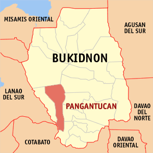
mapsize =
map_caption = Map ofBukidnon showing the location of Pangantucan, Bukidnon
mapsize1 =
map_caption1 =
pushpin_
pushpin_label_position =
pushpin_map_caption =
pushpin_mapsize =
subdivision_type = Country
subdivision_name =Philippines
subdivision_type1 = Region
subdivision_name1 = Region X
subdivision_type2 = Province
subdivision_name2 = Bukidnon
subdivision_type3 = Districts
subdivision_name3 = 1st District
subdivision_type4 =Barangays
subdivision_name4 = 19
government_type =
leader_title = Mayor
leader_name = Manolito G. Garces
leader_title1 = Vice Mayor
leader_name1 = Miguel A. Silva, Jr.
established_title = Incorporated (town)
established_date =1961
established_title2 =
established_date2 =
established_title3 =
established_date3 =
area_magnitude =
unit_pref =
area_footnotes =
area_total_km2 = 343.34
area_land_km2 =
area_water_km2 =
area_total_sq_mi = 132.56
area_land_sq_mi =
area_water_sq_mi =
area_water_percent =
area_urban_km2 =
area_urban_sq_mi =
area_metro_km2 =
area_metro_sq_mi =
population_as_of = 2000
population_footnotes =
population_note =
population_total = 43,202
population_density_km2 = 126
population_density_sq_mi = 326
population_metro =
population_density_metro_km2 =
population_density_metro_sq_mi =
population_urban =
population_density_urban_km2 =
population_density_urban_sq_mi =
timezone = PST
utc_offset = +8
timezone_DST =
utc_offset_DST =
latd= |latm= |lats= |latNS=
longd= |longm= |longs= |longEW=
elevation_footnotes =
elevation_m =
elevation_ft =
postal_code_type = ZIP code
postal_code = 8717
area_code = 88
blank_name =
blank_info =
blank1_name =
blank1_info =
website =
footnotes = Pangantucan is a 3rd class municipality in the province of Bukidnon,Philippines . According to the2000 census, it has a population of 43,202 people in 8,168 households.History
The name “Pangantucan”, meaning wisdom and strength, is dedicated to a white stallion. The horse uprooted a bamboo on time to warn his master, a datu of the tribe, of an impending danger from Manobo marauders, thereby saving the tribe of a one-sided massacre.
Once a barrio of Maramag, Pangantucan, being the seat of government, was joined with Adtuyon, Dominorog, Panalagsagan, Kalilangan and Barandias to form a separate municipal district in
1931 .It was created a regular municipality in1961 .Geography
Location
Pangantucan is one the 20 municipalities in the Province of Bukidnon. It is situated at the South–Western part of the province of Bukidnon and located approximately 75 km South of Malaybalay, the capital town of Bukidnon, and is about 166 km away from Cagayan de Oro City. Wao, Lanao del Sur can be reached through a 50 km concrete/gravel paved national road south from the municipality. The Municipality of Pangantucan is bounded on the South – West side by the province of Lanao del Sur and by the province of North Cotabato on the southern part. The Municipality of Kalilangan lies at the western part of the municipality while on its North – West portion is the famous Mr. Kitanglad Ranges. Valencia, regarded as the trade center of Bukidnon bounds Pangantucan on its northern part while Maramag and the Municipalities of Don Carlos and Kadingilan are found on its east and south side respectively. Pangantucan has a land area of 493.944 km² (49,394 hectares) which is 9th largest among the 20 municipalities and two cities of the province. It composed of 19 barangays, 18 of which are accessible on summer days by motor vehicle fir for the bad roads. In its central part, one barangay can only be reached by a trail.
Topography
The terrain of Pangantucan is characterized by slightly undulating and rolling upland areas. In fact, 62 percent of the municipal land area features rolling or hilly terrain with slopes ranging from 18 percent to 50 percent. Only about 14 percent is suitable for agricultural production. On the northwest portion of the municipality is Mt. Kalatungan, the second highest peak in the province with an elevation of 2,824 meters. Its ranges occupy about 21 percent of the municipality’s total land area.
Climate
The climate of Pangantucan is of Type IV of the Modified Corona’s Climate Classification. It is characterized by more or less evenly distributed rainfall throughout the year with rare incidence of tropical cyclone. Rainfall distribution variation (Figure 1) is influenced by rain shadow effect of the mountainous belt on the eastern side of Bukidnon and by the presence of adjoining hills and mountain ranges. Based on the data from 1995-2000, Pangantucan has an annual average rainfall of 2764.60 mm. June is the wettest month with an average rainfall of 354.14 mm, followed by the months of August, September and July with an average rainfall of 341.21 mm, 311.33 mm and 296.28 mm respectively. February is the driest month with its average rainfall of 108.17 mm. Note that abnormally low values during the time from December 1997 to May 1998 coincided with drought months.
Demography
Population
In
1990 , the population of Pangantucan stood at 35,777. Its density was 72 persons per square kilometer. It registered a population growth of 2.10 percent based on the1980 census of population. Available data indicated that the population has steadily been increasing from1976 up to the present. The latest survey conducted by the National Statistics Office (NSO) in2000 showed that Pangantucan has a total population of 43,202. Of the total population 51.45 percent are male and the rest are the female population.Economy
The Poblacion is the nucleus of growth within the municipality. It is the center of both government and commercial activities, and the site of various establishments, services and facilities.
Outside the Poblacion are the rural areas where majority of the population reside, and whose prime economic activity is farming. Agriculture is the major land user with an aggregate are of 17,429 hectares devoted to its use. Of this area, 4,806 hectares are planted with corn and 1,121 hectares are planted with rice. Commercial/industrial and other crops account for some 11,502 hectares.
In addition livestock and poultry are also major sources of livelihood in Pangantucan, Total livestock in 2002 reached 20,276. On the other hand, poultry production was reported at 56,710 for the same period.
Supporting the agricultural activities in the municipality are about 74 tractors, 6 rice thresher, 97 corn shellers, 19 rice/corn mills, 6 mechanical dryers, 128 multi-purpose pavement and 5 storage/warehousing facilities.
Commerce and trade play a significant role in Pangantucan economy. Some 232 commercial establishments are reported in the area of which about 4 engaged in wholesale activity.
Barangays
Pangantucan is politically subdivided into 19
barangay s.
* Adtuyon
* Bacusanon
* Bangahan
* Barandias
* Concepcion
* Gandingan
* Kimanait
* Kipadukan
* Langcataon
* Lantay
* Madaya
* Malipayon
* Mendis
* Nabaliwa
* New Eden
* Payad
* Pigtauranan
* Poblacion
* PortulinExternal links
* [http://www.nscb.gov.ph/activestats/psgc/default.asp Philippine Standard Geographic Code]
* [http://www.t-macs.com/kiso/local/ 2000 Philippine Census Information]
Wikimedia Foundation. 2010.