- Odiongan, Romblon
-
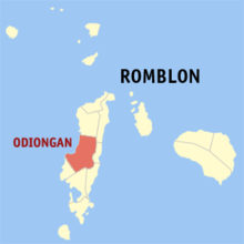 Map of Romblon showing the location of Odiongan
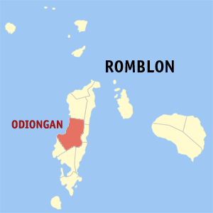
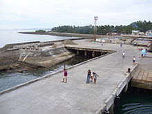 Poctoy Pier in Odiongan
Odiongan is a 2nd class municipality in the province of Romblon, Philippines. According to the 2000 census, it has a population of 39,069 people in 8,624 households. Odiongan is located in the Mid-western part of Tablas Island.
Bantoanon or Asi is the native language of majority of the municipality's inhabitants, while Onhan is the medium of communication in southern barangays bordering Ferrol and Looc municipalities respectively.
Contents
Population of Odiongan in various times
Barrio/Barangay
NameLand Area
(Hectares)1894
/a1896
/a,c1903
/a,g1918
/a,b1939
/a1948
/a1960
/a1970
/a1975
/a1980 1990 1995 2000 2007
/hPoblacion
(Dentre de Pueblo) /d1,388 1,307 1,818 1,079 1,631 1,936 2,409 2,912 Ligaya (U)
(Poblacion)19.10 756 791 920 1,083 1,050 956 Liwanag (U)
(Poblacion)41.57 684 767 924 706 1,011 1,078 Liwayway (U)
(Poblacion)13.40 715 535 621 705 793 696 Tabing Dagat (U)
(Poblacion)20.89 873 852 972 1,011 1,114 1,104 Agnonoc
(Agnoknok)231 249 240 351 557 440 519 554 804 Agpudlos 339 Amatong 884.07 143 146 209 226 627 352 540 712 831 962 881 1,161 1,090 1,269 Anahao
(Anajao)464.17 206 164 336 359 698 806 1,393 1,269 1,490 1,651 1,671 1,721 1,855 2,143 Balili
(Bariri)209 229 Bangon 268.94 137 181 468 116 156 356 213 609 643 756 1,001 1,138 1,135 1,212 Batiano 144.89 139 155 114 332 359 720 831 882 948 1,006 1,282 1,441 1,759 1,864 Budiong /i 189.35 625 750 1,070 963 1,100 1,416 1,600 2,032 2,262 Bunsoran 423 344 460 Cabacungan
(Cabaungan)224 Calabasag 200 238 Calonacon 343 Camogtong 212 Canduyong
(Candoyong)552.20 192 230 371 664 1,209 645 952 1,071 1,126 1,203 1,421 1,262 1,747 1,697 Can-ero 218 Cayong
(Colong)198 216 259 Claro M. Recto 360 435 Dapawan
(Dapauan)316.72 149 182 126 767 1,264 945 1,125 1,193 1,125 1,223 1,730 2,147 2,510 3,627 Despujols 421 Embarcacion 9 Ferrol /e 379 345 566 494 695 871 923 1,032 1,239 Gabawan
(Gabauan)380.26 171 194 481 534 651 603 855 1,318 1,402 1,443 1,677 1,824 2,041 2,179 Ginaguman
(Hinaguman)393 384 653 773 470 687 702 Libertad 1,245.02 623 831 1,350 1,575 2,036 2,461 2,490 2,708 1,631 1,847 1,912 2,163 Linawan 281 Lupog 209 Malilico 356.67 295 271 596 705 917 750 711 666 829 935 872 857 Marigondon 682 Matutuna 226 Mayha 127.62 107 148 400 537 602 638 685 687 925 987 1,091 1,234 Pag-alad 642 Panique 1,022.94 181 217 340 612 861 1,075 1,207 1,510 1,547 1,641 1,954 2,460 2,305 2,401 Pato-o 4,964.63 189 198 182 270 890 856 915 1,505 1,682 1,669 2,167 2,081 2,527 2,508 Penaypayan
(Pinaypayan)175 201 Poctoy 192.22 563 568 743 906 1,018 900 1,464 1,762 1,891 2,011 Progreso 501 855 849 Progreso Este 1,720.90 496 742 896 766 1,053 1,195 1,238 1,280 Progreso Oeste 1,449.67 477 554 626 806 819 898 900 895 Rizal 1,026.10 367 466 567 666 1,153 1,123 1,155 1,533 1,437 1,463 1,629 Siguienza
(Siquenza)202 258 Taboboan 492.75 205 360 497 695 749 787 733 868 921 1,254 1,336 Tan-agan 567 Tingaray 261 Tubigon
(Tobigon)270 127 136 270 566 594 668 Tuburan /f 1,489 1,589 1,560 1,550 Tuguis 307 Tulay
(Tolay)352.55 172 190 299 385 698 843 1,065 1,300 1,419 1,436 1,493 1,730 1,852 1,917 Tumingad
(Tomingad)1,961.37 137 219 519 621 953 987 1,071 1,626 1,550 1,732 1,757 1,886 2,067 2,194 Total 18,208.00 5,240 5,649 8,323 13,366 16,628 18,401 22,859 28,501 30,198 27,188 32,498 35,527 39,069 42,062 /a – Includes barrios annexed to Ferrol /b – Includes barrios annexed to Despujols (San Andres) /c – Reported in 1897 /d – Official name of Poblacion in 1894 & 1896 census. /e – Visita Ferrol until 1903. /f – Area included under Libertad. /g - The American civil government from 1899-1901 reduced the number of barrio to facilitate the military policy of concentrating the civilian population of the poblaciones. Thus, in 1901 Odiongan lost 6 barrios, namely: Calabasag, Penaypayan, Siguienza, Balili (Bariri), Lupog ang Tingaray. /h - 2007 NCSO Census /i - Created barrio under R.A. No. 1117 on June 15, 1954 taken from Canduyong.
Barangays
Odiongan is politically subdivided into 25 barangays. Budiong was formerly a sitio of Canduyong; it became a barrio in 1954.[1]
- Amatong
- Anahao
- Bangon
- Batiano
- Budiong
- Canduyong
- Dapawan
- Gabawan
- Libertad
- Malilico
- Mayha
- Panique
- Pato-o
- Ligaya (Pob.)
- Liwanag (Pob.)
- Poctoy
- Progreso Este
- Progreso Weste
- Rizal
- Tabing Dagat (Pob.)
- Tabobo-an
- Tulay
- Tumingad
- Liwayway (Pob.)
- Tuburan
References
External links
- Odiongan Homepage
- Odiongan Romblon Hotel Reservations
- Philippine Standard Geographic Code
- 2000 Philippine Census Information
Municipalities Categories:- Municipalities of Romblon

Wikimedia Foundation. 2010.