- Corlea Trackway
-
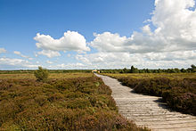 The Corlea Trackway in 2009
The Corlea Trackway is an Iron Age trackway, or togher, near the village of Kenagh, south of Longford town, County Longford, in the Republic of Ireland. It was known locally as the Danes Road. It can be found in the bog in County Longford in Ireland.
The trackway is situated in an area which is the site of industrial-scale mechanised peat harvesting by the Bord na Móna, principally to supply the peat-fired power stations of the Electricity Supply Board. While today a generally flat and open landscape, in the Iron Age it was covered by bog, quicksand, and ponds, surround by dense woodlands of birch, willow, hazel and alder while higher ground was covered by oak and ash. The terrain was dangerous and impassible for much of the year.[1]
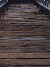 Part of the recovered trackway
In 1984, timbers recovered from Corlea were radiocarbon dated to the Iron Age, rather than the Bronze Age as had been expected, and an archaeological project was established under the leadership of Professor Barry Raftery to investigate the site before it was destroyed by peat-digging. Excavations to 1991 in Corlea bog revealed 59 toghers in an area of around 125 hectares and further work has raised the total to 108 with a further 76 in the nearby Derryoghil bog.[2]
The majority of these toghers are constructed from woven hurdles laid on heaped brushwood on top of the surface, built to be used by people on foot. Four, including Corlea 1, the Corlea Trackway proper, are corduroy roads, built from split planks laid on top of raised rails and suitable for wheeled traffic. The Corlea Trackway is made from oak planks 3 to 3.5 metres long and around 15 centimetres thick laid on rails around 1.2 metres apart. The road was at least 1 kilometre long. Dendrochronological study suggests that the timber used in construction was felled in late 148 BC or early in 147 BC and the road built then. Raftery estimated that the sleepers alone amount to a 300 large oak trees, or a thousand wagon-loads, with a similar volume of birch for the rails.[3] The Corlea Trackway ended on a small island, from which a second trackway, excavated in 1957 and since radiocarbon dated also to 148 BC, again around 1 kilometre long, connected to dry land on the far side of the bog.[1] The construction of the roadway required a great deal of labour, comparable to that used in the construction of ritual monuments such as barrows.[4]
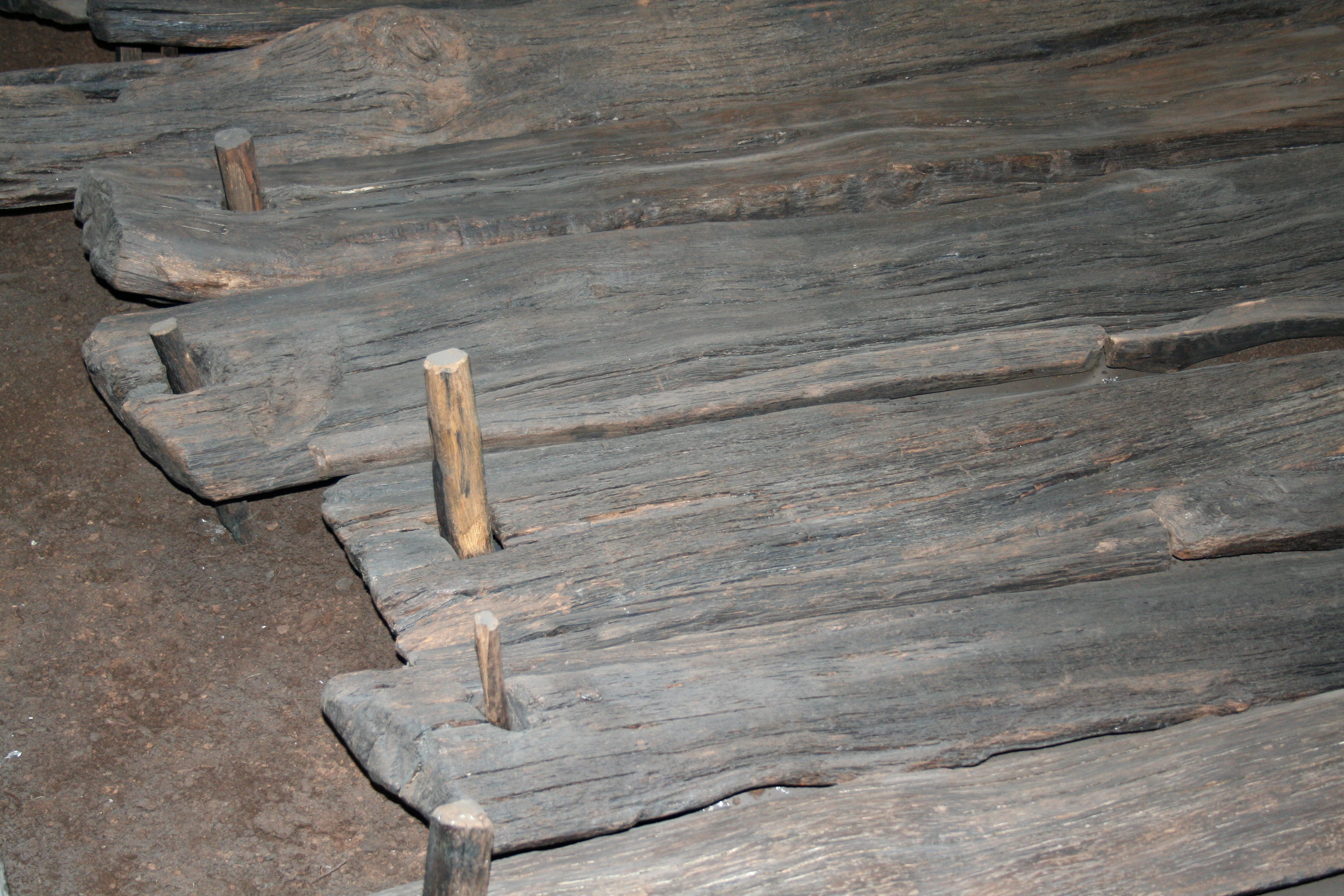
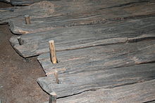 Wooden planks and nails
The purpose of the Corlea Trackway is uncertain. For the smaller toghers, O'Sullivan remarks that "there is a growing sense that these were not structures designed to cross the bog, but to get into the bog".[5] Massive structures such as the Corlea Trackway may also have served to get into the bog, perhaps for ritual purposes, rather than merely to cross it.[6] Whatever its purpose, the roadway was usable for only a few years. Gradually covered by the rising bog and sinking under its own weight, it was covered by the bog within a decade, and perhaps less, where it remained preserved for two millennium.[7]
The Corlea Trackway, seemingly constructed in a single year, has suggested comparisons with the Irish language tale Tochmarc Étaíne (The Wooing of Étaín), where King Eochu Airem sets Midir tasks such as planting a forest and building a road across a bog where none had ever been before at a place called Móin Lámraige.[1][8]
Contents
Notes
- ^ a b c Raftery, Pagan Celtic Ireland, chapter 5.
- ^ Pryor, Britain BC, pp. 381–382.
- ^ Pryor, Britain BC, pp. 382–385, fig. 90 & fig. 91; Raftery, Pagan Celtic Ireland, chapter 5.
- ^ O'Sullivan, "Exploring", pp. 173–174.
- ^ O'Sullivan, "Exploring", p. 175.
- ^ Pryor, Britain BC, pp. 387–391, argues for a solely ritual purpose. Raftery, Pagan Celtic Ireland, chapter 5, notes that the Corlea Trackway would have served to connect the later significant sites at Cruachan and Uisnech.
- ^ Pryor, Britain BC, p. 386.
- ^ Pryor, Britain BC, pp. 387–388.
References
- O'Sullivan, Aidan (2007), "Exploring past people's interaction with wetland environments in Ireland", Proceedings of the Royal Irish Academy, Section C 107: 147–203, doi:10.3318/PRIC.2007.107.147, http://www.ria.ie/cgi-bin/ria/papers/100705.pdf
- Pryor, Francis (2003), Britain BC: Life in Britain and Ireland before the Romans, London: HarperCollins, ISBN 0-00-712693-X
- Raftery, Barry (1994), Pagan Celtic Ireland: The Enigma of the Irish Iron Age, London: Thames & Hudson, ISBN 0-500-05072-4
See also
- History of roads in Ireland
External links
- Corlea Trackway Visitor Centre (at the Office of Public Works Heritage Ireland website)
- Virtual Tour of Corlea Trackway
Categories:- National Monuments in County Longford
- Archaeological sites in County Longford
- Buildings and structures in County Longford
- History of County Longford
- Iron Age Europe
- Longford (town)


Wikimedia Foundation. 2010.