Mulroy Bay

Mulroy Bay
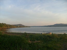
Mulroy Bay, Co. Donegal.

Mulroy Bay (Irish: Cuan na Maoil Ruaidh[1]) is a relatively small bay / sea loch on the north coast of County Donegal, Ireland.

Mulroy Bay is the most convoluted of the marine inlets in north-west Ireland. It is approximately 12 km long in a north-south direction. The entrance to the bay is a narrow embayment leading to a winding entrance channel 10 km in length. This channel varies in width and depth, with three significant narrows only 100-150 m across, where the current reaches maxima of 3-5 knots. It opens into the Broad Water, an open shallow sea lough 8 km from north to south and 2.5 km from east to west, generally less than 20 m in depth and with many small rocky islands and islets.[2][3]

Settlements founded on the bay include Milford, Kerrykeel and Cranford.

References

Mulroy Bay has extensive Fish and Shellfish farming operations. Mussels, Scallops and Salmon are grown on a commercial basis.

External links

Mulroy Bay on Ecoserve.ie

Coordinates: 55°09′N 7°41′W / 55.15°N 7.683°W / 55.15; -7.683


Wikimedia Foundation. 2010.

Игры ⚽ Нужен реферат?

Look at other dictionaries:

  • Mulroy Bay — 55.15 7.6833333333333 Koordinaten: 55° 9′ 0″ N, 7° 41′ 0″ W …   Deutsch Wikipedia

  • Mulroy Bay — Sp Malròjaus įlanka Ap Mulroy Bay angliškai L Š Atlante, Airija …   Pasaulio vietovardžiai. Internetinė duomenų bazė

  • Rosguill — Gainne Mhór from Carrigart Rosguill (Irish language and official name: Ros Goill)[1] is a peninsula situated in north north west County Donegal, Ireland. Lying between the peninsulae of Fanad to the east and Horn Head to the west, Rosguill is a… …   Wikipedia

  • Fanad — Leuchtturm Fanad Head Gewässer 1 Lough Swilly (Atlantischer Ozean) Gewässer 2 …   Deutsch Wikipedia

  • Oileán Ruaidh — This article is about a small island in Mulroy Bay. For the rock discovered on Mars, see Oileán Ruaidh (Mars rock). Oileán Ruaidh or Island Roy is a small island in Mulroy Bay, County Donegal, in the E.U. state of Ireland. Oileán Ruaidh is a… …   Wikipedia

  • County Donegal — Contae Dhún na nGall Coontie Dunnygal / Coontie Dinnygal Coat of arms …   Wikipedia

  • Fanad — Infobox Lighthouse name = Fanad Lighthouse caption = Fanad Lighthouse Co Donegal Lough Swilly and Mulroy Bay location = Irish Coast, IRL coordinates = yearbuilt = yearlit = automated = yeardeactivated = foundation = construction = shape = marking …   Wikipedia

  • Clan Sweeney — A plate from The Image of Irelande, by John Derrick, published in 1581. The chief sitting at his table, entertained by his bard and harper is thought to be a Mac Sweyne .[citation needed] Clan Sweeney …   Wikipedia

  • Coastal landforms of Ireland — Ireland is an island surrounded by water,[1] with a 7,500 kilometre coastline.[2] This list catalogues about 400 of the coastal landforms of the island including bays, estuaries, harbours, headlands, and many others.[3][4][5] Most offshore… …   Wikipedia

  • List of bays of the British Isles — This is a list of bays of the British Isles, geographically by island. They are listed by island, in clockwise order, from the stated starting point.BritainClockwise from the River Tweed:England from the River Tweed to the Bristol Channel*Budle… …   Wikipedia

Share the article and excerpts

Direct link
Do a right-click on the link above
and select “Copy Link”