- East Frisian Islands
Infobox Islands
name = East Frisian Islands

image caption =
image size = 300px
locator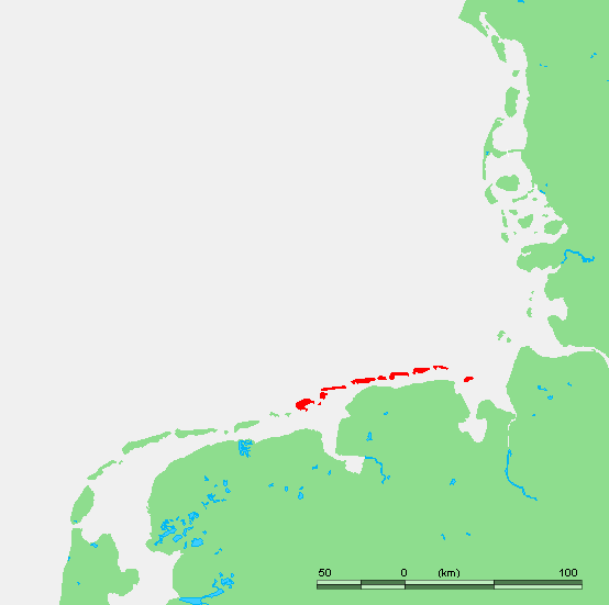
locator map size = 300px
map_custom = no
native name = Ostfriesische Inseln
native name link = German language
nickname =
location =Wadden Sea
coordinates =
archipelago =
total islands = 12
major islands =Borkum ,Norderney
area =
length =
width =
coastline =
highest mount =
elevation =
country = Germany
country admin divisions title = State
country admin divisions = flag|Lower Saxony
country admin divisions title 1 = Districts
country admin divisions 1 = Leer
Aurich
Wittmund
Friesland
country admin divisions title 2 =
country admin divisions 2 =
population =
population as of =
density =
ethnic groups = Germans, Frisians
additional info =The East Frisian Islands (German: "Ostfriesische Inseln") are a chain of islands in theNorth Sea , off the coast ofLower Saxony ,Germany .The seven inhabited islands are, from west to east:
#Borkum
#Juist
#Norderney
#Baltrum
#Langeoog
#Spiekeroog
#Wangerooge
Borkum belongs to the district of Leer; Juist, Norderney and Baltrum are parts of Aurich; Langeoog and Spiekeroog belong to Wittmund (in the near of Dose); and Wangerooge is part of Friesland. Norderney is the remaining part ofBuise , which was almost entirely engulfed by the sea in the 17th century.There are five uninhabited islands:
#Kachelotplate
#Lütje Hörn
#Memmert
#Minsener Oog (artificial island)
#Mellum (east of the mouth of the Jade river, by some sources therefore not considered part of the East Frisian Islands anymore)
#Großer Knechtsand (further east, not part of the East Frisian Islands anymore)Two more islands,Memmert south of Juist, andMellum east of Wangerooge are uninhabited. Another very small island,Lütje Hörn east of Borkum is in constant danger of being washed away. In 2003 the German Coastal Defence (NLWK) announced that the sandbankKachelotplate can now be called anisland too, because it is no longer regularly flooded by high tide. However, it is not larger than 2 km² and will of course remain unsettled. Kachelotplate is located north of the mouth of the Ems river.Most of the islands do not allow cars. The exceptions are Borkum and Norderney, which are also the most crowded islands. There are no bridges connecting the mainland with the islands. Each island is accessible by ferry.
Borkum and Norderney, the Nazi
labour camp s onAlderney were named after the islands.The islands and the surrounding sea are part of the
Lower Saxony Wadden Sea National Park .Effects of storms and currents
Even though today they are established islands, some of them continue to be in motion. On the East Frisian Island of
Juist for example, since the year 1650 there are five different proven sites for the church, as the spot for rebuilding the church had to keep pace with the ever-moving island. At times, Juist even consisted of two islands, which eventually grew back together. The neighboring island ofWangerooge in the last 300 years has moved a distance equivalent to its own length to the east, its church tower, destroyed at the outbreak of World War I apparently moving from east to west. [Cite web
publisher= War Times Journal
title =Germany's High Seas Fleet in the World War
date =
year =
url =http://www.richthofen.com/scheer/scheer03a.htm
accessdate = 2007-09-30]In this process, land is slowly eroded on the western coasts, while sediments are deposited on the eastern coasts. As a result, western coasts are increasingly protected by human action. The canals between the islands serve as passages for the tides, so that in these places the scouring action of current prevents the islands gradually joining one to another.
ee also
*
Frisia
*Frisian languages
*Frisian Islands
*Frisians
*List of islands of Germany External links
* [http://medien.informatik.uni-bremen.de/rose/frameset_islands.html Basic information on geography and ecology of some of the smaller islands]
References
Wikimedia Foundation. 2010.