- Crosland Moor Airfield
-
Crosland Moor Airfield 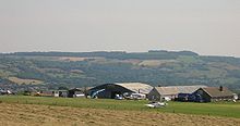
IATA: none – ICAO: EGND[1] Summary Airport type Private Operator Huddersfield Aviation Ltd. Serves Huddersfield Location Crosland Moor Elevation AMSL 825 ft / 251 m Coordinates 53°37′16″N 001°49′54″W / 53.62111°N 1.83167°W Website Map Loaction in West Yorkshire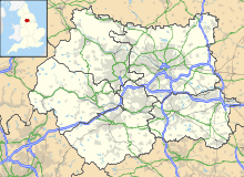
 EGND
EGNDRunways Direction Length Surface m ft 07/25 750 2,461 Asphalt/Grass Source: Crosland Moor Airfield Crosland Moor Airfield (ICAO: EGND) is a small privately owned airfield located 1.5 NM (2.8 km; 1.7 mi) south-west of Huddersfield, West Yorkshire, in England. The airfield was established by Sir David Brown who owned a local business and flew a de Havilland Dove,[2] registration G-ARDH.[3] It is now run by former professional motorcycle road racer James Whitham.[4]
Contents
Technical information
- Runway 07/25 is 750 m (2,461 ft) long, and is part asphalt, part grass. There is a 2.6% slope down runway 07 from the start of the asphalt.
- Elevation: 825 ft (251 m)
- Radio frequency: Huddersfield Radio 128.375 MHz[1]
Incidents
- 6 December 2008 - Piper Cherokee aborts take-off after failing to reach required airspeed due to the pilot inadvertently leaving the carburettor heat on and overruns the runway. One person suffers minor injuries and the aircraft is significantly damaged.[5][6]
- 1 September 1996 - WAR Hawker Sea Fury replica crashed 250 m (820 ft) south of the runway 07 threshold shortly after take-off killing the 69 year old pilot, the only person on board.[7]
- May 1988 - Microlite crashes after misjudging landing when there was a sudden change of wind direction. It landed in a field near the runway, killing the pilot.
References
- ^ a b "North & Scotland frequency reference card". Civil Aviation Authority. 2008-08-28. http://www.caa.co.uk/docs/64/DAP_ACD_Freq_north_web.pdf. Retrieved 2009-01-24.[dead link]
- ^ "Flight". Flight International. 1952-12-12. http://www.flightglobal.com/pdfarchive/view/1952/1952%20-%203688.html. Retrieved 2009-01-25.
- ^ "G-ARDH Register Entry". Civil Aviation Authority. http://www.caa.co.uk/docs/HistoricalMaterial/G-ARDH-2.pdf. Retrieved 2009-01-25.
- ^ David Himelfield (2008-07-12). "Writer Jamie at the finish line!". Huddersfield Daily Examiner. http://www.examiner.co.uk/news/local-west-yorkshire-news/2008/07/12/writer-jamie-at-the-finish-line-86081-21328008/. Retrieved 2009-05-21.
- ^ Roy Wright (2009-03-17). "Crosland Moor plane crash due to three errors". Huddersfield Daily Examiner. http://www.examiner.co.uk/news/local-west-yorkshire-news/2009/03/17/huddersfield-crosland-moor-plane-crash-due-to-three-errors-86081-23158954/. Retrieved 2009-05-21.
- ^ "Piper PA-28-181 Cherokee Archer II, G-BPYO". Air Accident Investigation Branch. March 2009. http://www.aaib.gov.uk/cms_resources/Piper%20PA-28-181%20Cherokee%20Archer%20II,%20G-BPYO%2003-09.pdf.
- ^ "WAR Hawker Sea Fury Replica, G-BLTG, 1 September 1996". Air Accident Investigation Branch. http://www.aaib.gov.uk/cms_resources/dft_avsafety_pdf_500567.pdf.
External links
 Media related to Crosland Moor Airfield at Wikimedia CommonsCategories:
- Airports in England
- Geography of Huddersfield
- Transport in West Yorkshire
- Kirklees
- Colne Valley
- United Kingdom airport stubs


Wikimedia Foundation. 2010.