List of crossings of the River Wear — This is a list of crossings of the River Wear, heading downstream, including road and rail bridges and fords.Wearhead to Stanhope* Wearhead Bridge (road) * West Blackdene Bridge (road, foot?) * Ireshopeburn Bridge (road?, foot?) * Coronation… … Wikipedia
Queen Alexandra Bridge — This article is about the bridge crossing the River Wear; for the bridge crossing the Ottawa River, see Alexandra Bridge. Infobox Bridge bridge name = Queen Alexandra Bridge caption = The Queen Alexandra Bridge in October 2007. official name =… … Wikipedia
Coxgreen Footbridge — Infobox Bridge bridge name = Coxgreen Footbridge caption = Coxgreen Footbridge, 2008. official name = locale = Sunderland, England carries = Pedestrians crosses = River Wear open = 1958Coxgreen Footbridge is a footbridge spanning the River Wear… … Wikipedia
Cox Green Footbridge — Cox Green Footbridge, 2008. Carries Pedestrians Crosses River Wear Locale … Wikipedia
New Wear Bridge — Official name New Wear Crossing Carries dual carriage Way, pedestrian,cycling Crosses River Wear, Locale Sunderland, England, United Kingdom … Wikipedia
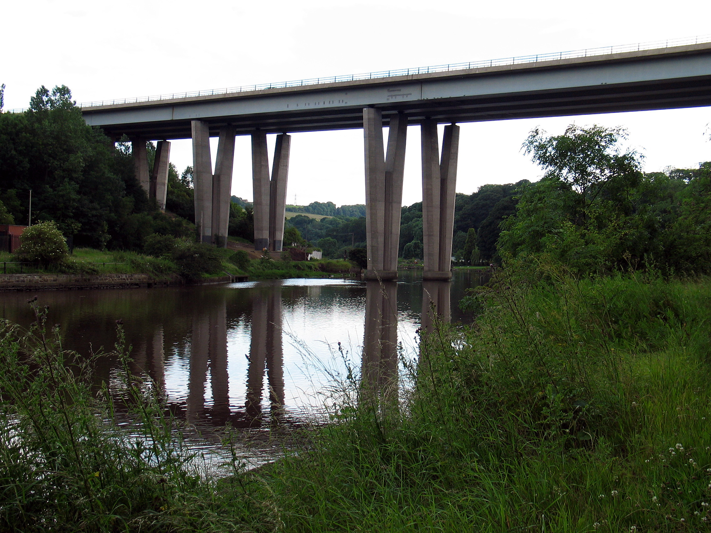
Leamside Line — Legend Tyne and Wear Metro … Wikipedia
Monkwearmouth Station Museum — Coordinates: 54°54′47″N 1°23′06″W / 54.913°N 1.385°W / 54.913; 1.385 … Wikipedia
Sunderland Museum and Winter Gardens — from Mowbray Park Established 1846 Location Burdon Road, Sunderland, England … Wikipedia
Mowbray Park — The bandstand in Mowbray Park Type Municipal Location Sunderland, England … Wikipedia
Holy Trinity Church, Sunderland — Western (front) elevation Holy Trinity is a former church in Sunderland. It was opened in 1719 as the church for the newly created Parish of Sunderland … Wikipedia