- Mountain Lake Wilderness
-
Mountain Lake Wilderness Part of Jefferson National Forest Wilderness Area Country United States States Virginia, West Virginia Counties Craig VA, Giles VA, Monroe WV Coordinates 37°21′53″N 80°33′08″W / 37.36472°N 80.55222°W Highest point Lone Pine Peak [1] - elevation 4,000 ft (1,219 m) Lowest point - elevation 2,200 ft (671 m) Area 11,035 acres (4,466 ha) - Virginia 8,314 acres (3,365 ha) - West Virginia 2,721 acres (1,101 ha) Established 1984 [1] Management George Washington and Jefferson National Forests Owner USDA Forest Service Nearest city Pembroke, Virginia 
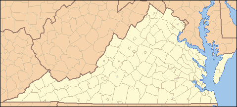
 Location of Mountain Lake Wilderness in Virginia
Website: Mountain Lake Wilderness For the similarly named place in Oregon, see Mountain Lakes Wilderness.Mountain Lake Wilderness is a U.S. Wilderness Area in the George Washington and Jefferson National Forests. The wilderness area is located next to privately owned Mountain Lake[2], and consists of 8,314 acres (3,365 ha) in Virginia and 2,721 acres (1,101 ha) in West Virginia.[3]
Mountain Lake Wilderness ranges in elevation from about 2,200 feet (670 m) to over 4,000 feet (1,200 m). The area is bisected by the Eastern Continental Divide and has about 17 miles (27 km) of hiking trails, including 5 miles (8 km) of the Appalachian Trail.[1] The War Spur overlook, with "outstanding views of the surrounding mountains"[4] that are covered with eastern hardwood forests, is reached by the War Spur and Chestnut Trail loop. The trailhead for this 2.5-mile (4.0 km) hike is on Route 700, 3 miles (5 km) north of Mountain Lake.
See also
References
- ^ a b c "Mountain Lake Wilderness". Wilderness.net. Archived from the original on 2008-12-29. http://www.webcitation.org/5dPurbWJM. Retrieved 2008-04-06.
- ^ "Education Opportunities for Public & Home Schools". Mountain Lake Conservancy. Archived from the original on 2008-12-28. http://www.webcitation.org/5dPvC7IPs. Retrieved 2008-04-06.
- ^ "Mountain Lake Wilderness". George Washington and Jefferson National Forests. Archived from the original on 2008-12-29. http://www.webcitation.org/5dPukbuR3. Retrieved 2008-04-05.
- ^ "War Spur & Chestnut Loop Trail". George Washington and Jefferson National Forests. Archived from the original on 2008-12-28. http://www.webcitation.org/5dPv1GSaf. Retrieved 2008-04-06.
External links
Protected Areas of Virginia Federal Alexandria · Arlington · Balls Bluff · City Point · Cold Harbor · Culpeper · Danville · Fort Harrison · Fredericksburg · Glendale · Hampton · Hampton VA · Poplar Grove · Quantico · Richmond · Seven Pines · Staunton · Winchester · Yorktown
National TrailsGeorge Washington · Jefferson · Mount Rogers National Recreation Area · Mountain Lake Wilderness · Ramsey's Draft Wilderness · Rough Mountain Wilderness · Saint Mary's Wilderness
State Bear Creek Lake · Belle Isle · Biscuit Run · Breaks Interstate · Caledon Natural Area · Chippokes Plantation · Claytor Lake · Douthat · Fairy Stone · False Cape · First Landing · Grayson Highlands · High Bridge Trail · Holliday Lake · Hungry Mother · James River · Kiptopeke · Lake Anna · Leesylvania · Mason Neck · Natural Tunnel · New River Trail · Occoneechee · Pocahontas · Sailor's Creek Battlefield · Shot Tower · Shenandoah River · Sky Meadows · Smith Mountain Lake · Southwest Virginia Museum · Staunton River · Staunton River Battlefield · Tabb Monument · Twin Lakes · Westmoreland · Wilderness Road · York River
Appomattox-Buckingham · Big Woods · Bourassa · Browne · Channels · Chilton Woods · Conway-Robinson · Crawfords · Cumberland · Devil's Backbone · Dragon Run · Hawks · Lesesne · Matthews · Moore's Creek · Niday Place · Paul · Prince Edward-Gallion · Sandy Point · Whitney · Zoar
Antioch Pines · Bethel Beach · Big Spring Bog · Blackwater · Buffalo Mountain · Bull Run Mountains · Bush Mill Stream · Camp Branch Wetlands · Cape Charles Coastal Habitat · The Cedars · The Channels · Cherry Orchard Bog · Chestnut Creek Wetlands · Chestnut Ridge · Chotank Creek · Chub Sandhill · Cleveland Barrens · Clover Hollow · Cowbane Prairie · Crow's Nest · Cumberland Marsh · Dameron Marsh · Deep Run Ponds · Dendron Swamp · Difficult Creek · Elklick Woodlands · False Cape · Folly Mills Creek Fen · Goshen Pass · Grafton Ponds · Grassy Hill · Grayson Glades · Hickory Hollow · Hughlett Point · Johnsons Creek · Magothy Bay · Mark's and Jack's Island · Mount Joy Pond · Mutton Hunk Fen · Naked Mountain · New Point Comfort · North Landing River · Northwest River · Ogdens Cave · Parkers Marsh · Parramore Island · Pedlars Hill · Pinnacle · Poor Mountain · Red Rock Mountain · Savage Neck Dunes · Unthanks Cave · William B. Trower Bayshore · Wreck Island
Wildlife
Management AreasAmelia · Big Survey · Briery Creek · Chester F. Phelps · Cavalier · Chickahominy · Clinch Mountain · Crooked Creek · Dick Cross · Fairystone Farms · Featherfin · G. Richard Thompson · Game Farm Marsh · Goshen and Little North Mountain · Hardware River · Havens · Hidden Valley · Highland · Hog Island · Horsepen Lake · James River · Land's End · Mockhorn Island · Pettigrew · Powhatan · Princess Anne · Ragged Island · Rapidan · Saxis · Stewarts Creek · T. M. Gathright · Turkeycock · Weston · White Oak Mountain
Other Counties A–B · C · D–G · H–M · N–R · S–Z · Bridges · National Historic Landmarks
Categories:- Protected areas of Craig County, Virginia
- George Washington and Jefferson National Forests
- Protected areas of Giles County, Virginia
- IUCN Category Ib
- Protected areas of Monroe County, West Virginia
- Wilderness Areas of Virginia
- Wilderness Areas of West Virginia
Wikimedia Foundation. 2010.