- Mellor Brook
-
Coordinates: 53°46′30″N 2°32′49″W / 53.775°N 2.547°W
Mellor Brook 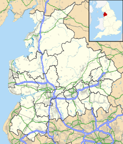
 Mellor Brook
Mellor Brook shown within LancashirePopulation Unknown OS grid reference SD640311 District South Ribble Ribble Valley Shire county Lancashire Region North West Country England Sovereign state United Kingdom Post town BLACKBURN Postcode district BB2 Dialling code 01254 Police Lancashire Fire Lancashire Ambulance North West EU Parliament North West England UK Parliament South Ribble Ribble Valley List of places: UK • England • Lancashire For the stream, flowing through Mellor near Marple in Greater Manchester, see Mellor, Greater Manchester.Mellor Brook is a village which straddles the borders of the Boroughs of Ribble Valley and South Ribble in Lancashire, England.
The village of Mellor Brook is approximately 4 miles (6 km) north-west of Blackburn.
The geographical area of Mellor Brook is quite small, covering an area of approximately 4 square miles (10 km2).
There is a bakery located in the heart of Mellor Brook. The bakery is well known and successful and started in the village, eventually moving its main operation to nearby Ramsgreave, but still retaining its original village shop. The shop's pies are a favourite of the English fashion designer, Wayne Hemingway. In recent years both the village's newsagent and Post Office have closed.
In 1808/9 the road (A59) from Mellor Brook to Clitheroe was opened as a toll road hence the position of the toll house at the top of Higher Commons Lane.
Preston New Road (A677) between Blackburn and Preston, followed in 1824 and hence Branch Road, getting its name because it joined the two turnpike roads, opened at the same time.
The village also has a thriving community centre; it is thought the building came into existence in June 1823 when a plot of land was assigned to a group of gentlemen on which they could build an independent place of worship. The building was purchased by the Church of England in 1833 and it was proposed that it be used during the week as a schoolhouse. The premises became known as St Saviours Chapel, Mellor Brook. The building was used as a primary school right up until 1962 after which time the Church allowed it to be sold to the parish councils of the area.
In 1966 Mellor Brook Community Centre came into existence and has been such ever since.
The village is adjacent to the former Samlesbury Aerodrome, now under the tenure of BAe. BAe have successfully developed Commercial units on the site close the village. A village meeting was held in 2008 with over 100 attendees, including the sitting MP for the Ribble Valley, Nigel Evans. Evans agreed to return to further address the concerns of the villagers raised following his subsequent meetings with BAe. To date Evans has failed to return.
External links
Categories:- Villages in Lancashire
- Geography of Ribble Valley
- Geography of South Ribble

Wikimedia Foundation. 2010.