- Middelburg, Eastern Cape
-
Middelburg, Eastern Cape Country  South Africa
Province Eastern Cape Time zone SAST (UTC+2) Postal code 5900 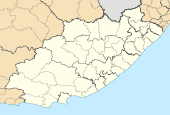
 Location of Middelburg, Eastern Cape
Middelburg is a town in the Eastern Cape province of South Africa, in the Great Karoo. It lies in the Upper Karoo, 1 279 m above sea level, with a population of 44000.[1] It falls under the Inxuba Yethemba Local Municipality, in the Chris Hani District Municipality.
In 1837 the Cape Colony government proclaimed the district of Colesberg, and established the Town of Middelburg in 1852, so named since it is midway between Graaff-Reinet and Colesberg. (It is also approximately halfway between Port Elizabeth and Bloemfontein, as well as between Johannesburg and Cape Town.) The R56, the shortest route between the Western Cape & Kwazulu-Natal begins at Middelburg.
The town and surrounding areas are rich in history from the Anglo Boer War. The adjacent Grootfontein College of Agriculture was originally established as a military camp and training centre for British troops.[2] About 7 000 troops from the Third Manchester Regiment were stationed at Grootfontein - some of them were married, so about 3 000 women and children also lived at Grootfontein.[1] In 1910 the Union of South Africa took control of the farm after which the Grootfontein School of Agriculture was established in 1911. Today the college offers a two year Certificate in Agriculture and a three year Diploma in Agriculture, both accredited by the Higher Education Quality Committee.
Middelburg is the birthplace of playwright Athol Fugard. Other well known South Africans who were born in or lived in Middelburg include Eddie Stuart (Footballer), Steven Sykes (Rugby player), Arthur Lennox Ochse (Cricketer), John James Clements (recipient of the Victoria Cross), Eric Rosenthal (historian and author), Cecily Norden (Horse industry), and John Phillip Harison Acocks (botanist).
References
External links
- Middelburg, Eastern Cape, middelburgec.co.za
- Middelburg Visitors Guide, www.travel-informed.co.za
- Regional map, saexplorer.co.za
- Street map, middelburgec.co.za
- Grootfontein College of Agriculture, gadi.agric.za
- Manchester Regiment 3rd and 4th battalions
Coordinates: 31°29′38″S 25°01′02″E / 31.49389°S 25.01722°E
Province of Eastern Cape, South Africa Provincial Capital: BhishoMetropolitan
MunicipalitiesBuffalo City · Nelson Mandela BayDistrict
and Local
MunicipalitiesCamdeboo · Blue Crane Route · Ikwezi · Makana · Ndlambe · Sunday's River Valley · Baviaans · Kouga · Kou-KammaInxuba Yethemba · Tsolwana · Inkwanca · Lukhanji · Intsika · Emalahleni · Engcobo · SakhisizweElundini · Senqu · Maletswai · GariepCategories:- Populated places established in 1837
- Populated places in the Eastern Cape
- Karoo
- Eastern Cape geography stubs

Wikimedia Foundation. 2010.