- Manchester-by-the-Sea, Massachusetts
-
Manchester-by-the-Sea, Massachusetts — Town — The First Parish Church in central Manchester-by-the-Sea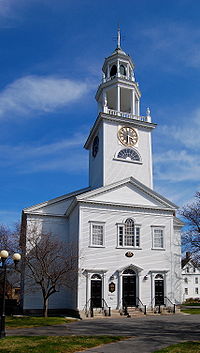
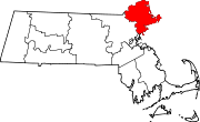
SealLocation in Essex County in Massachusetts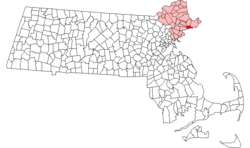
Coordinates: 42°34′40″N 70°46′10″W / 42.57778°N 70.76944°WCoordinates: 42°34′40″N 70°46′10″W / 42.57778°N 70.76944°W Country United States State Massachusetts County Essex Settled 1629 Incorporated 1645 Government - Type Open town meeting Area - Total 18.3 sq mi (47.3 km2) - Land 9.3 sq mi (24.1 km2) - Water 9.0 sq mi (23.2 km2) Elevation 30 ft (9 m) Population (2000) - Total 5,228 - Density 562.7/sq mi (217.3/km2) Time zone Eastern (UTC-5) - Summer (DST) Eastern (UTC-4) ZIP code 01944 Area code(s) 351 / 978 FIPS code 25-37995 GNIS feature ID 0619451 Website http://www.manchester.ma.us/ Manchester-by-the-Sea (also called just Manchester) is a town on Cape Ann, in Essex County, Massachusetts, in the United States. As of the 2000 census, the town population was 5,228.
Contents
History
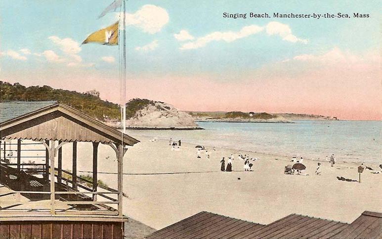
 Singing Beach in 1914
Manchester-by-the-Sea was first settled in 1629 and was officially incorporated in 1645.
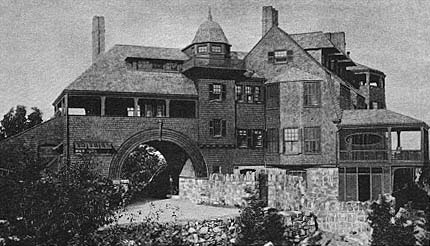
The community thrived as a fishing community until 1845, when Richard Dana, a Boston based poet, built his summer house in the community. Over the next fifty years, development of summer houses along the coast line established the community as Boston society's community of choice for summer residency. The trend continued with designs by other notable architects, such as Sunnywaters, designed by John Hubbard Sturgis for his older brother, Russell, in 1862. The most famous of these "summer cottages" was Kragsyde, built on Smith's Point in 1883 and demolished in 1929. Commissioned by George Nixon Black, the Peabody and Stearns designed residence has been hailed as the zenith of the Shingle style substyle of the Queen Anne style of architecture.
Name
The town was founded as "Jeffery's Creek." In the mid-1800s, there were enough other Manchesters in New England (especially Manchester, New Hampshire) that locals began following the lead of railroad conductors and referring to the town as "Manchester-by-the-Sea". The name of the town was officially changed in 1990 following a close town meeting vote and an act of the state legislature. This change was driven by the late Edward Corely, a long time resident of Manchester. All town documents (and the town seal) now use the name "Manchester-by-the-Sea", as have (thanks to some minor resident activism) the majority of public and private lists of Massachusetts cities and towns, including that of the state government.
Geography
According to the United States Census Bureau, the town has a total area of 18.2 square miles (47 km2), of which, 9.3 square miles (24 km2) of it is land and 9.0 square miles (23 km2) of it (49.10%) is water. The town lies along the North Shore of Massachusetts Bay, which in turn leads to the Atlantic Ocean. There are seven beaches lining the coast, and several small islands dot the coast, the largest being Kettle Island and House Island. Several small coves line the coast, the largest being Manchester Harbor, which is fed by Sawmill Brook and other small brooks. There are several protected areas within town, including Cedar Swamp Conservation Area, Cheever Commons Conservation Area, Coolidge Reservation Area,Owls Nest Nature Preservation Land, Powder house Hill Reservation, and Wyman Hill Conservation Area.
Manchester-by-the-Sea is bordered by Beverly and Wenham to the west, Hamilton to the northwest, Essex to the north, and Gloucester to the east. The town is located 9 miles (14 km) northeast of Salem and 24 miles (39 km) northeast of Boston. Manchester-by-the-Sea lies along Route 128, which has two exits within town as it passes from Beverly to Gloucester, with a small portion crossing through the corner of Essex. Route 127 also passes from west to east through town, passing through the center of town. There is no bus service directly into town, with service passing east via the Cape Ann Transportation Authority in Gloucester and MBTA Bus, which provides service to Beverly. The town is served by a stop along the Newburyport/Rockport Line of the MBTA Commuter Rail, providing service from Rockport along the North Shore to Boston's North Station. The nearest airport is the Beverly Municipal Airport, with the nearest national and international service at Boston's Logan International Airport.
Demographics
Historical populations Year Pop. ±% 1850 1,638 — 1860 1,698 +3.7% 1870 1,665 −1.9% 1880 1,640 −1.5% 1890 1,789 +9.1% 1900 2,522 +41.0% 1910 2,673 +6.0% 1920 2,466 −7.7% 1930 2,636 +6.9% 1940 2,472 −6.2% 1950 2,868 +16.0% 1960 3,932 +37.1% 1970 5,151 +31.0% 1980 5,424 +5.3% 1990 5,286 −2.5% 2000 5,228 −1.1% 2001* 5,276 +0.9% 2002* 5,265 −0.2% 2003* 5,288 +0.4% 2004* 5,231 −1.1% 2005* 5,180 −1.0% 2006* 5,159 −0.4% 2007* 5,151 −0.2% 2008* 5,164 +0.3% 2009* 5,203 +0.8% 2010 5,136 −1.3% * = population estimate.
Source: United States Census records and Population Estimates Program data.[1][2][3][4][5][6][7][8][9][10]As of the census[11] of 2000, there were 5,228 people, 2,168 households, and 1,435 families residing in the town. The population density was 562.7 people per square mile (217.3/km²). There were 2,327 housing units at an average density of 250.5 per square mile (96.7/km²). The racial makeup of the town was 98.87% White, 0.06% African American, 0.17% Native American, 0.38% Asian, 0.11% from other races, and 0.40% from two or more races. Hispanic or Latino of any race were 0.77% of the population.
There were 2,168 households out of which 29.6% had children under the age of 18 living with them, 55.7% were married couples living together, 8.1% had a female householder with no husband present, and 33.8% were non-families. 27.5% of all households were made up of individuals and 11.8% had someone living alone who was 65 years of age or older. The average household size was 2.40 and the average family size was 2.96.
In the town the population was spread out with 23.9% under the age of 18, 4.4% from 18 to 24, 24.0% from 25 to 44, 31.2% from 45 to 64, and 16.4% who were 65 years of age or older. The median age was 44 years. For every 100 females there were 89.4 males. For every 100 females age 18 and over, there were 86.8 males.
The median income for a household in the town was $98,467, and the median income for a family was $118,609. Males had a median income of $88,466 versus $67,981 for females. The per capita income for the town was $57,910. About 0.6% of families and 1.8% of the population were below the poverty line, including 0.3% of those under age 18 and 1.5% of those age 65 or over.
Media
The local newspaper, the Manchester Cricket, is published weekly.
Points of interest
Singing Beach
One mile from the town center is Singing Beach, so named because the sand comprising the beach squeaks when walked upon (see Singing sand). This beach is quite popular during summer months in particular because it is easily accessible from Boston by a half-mile walk from the MBTA train station. Also located on this historic beach is the famous tourist attraction "Eaglehead" a rock composite that is infamous for rock climbing and other recreation activities.
Other points of interest
- Agassiz Rock
- Coolidge Reservation
- Kragsyde
- Smith's Point
- Singing Beach
- Crow Island
- Tucks Point
-

Singing Beach in 2005
-

Kragsyde Mansion
-
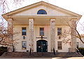
Town Hall
-

Trask House Museum
-

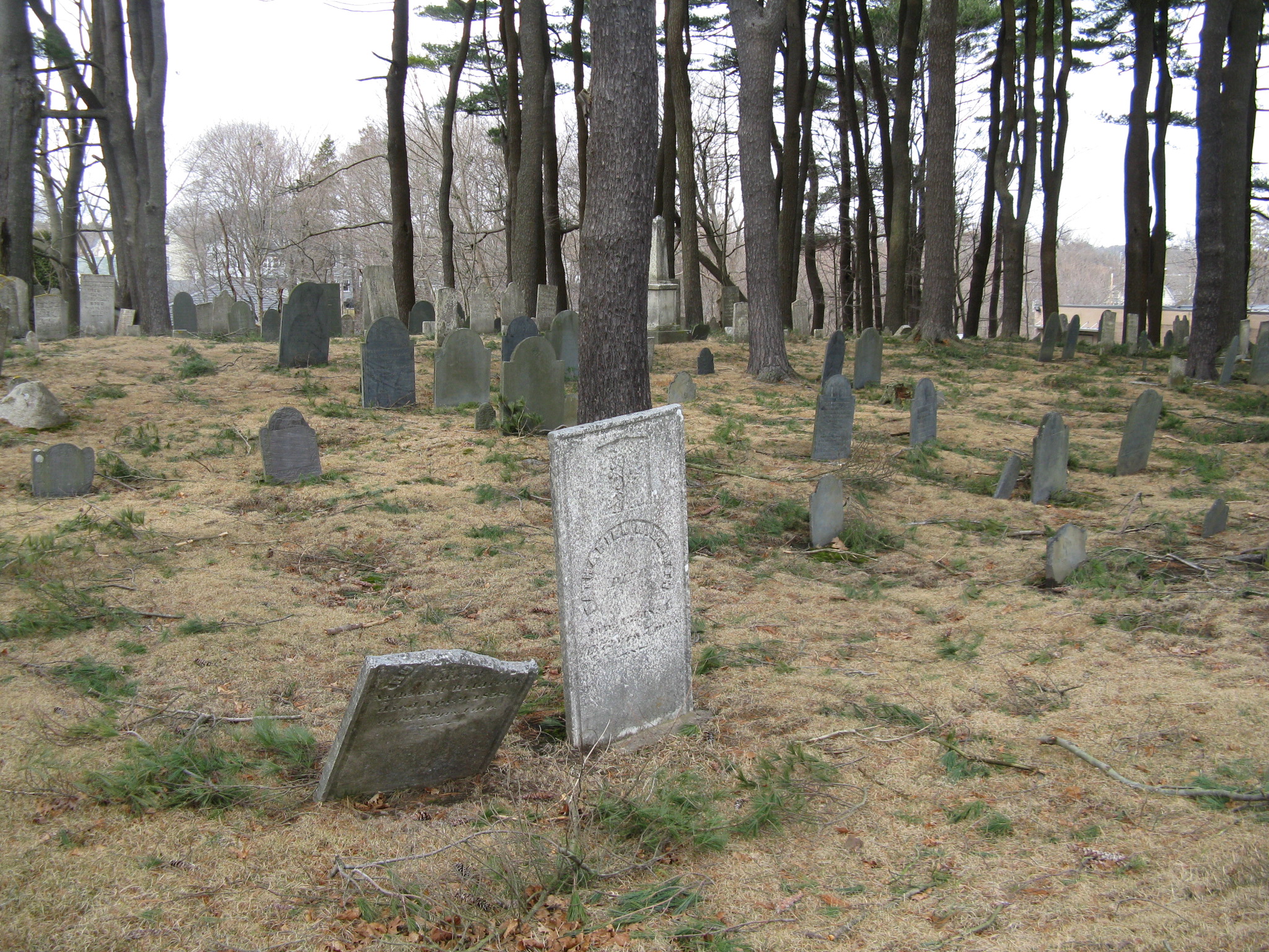
Old Burial Ground
Film references
The town provided the backdrop for these films:
- The Love Letter
- Mermaids
- State and Main
- Tell Me That You Love Me, Junie Moon
- What's the Worst That Could Happen? (standing in for Marblehead, Massachusetts)
- The Good Son
- The Proposal
- Edge of Darkness
It was also featured in a season of the TV series This Old House, and was featured in a "Main Streets and Back Roads" episode of Chronicle.
Notable residents
- Gardner Read, composer (1913–2005)
- Susan Minot, author
- Joe Lloyd, professional golfer
- Ray Ozzie, software entrepreneur
- George Putnam III, trustee of Putnam Investments
- Sprague Grayden, actress
- Jay Severin, radio talk show host on WTKK
- Josiah Spaulding, American businessman, attorney, and politician. Chairman of the Massachusetts Republican Party from 1965-1970.
- Josh Gates, host of Destination Truth—former resident
- William Northey Hooper, manufacturer and Boston politician
- Henry Northey Hooper, a founder of the sugar industry in Hawaii
- Morgan Kennedy, musical theater legend, created the button headband
- Sean J Halloran, world renowned Team Captain of FIRST Robotics Team 2084 RobotsByTheC
References
- ^ "TOTAL POPULATION (P1), 2010 Census Summary File 1, All County Subdivisions within Massachusetts". United States Census Bureau. http://factfinder2.census.gov/bkmk/table/1.0/en/DEC/10_SF1/P1/0400000US25.06000. Retrieved September 13, 2011.
- ^ "Massachusetts by Place and County Subdivision - GCT-T1. Population Estimates". United States Census Bureau. http://factfinder.census.gov/servlet/GCTTable?_bm=y&-geo_id=04000US25&-_box_head_nbr=GCT-T1&-ds_name=PEP_2009_EST&-_lang=en&-format=ST-9&-_sse=on. Retrieved July 12, 2011.
- ^ "1990 Census of Population, General Population Characteristics: Massachusetts". US Census Bureau. December 1990. Table 76: General Characteristics of Persons, Households, and Families: 1990. 1990 CP-1-23. http://www.census.gov/prod/cen1990/cp1/cp-1-23.pdf. Retrieved July 12, 2011.
- ^ "1980 Census of the Population, Number of Inhabitants: Massachusetts". US Census Bureau. December 1981. Table 4. Populations of County Subdivisions: 1960 to 1980. PC80-1-A23. http://www2.census.gov/prod2/decennial/documents/1980a_maABC-01.pdf. Retrieved July 12, 2011.
- ^ "1950 Census of Population". Bureau of the Census. 1952. Section 6, Pages 21-10 and 21-11, Massachusetts Table 6. Population of Counties by Minor Civil Divisions: 1930 to 1950. http://www2.census.gov/prod2/decennial/documents/23761117v1ch06.pdf. Retrieved July 12, 2011.
- ^ "1920 Census of Population". Bureau of the Census. Number of Inhabitants, by Counties and Minor Civil Divisions. Pages 21-5 through 21-7. Massachusetts Table 2. Population of Counties by Minor Civil Divisions: 1920, 1910, and 1920. http://www2.census.gov/prod2/decennial/documents/41084506no553ch2.pdf. Retrieved July 12, 2011.
- ^ "1890 Census of the Population". Department of the Interior, Census Office. Pages 179 through 182. Massachusetts Table 5. Population of States and Territories by Minor Civil Divisions: 1880 and 1890. http://www2.census.gov/prod2/decennial/documents/41084506no553ch2.pdf. Retrieved July 12, 2011.
- ^ "1870 Census of the Population". Department of the Interior, Census Office. 1872. Pages 217 through 220. Table IX. Population of Minor Civil Divisions, &c. Massachusetts. http://www2.census.gov/prod2/decennial/documents/1870e-05.pdf. Retrieved July 12, 2011.
- ^ "1860 Census". Department of the Interior, Census Office. 1864. Pages 220 through 226. State of Massachusetts Table No. 3. Populations of Cities, Towns, &c.. http://www2.census.gov/prod2/decennial/documents/1860a-08.pdf. Retrieved July 12, 2011.
- ^ "1850 Census". Department of the Interior, Census Office. 1854. Pages 338 through 393. Populations of Cities, Towns, &c.. http://www2.census.gov/prod2/decennial/documents/1850c-11.pdf. Retrieved July 12, 2011.
- ^ "American FactFinder". United States Census Bureau. http://factfinder.census.gov. Retrieved 2008-01-31.
External links
- Visitor Information from the Cape Ann Chamber of Commerce
- Manchester-by-the-Sea Commercial Website
- Town of Manchester-by-the-Sea
- Manchester-by-the-Sea Wiki
- Essex Images
- Name Change
Municipalities and communities of Essex County, Massachusetts Cities Amesbury | Beverly | Gloucester | Haverhill | Lawrence | Lynn | Methuen | Newburyport | Peabody | Salem
Towns Andover | Boxford | Danvers | Essex | Georgetown | Groveland | Hamilton | Ipswich | Lynnfield | Manchester-by-the-Sea | Marblehead | Merrimac | Middleton | Nahant | Newbury | North Andover | Rockport | Rowley | Salisbury | Saugus | Swampscott | Topsfield | Wenham | West Newbury
CDPs Other
villagesAnnisquam | Ballardvale | Beverly Farms | Bradford | Byfield | Clifton | Plum Island
Categories:- Populated coastal places in Massachusetts
- Towns in Essex County, Massachusetts
- Populated places established in 1629
- Beaches of Massachusetts


Wikimedia Foundation. 2010.